MyTopo
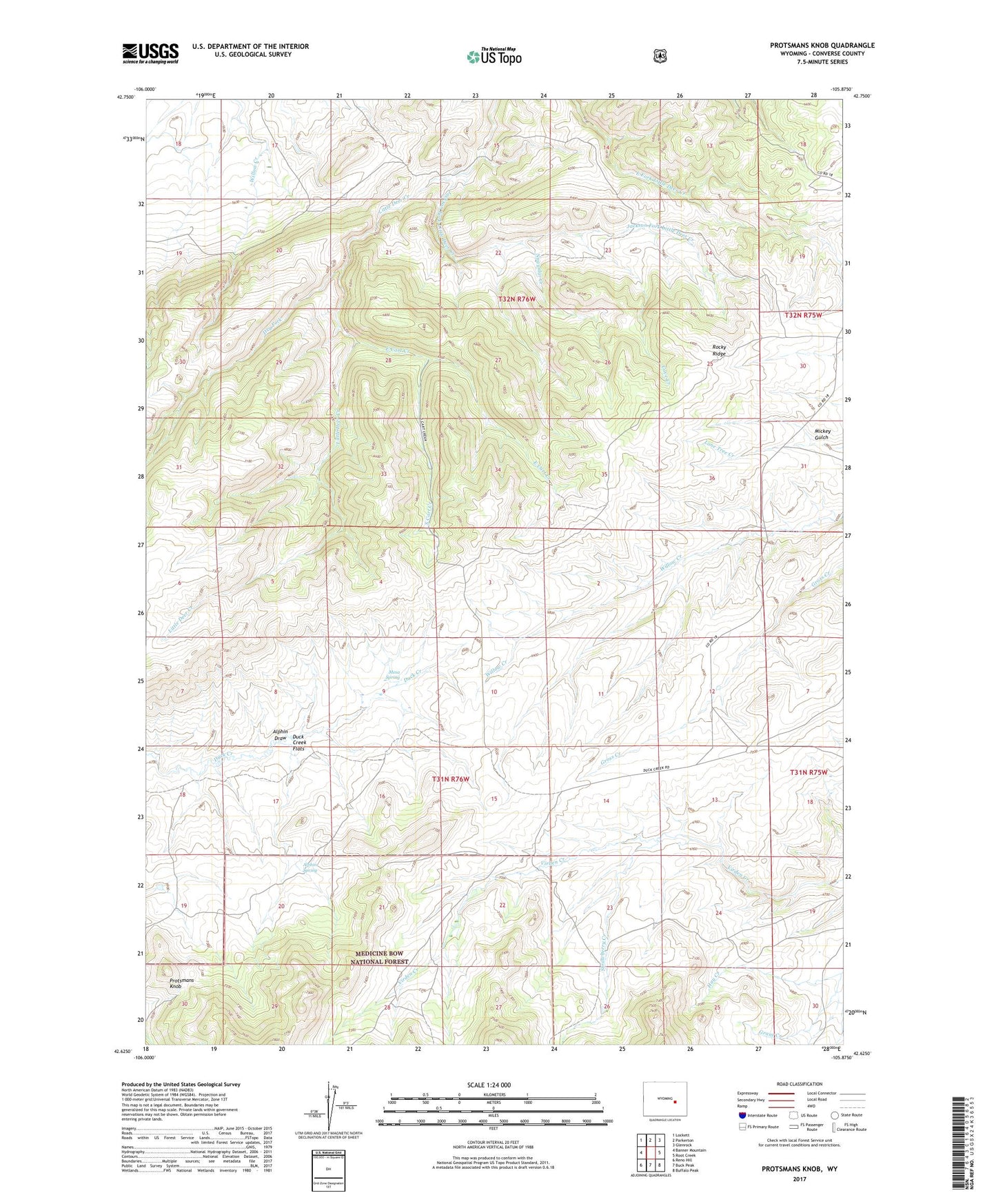
Protsmans Knob Wyoming US Topo Map
Couldn't load pickup availability
Also explore the Protsmans Knob Forest Service Topo of this same quad for updated USFS data
2021 topographic map quadrangle Protsmans Knob in the state of Wyoming. Scale: 1:24000. Based on the newly updated USGS 7.5' US Topo map series, this map is in the following counties: Converse. The map contains contour data, water features, and other items you are used to seeing on USGS maps, but also has updated roads and other features. This is the next generation of topographic maps. Printed on high-quality waterproof paper with UV fade-resistant inks.
Quads adjacent to this one:
West: Banner Mountain
Northwest: Lockett
North: Parkerton
Northeast: Glenrock
East: Root Creek
Southeast: Buffalo Peak
South: Buck Peak
Southwest: Reno Hill
This map covers the same area as the classic USGS quad with code o42105f8.
Contains the following named places: Alphin Draw, Alphin Spring, Cave Creek, Dry Fork, Duck Creek Flats, East Cart Creek, Hay Creek, Jackson Fork Little Deer Creek, Lucky Lode Claim, McCoun Wells and Rhoads Deposit, Mesa Spring, Mickey Gulch, Miller Cabin, Nagyidai Creek, Protsmans Knob, Rocky Ridge, Smith Deposit, South Cart Creek, Strawberry Creek, Swede Boy Mine