MyTopo
Monument Ridge Wyoming US Topo Map
Couldn't load pickup availability
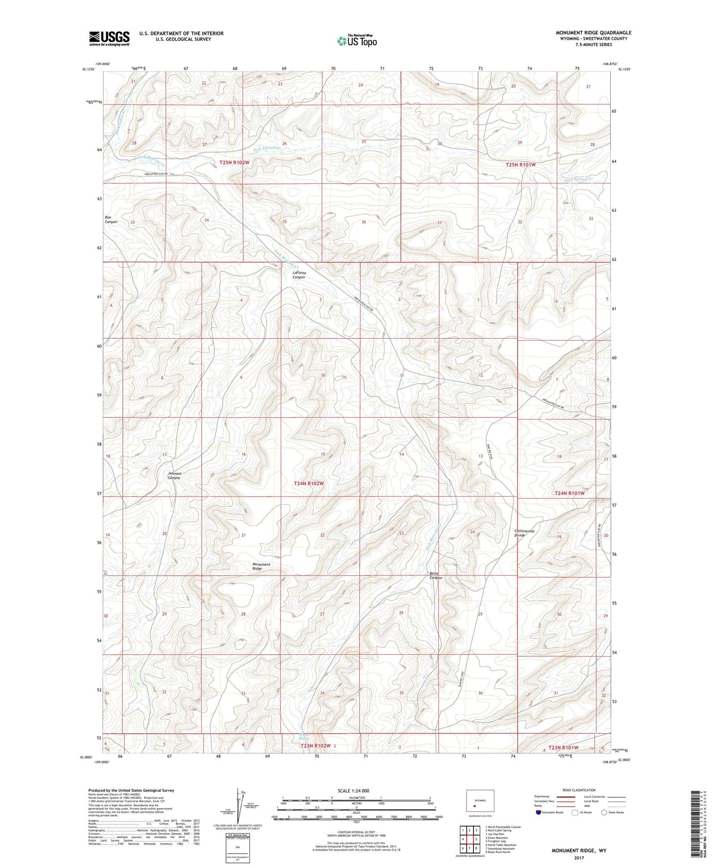
2021 topographic map quadrangle Monument Ridge in the state of Wyoming. Scale: 1:24000. Based on the newly updated USGS 7.5' US Topo map series, this map is in the following counties: Sweetwater. The map contains contour data, water features, and other items you are used to seeing on USGS maps, but also has updated roads and other features. This is the next generation of topographic maps. Printed on high-quality waterproof paper with UV fade-resistant inks.
Quads adjacent to this one:
West: Essex Mountain
Northwest: North Packsaddle Canyon
North: Rock Cabin Spring
Northeast: Joe Hay Rim
East: Freighter Gap
Southeast: Black Rock North
South: Steamboat Mountain
Southwest: North Table Mountain
This map covers the same area as the classic USGS quad with code o42108a8.
Contains the following named places: Blind Canyon, Freighter Gap, Jack Parnell Creek, Johnson Canyon, LaFonte Canyon, Minnie Spring, Monument Ridge, Rock Cabin Creek