MyTopo
Needle Mountain Wyoming US Topo Map
Couldn't load pickup availability
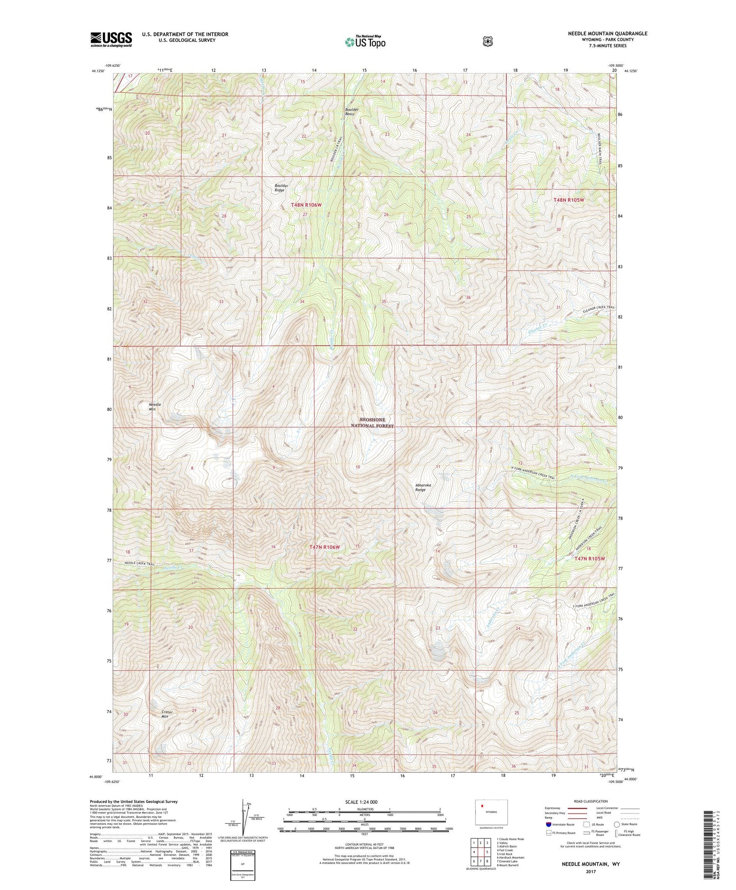
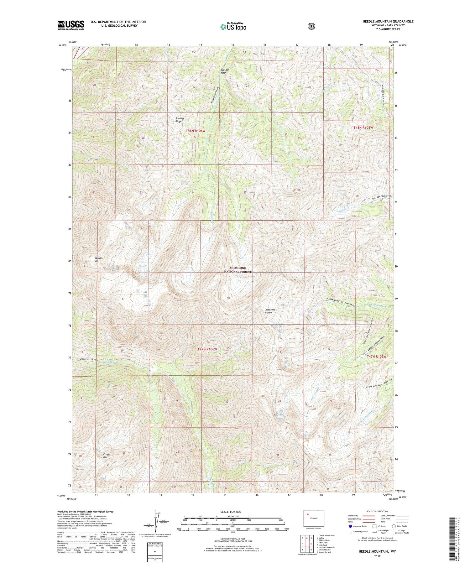
2021 topographic map quadrangle Needle Mountain in the state of Wyoming. Scale: 1:24000. Based on the newly updated USGS 7.5' US Topo map series, this map is in the following counties: Park. The map contains contour data, water features, and other items you are used to seeing on USGS maps, but also has updated roads and other features. This is the next generation of topographic maps. Printed on high-quality waterproof paper with UV fade-resistant inks.
Quads adjacent to this one:
West: Fall Creek
Northwest: Clouds Home Peak
North: Valley
Northeast: Aldrich Basin
East: Irish Rock
Southeast: Mount Burwell
South: Emerald Lake
Southwest: Hardluck Mountain
Contains the following named places: Boulder Basin, Boulder Ridge, Crater Mountain, Needle Mountain, Shoshone National Forest, South Fork Anderson Creek, Washakie Wilderness