MyTopo
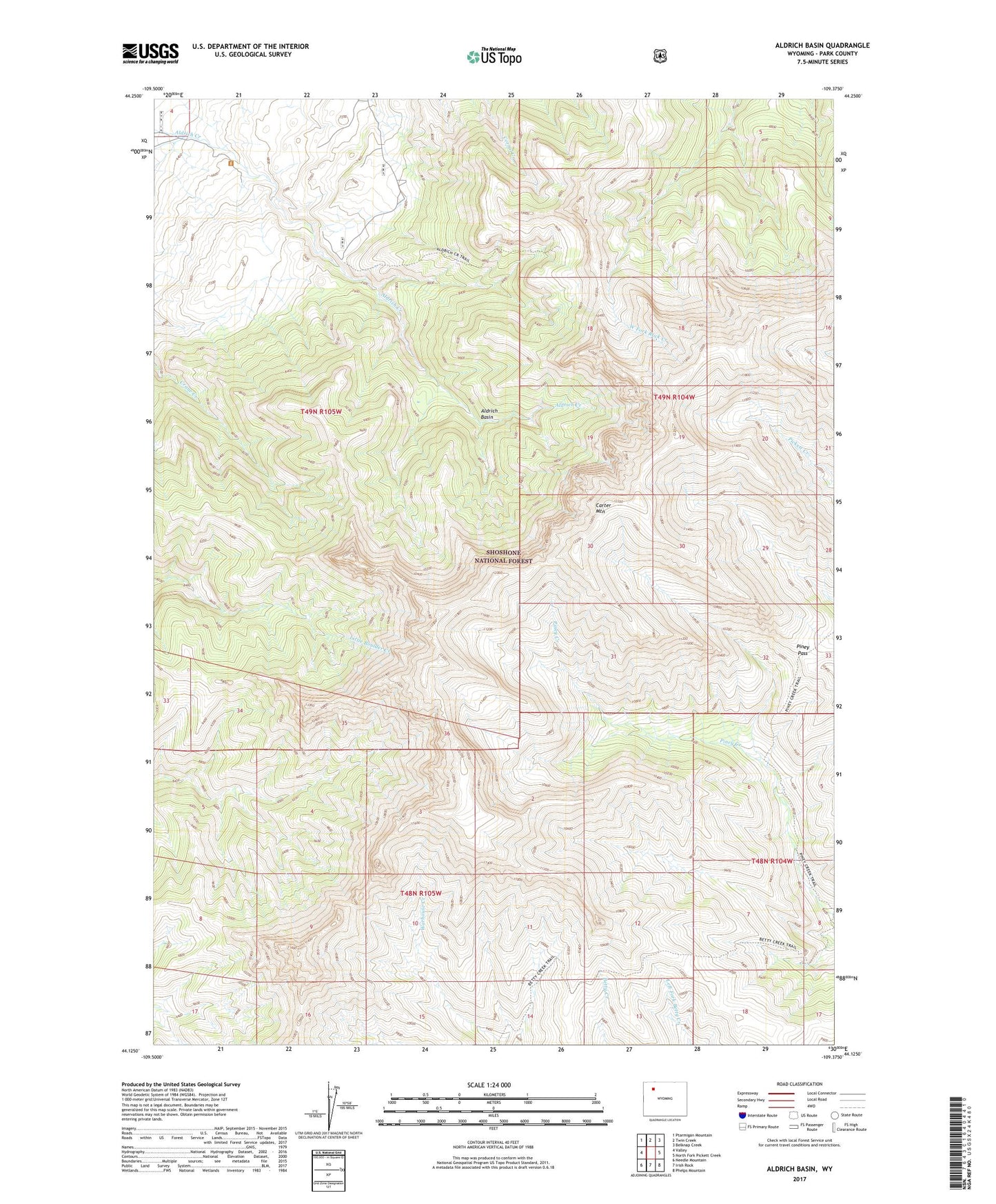
Aldrich Basin Wyoming US Topo Map
Couldn't load pickup availability
Also explore the Aldrich Basin Forest Service Topo of this same quad for updated USFS data
2021 topographic map quadrangle Aldrich Basin in the state of Wyoming. Scale: 1:24000. Based on the newly updated USGS 7.5' US Topo map series, this map is in the following counties: Park. The map contains contour data, water features, and other items you are used to seeing on USGS maps, but also has updated roads and other features. This is the next generation of topographic maps. Printed on high-quality waterproof paper with UV fade-resistant inks.
Quads adjacent to this one:
West: Valley
Northwest: Ptarmigan Mountain
North: Twin Creek
Northeast: Belknap Creek
East: North Fork Pickett Creek
Southeast: Phelps Mountain
South: Irish Rock
Southwest: Needle Mountain
This map covers the same area as the classic USGS quad with code o44109b4.
Contains the following named places: Aldrich Basin, Betty Cabin, Carter Mountain, Piney Pass