MyTopo
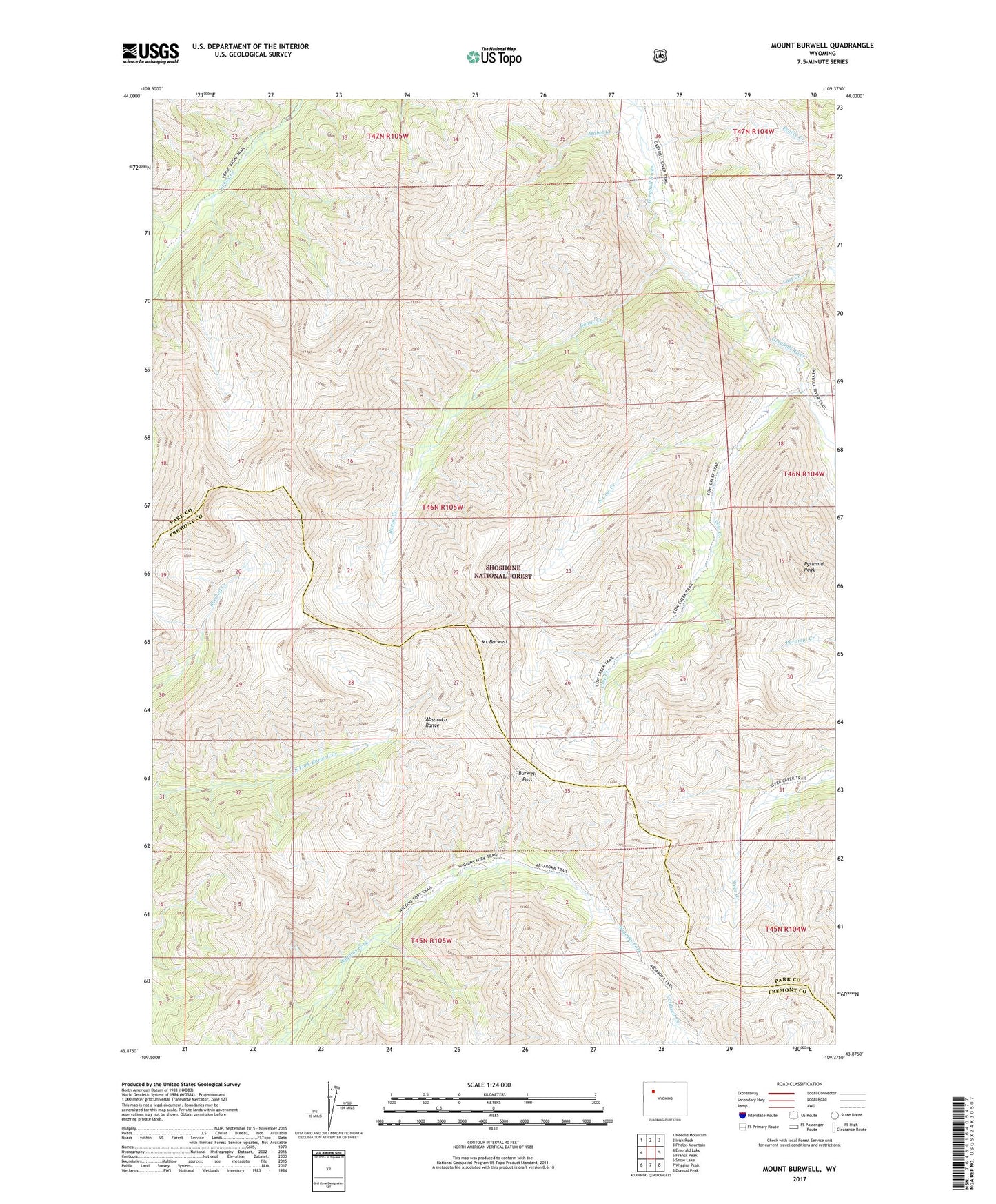
Mount Burwell Wyoming US Topo Map
Couldn't load pickup availability
Also explore the Mount Burwell Forest Service Topo of this same quad for updated USFS data
2021 topographic map quadrangle Mount Burwell in the state of Wyoming. Scale: 1:24000. Based on the newly updated USGS 7.5' US Topo map series, this map is in the following counties: Park, Fremont. The map contains contour data, water features, and other items you are used to seeing on USGS maps, but also has updated roads and other features. This is the next generation of topographic maps. Printed on high-quality waterproof paper with UV fade-resistant inks.
Quads adjacent to this one:
West: Emerald Lake
Northwest: Needle Mountain
North: Irish Rock
Northeast: Phelps Mountain
East: Francs Peak
Southeast: Dunrud Peak
South: Wiggins Peak
Southwest: Snow Lake
This map covers the same area as the classic USGS quad with code o43109h4.
Contains the following named places: Avalanche Creek, Bonne Creek, Burwell Pass, Cow Creek, Greybull River Trail, Last Creek, Mabel Creek, Mount Burwell, North Cow Creek, Pearce Creek, Pyramid Peak