MyTopo
Orpha Wyoming US Topo Map
Couldn't load pickup availability
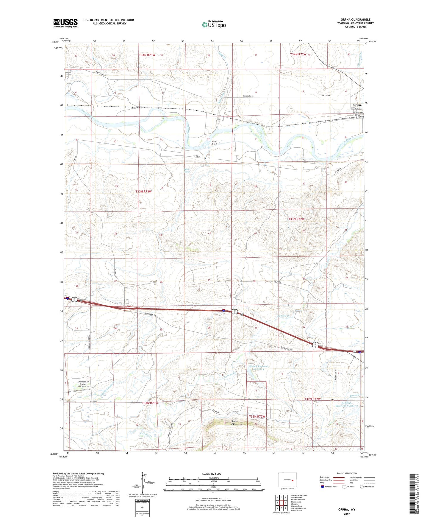
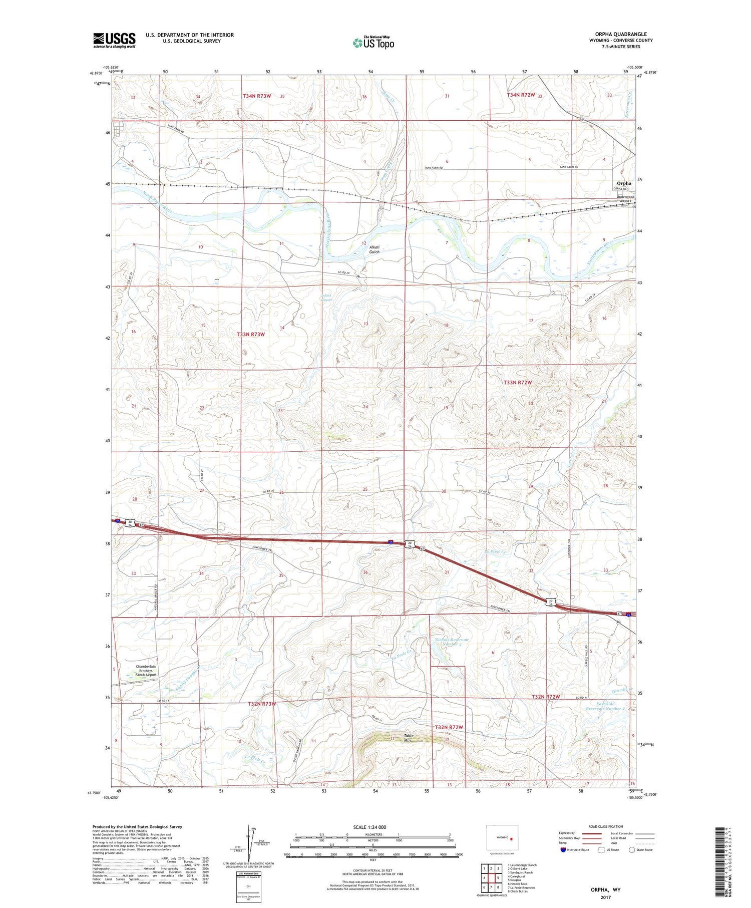
2021 topographic map quadrangle Orpha in the state of Wyoming. Scale: 1:24000. Based on the newly updated USGS 7.5' US Topo map series, this map is in the following counties: Converse. The map contains contour data, water features, and other items you are used to seeing on USGS maps, but also has updated roads and other features. This is the next generation of topographic maps. Printed on high-quality waterproof paper with UV fade-resistant inks.
Quads adjacent to this one:
West: Careyhurst
Northwest: Leuenberger Ranch
North: Gilbert Lake
Northeast: Sundquist Ranch
East: Douglas
Southeast: Chalk Buttes
South: La Prele Reservoir
Southwest: Hermit Rock
Contains the following named places: Alberta, Alkali Gulch, Burk Ranch, Chamberlain Brothers Ranch Airport, East Side Number 2 Dam, East Side Number 3 Dam, East Side Reservoir Number 2, East Side Reservoir Number 3, Fetterman, Hart Ranch, Inez Mine, Infant Geyser, La Prele Main Canal, LaPrele School, Moore Dam, Moore Reservoir, Mueller Ranch, Nichols Reservoir Number 2, Nichols Reservoir Number 2 Dam, Oregon Trail Monument, Orpha, Pleasant Valley School, Sage Creek, Sewell Ranch, Slichter Mine, Table Mountain, Whiting School