MyTopo
La Prele Reservoir Wyoming US Topo Map
Couldn't load pickup availability
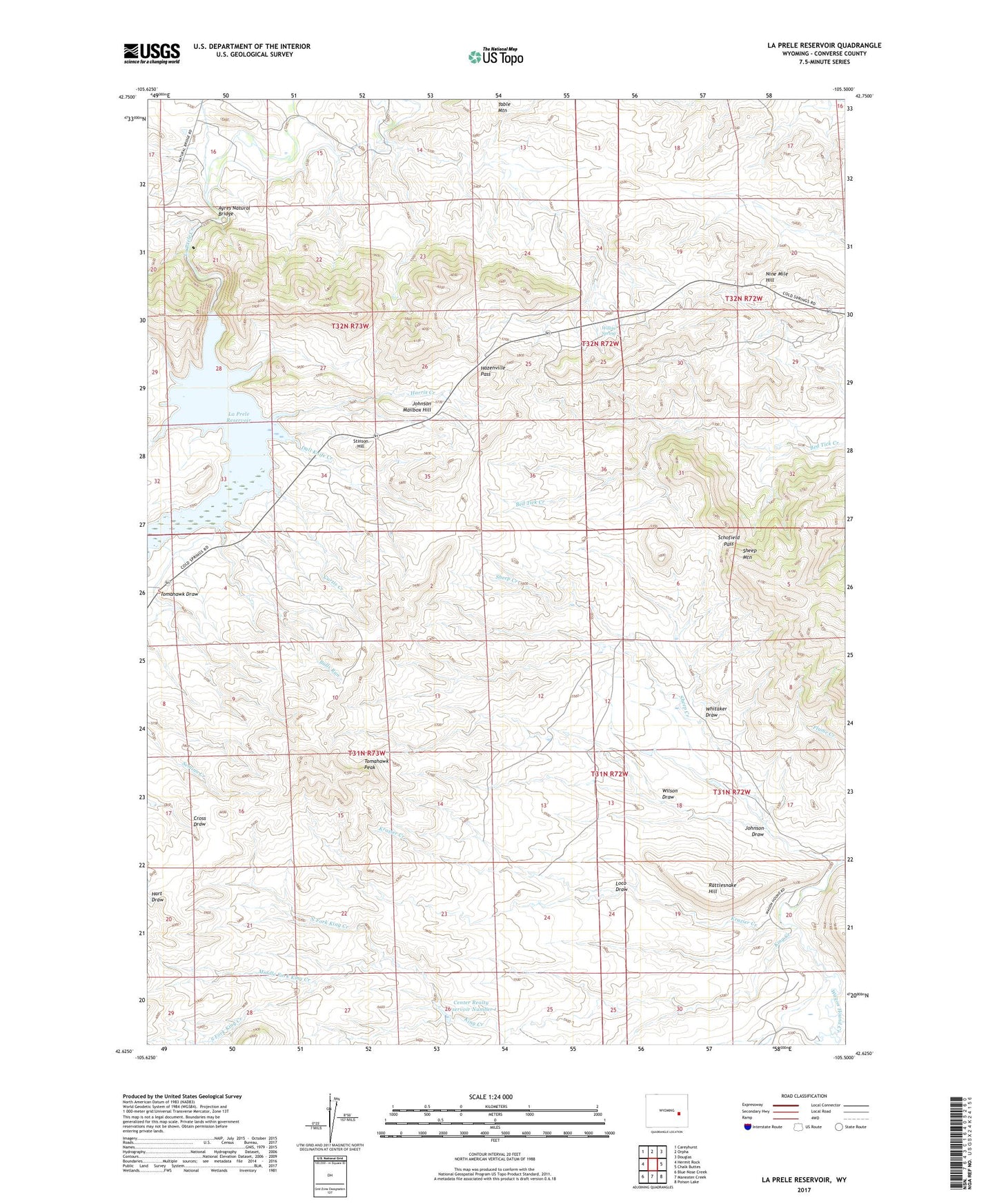
2021 topographic map quadrangle La Prele Reservoir in the state of Wyoming. Scale: 1:24000. Based on the newly updated USGS 7.5' US Topo map series, this map is in the following counties: Converse. The map contains contour data, water features, and other items you are used to seeing on USGS maps, but also has updated roads and other features. This is the next generation of topographic maps. Printed on high-quality waterproof paper with UV fade-resistant inks.
Quads adjacent to this one:
West: Hermit Rock
Northwest: Careyhurst
North: Orpha
Northeast: Douglas
East: Chalk Buttes
Southeast: Poison Lake
South: Maneater Creek
Southwest: Blue Nose Creek
This map covers the same area as the classic USGS quad with code o42105f5.
Contains the following named places: Ayres Natural Bridge, Buckshot Creek, Bulls Run, Center Realty Reservoir Number 1, Center Realty Reservoir Number 1 Dam, Curtis Creek, Dull Knife Creek, Harris Creek, Hazenville Pass, Johnson Draw, Johnson Mailbox Hill, KATH-FM (Douglas), King Creek, Krazier Creek, La Prele Dam, La Prele Reservoir, Loco Draw, Middle Fork King Creek, Nine Mile Hill, North Fork King Creek, Rattlesnake Hill, Sand Creek, Schofield Pass, Sheep Creek, South Fork King Creek, Stinson Hill, Tomahawk Draw, Tomahawk Peak, Whitaker Draw, Willow Spring, Wilson Draw, Wilson Number 1 Dam, Wilson Number 1 Reservoir