MyTopo
Pine Ridge Wyoming US Topo Map
Couldn't load pickup availability
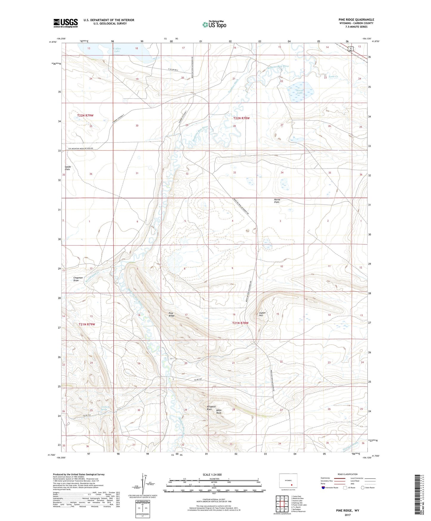
2021 topographic map quadrangle Pine Ridge in the state of Wyoming. Scale: 1:24000. Based on the newly updated USGS 7.5' US Topo map series, this map is in the following counties: Carbon. The map contains contour data, water features, and other items you are used to seeing on USGS maps, but also has updated roads and other features. This is the next generation of topographic maps. Printed on high-quality waterproof paper with UV fade-resistant inks.
Quads adjacent to this one:
West: Halfway Hill
Northwest: Como East
North: Medicine Bow
Northeast: Aurora Lake
East: Foote Creek Lake
Southeast: Pierce Reservoir
South: McFadden
Southwest: T L Ranch
This map covers the same area as the classic USGS quad with code o41106g2.
Contains the following named places: Alligator Rock, Bible Rock, Chace Number 1 Dam, Chapman Draw, Cronberg Spring, East Allen Lake, Foote Creek, Horne Flats, Horne Lake, Indian Hill, Pine Ridge, Second Sand Creek, Spade Flats, Thornton Ditch