MyTopo
Redbird Wyoming US Topo Map
Couldn't load pickup availability
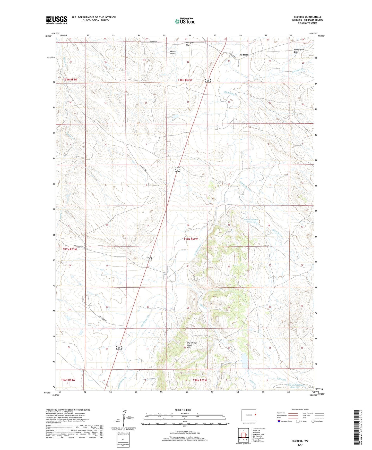
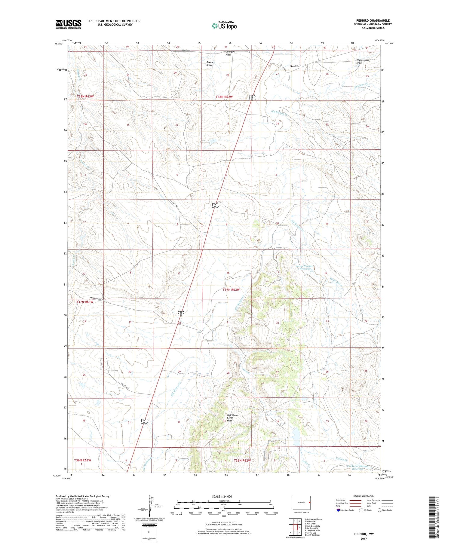
2021 topographic map quadrangle Redbird in the state of Wyoming. Scale: 1:24000. Based on the newly updated USGS 7.5' US Topo map series, this map is in the following counties: Niobrara. The map contains contour data, water features, and other items you are used to seeing on USGS maps, but also has updated roads and other features. This is the next generation of topographic maps. Printed on high-quality waterproof paper with UV fade-resistant inks.
Quads adjacent to this one:
West: Buck Creek Hills
Northwest: Greasewood Creek
North: Bowen Flat
Northeast: Mule Creek
East: Oat Creek NW
Southeast: South Oat Creek
South: Coyote Gap
Southwest: Telephone Draw
Contains the following named places: Alum Creek, Amelia Number 1 Dam, Amelia Number 1 Reservoir, Antelope Creek, Black Tail Creek, Clark and Metzger Reservoir, Clark Number 1 Dam, Clark Number 1 Reservoir, East Alum Creek, Graham Roughs, Johnny Wasserburger Dam, Johnny Wasserburger Reservoir, Leo Dam, Leo Reservoir, Old Woman Creek Hills, Pfister Number 1 Dam, Pfister Number 1 Reservoir, Redbird, Sorem Number 1 Dam, Sorem Number 1 Reservoir, Wheatgrass Draw