MyTopo
Buck Creek Hills Wyoming US Topo Map
Couldn't load pickup availability
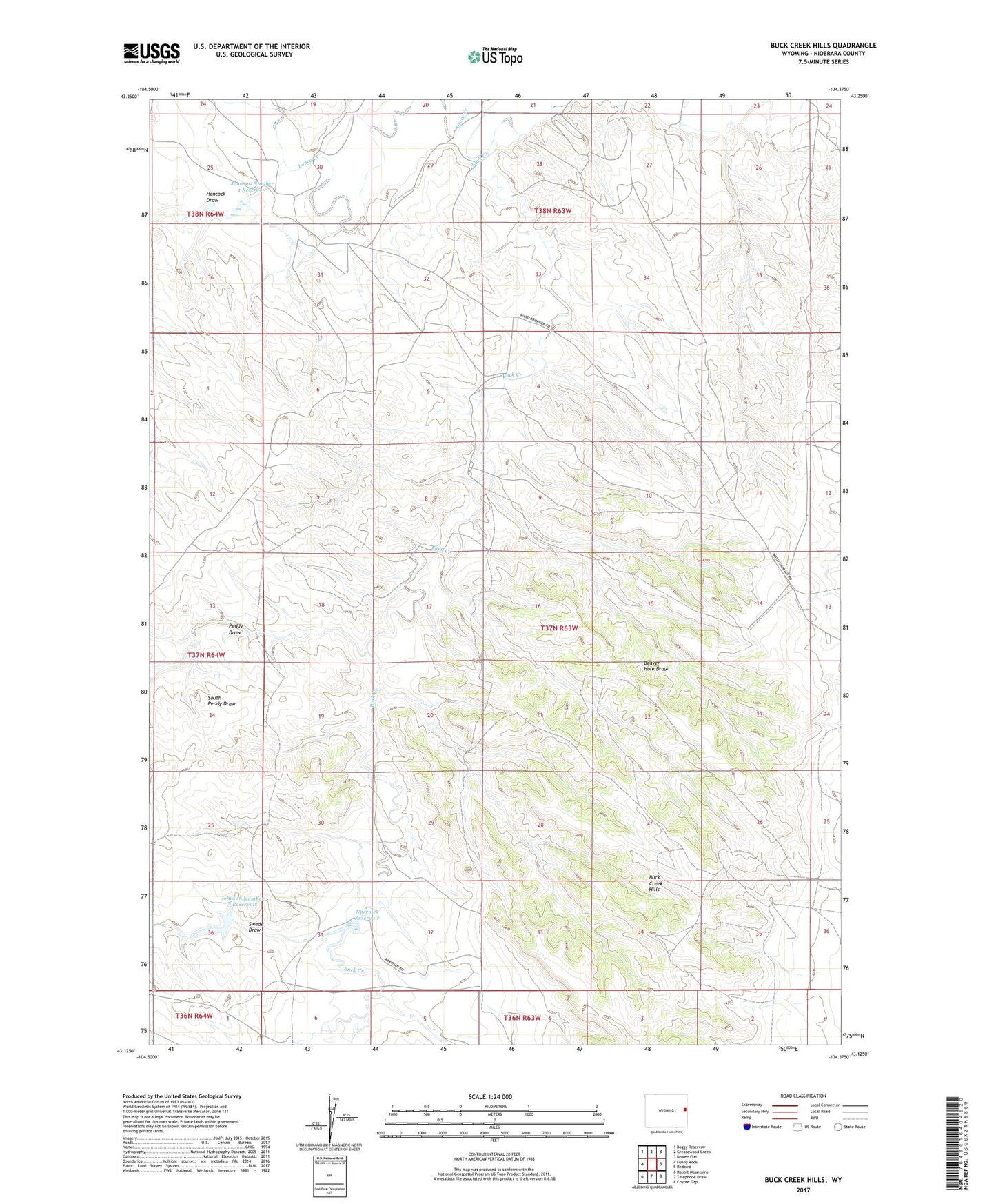
2021 topographic map quadrangle Buck Creek Hills in the state of Wyoming. Scale: 1:24000. Based on the newly updated USGS 7.5' US Topo map series, this map is in the following counties: Niobrara. The map contains contour data, water features, and other items you are used to seeing on USGS maps, but also has updated roads and other features. This is the next generation of topographic maps. Printed on high-quality waterproof paper with UV fade-resistant inks.
Quads adjacent to this one:
West: Funny Rock
Northwest: Boggy Reservoir
North: Greasewood Creek
Northeast: Bowen Flat
East: Redbird
Southeast: Coyote Gap
South: Telephone Draw
Southwest: Rabbit Mountains
This map covers the same area as the classic USGS quad with code o43104b4.
Contains the following named places: Beaver Hole Draw, Buck Creek, Buck Creek Hills, Clark Number 1 Dam, Clark Number 1 Reservoir, Hancock Draw, Johnson Number 1 Dam, Johnson Number 1 Reservoir, Johnson Number 3 Dam, Johnson Number 3 Reservoir, Narrows Dam, Narrows Reservoir, Peddy Draw, Roy Johnson Dam, Roy Johnson Reservoir, South Peddy Draw, Swede Draw