MyTopo
Scaper Reservoir Wyoming US Topo Map
Couldn't load pickup availability
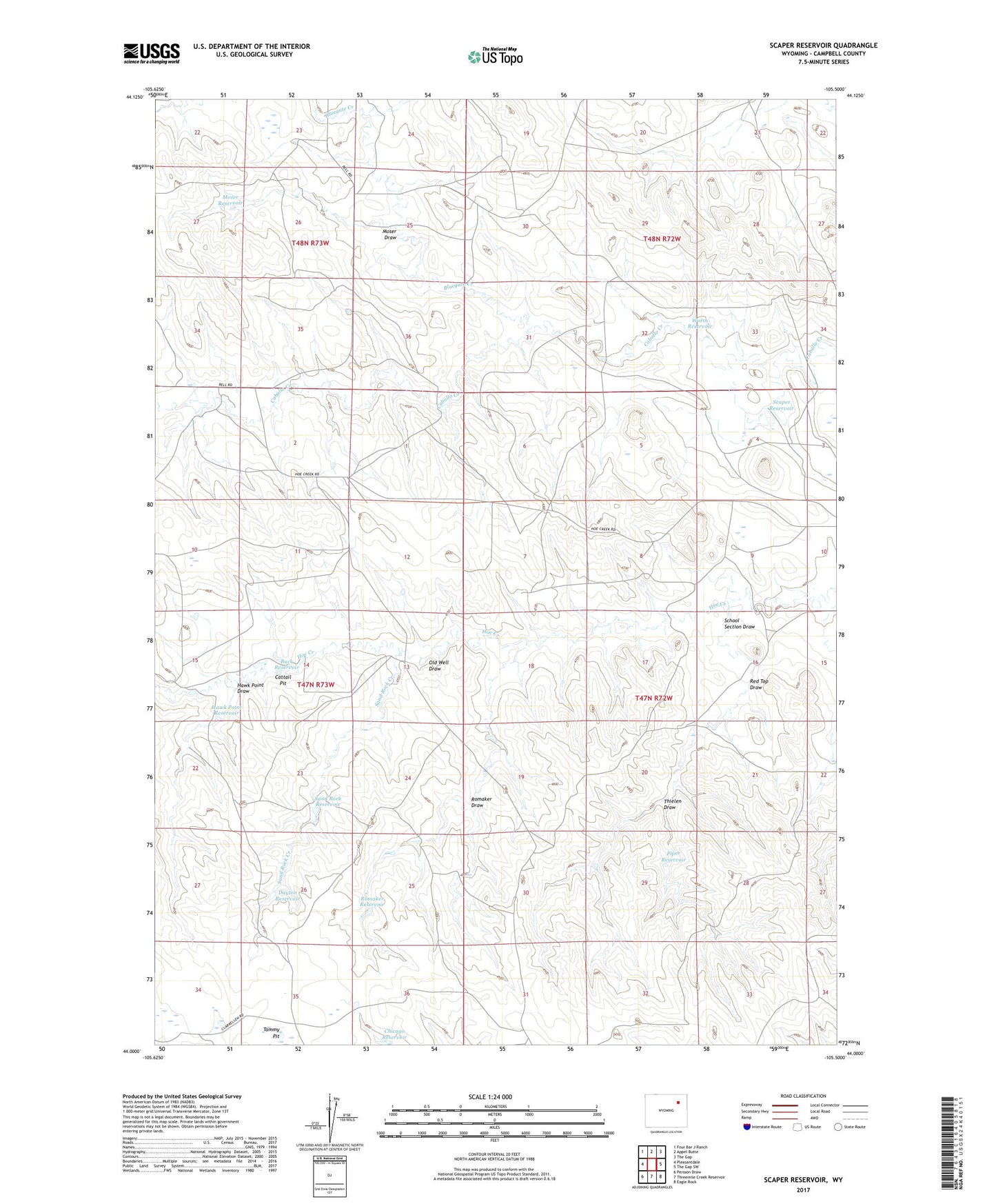
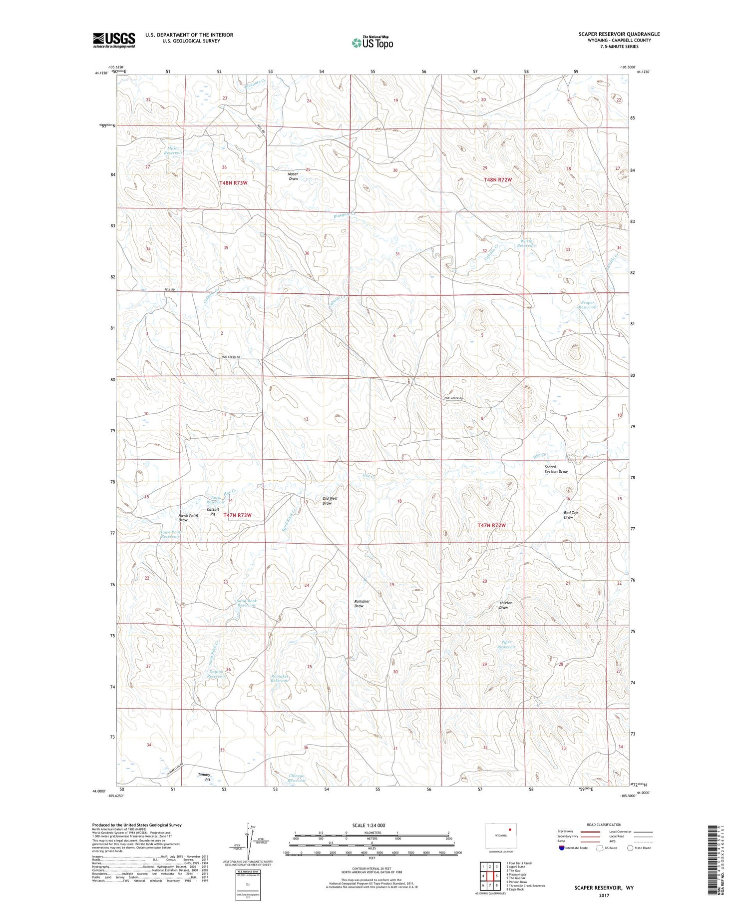
2021 topographic map quadrangle Scaper Reservoir in the state of Wyoming. Scale: 1:24000. Based on the newly updated USGS 7.5' US Topo map series, this map is in the following counties: Campbell. The map contains contour data, water features, and other items you are used to seeing on USGS maps, but also has updated roads and other features. This is the next generation of topographic maps. Printed on high-quality waterproof paper with UV fade-resistant inks.
Quads adjacent to this one:
West: Pleasantdale
Northwest: Four Bar J Ranch
North: Appel Butte
Northeast: The Gap
East: The Gap SW
Southeast: Eagle Rock
South: Threemile Creek Reservoir
Southwest: Persson Draw
Contains the following named places: Bluegate Creek, Buck Reservoir, Cattail Pit, Chicago Reservoir, Dayton Reservoir, Flat Dam, Hawk Point Draw, Hawk Point Reservoir, Hoe Creek Dam, Moser Draw, Moser Reservoir, Old Well Draw, Old Well Pit, Piper Reservoir, Red Top Draw, Red Top Reservoir, Romaker Draw, Romaker Reservoir, Sand Rock Creek, Sand Rock Reservoir, Scaper Reservoir, School Section Draw, Tammy Pit, Thielen Draw, Worth Dam, Worth Reservoir