MyTopo
Threemile Creek Reservoir Wyoming US Topo Map
Couldn't load pickup availability
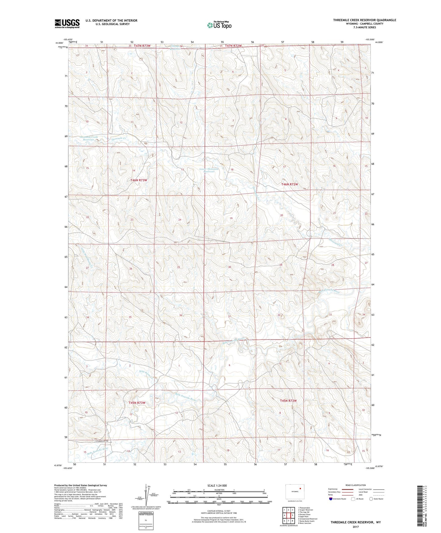
2021 topographic map quadrangle Threemile Creek Reservoir in the state of Wyoming. Scale: 1:24000. Based on the newly updated USGS 7.5' US Topo map series, this map is in the following counties: Campbell. The map contains contour data, water features, and other items you are used to seeing on USGS maps, but also has updated roads and other features. This is the next generation of topographic maps. Printed on high-quality waterproof paper with UV fade-resistant inks.
Quads adjacent to this one:
West: Persson Draw
Northwest: Pleasantdale
North: Scaper Reservoir
Northeast: The Gap SW
East: Eagle Rock
Southeast: Reno Junction
South: Rocky Butte Gulch
Southwest: Greasewood Reservoir
This map covers the same area as the classic USGS quad with code o43105h5.
Contains the following named places: Durham Dam, Durham Reservoir, Gillette South Division, Lee Wright Ranch, Lindsey Ranch, Little Wild Horse Creek, Little Wild Horse Reservoir, Lower Threemile Reservoir, Otis Wright Ranch, Threemile Creek Reservoir, Wild Horse Creek, ZIP Code: 82718