MyTopo
Scott Dam Wyoming US Topo Map
Couldn't load pickup availability
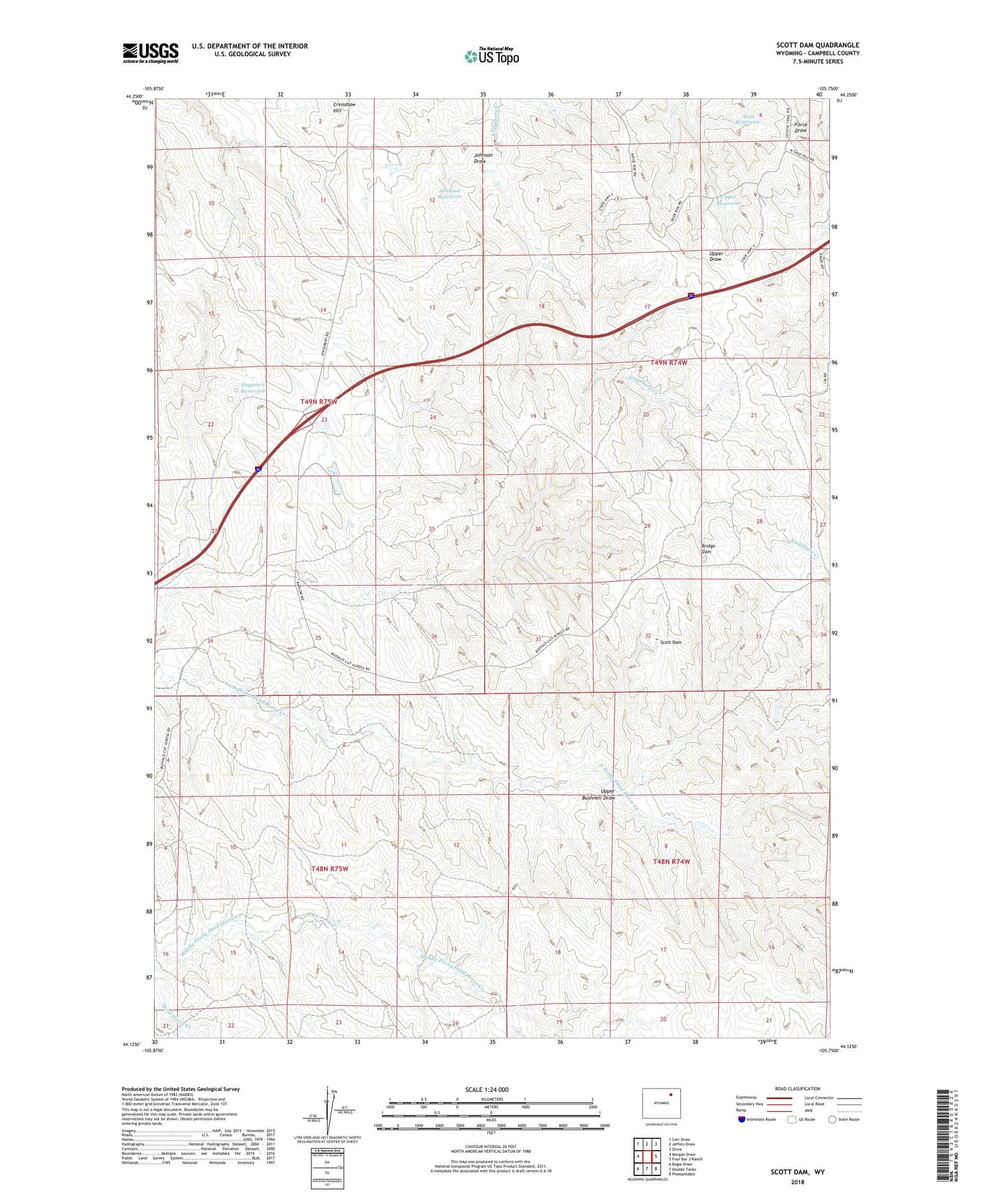
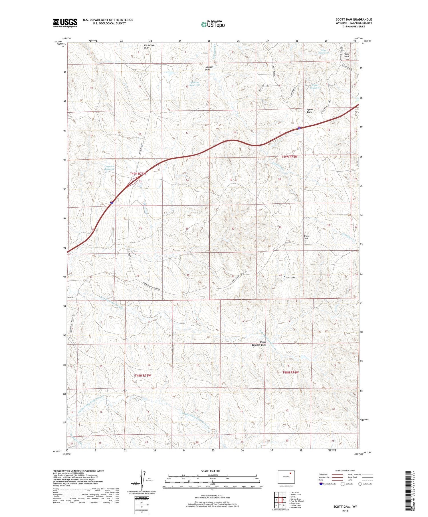
2021 topographic map quadrangle Scott Dam in the state of Wyoming. Scale: 1:24000. Based on the newly updated USGS 7.5' US Topo map series, this map is in the following counties: Campbell. The map contains contour data, water features, and other items you are used to seeing on USGS maps, but also has updated roads and other features. This is the next generation of topographic maps. Printed on high-quality waterproof paper with UV fade-resistant inks.
Quads adjacent to this one:
West: Morgan Draw
Northwest: Carr Draw
North: Jeffers Draw
Northeast: Oriva
East: Four Bar J Ranch
Southeast: Pleasantdale
South: Double Tanks
Southwest: Bogie Draw
Contains the following named places: Alan Reservoir, Barlow Ranch, Bridge Dam, Buffalo Wallow Dam, Chokecherry Dam, Crenshaw Hill, Dogtown Reservoir, Johnson Draw, Johnson Reservoir, Lee Mankin Dam, Lee Mankin Reservoir, Middle Prong Dead Horse Creek, Upper Bushnell Draw, Upper Reservoir