MyTopo
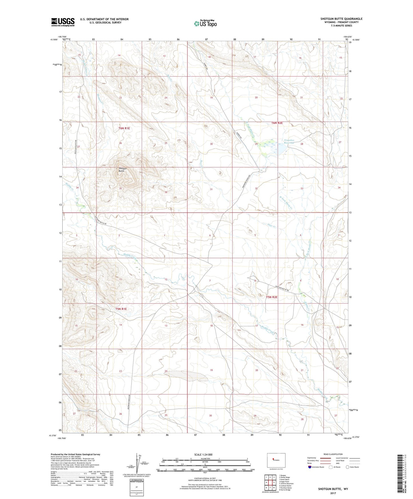
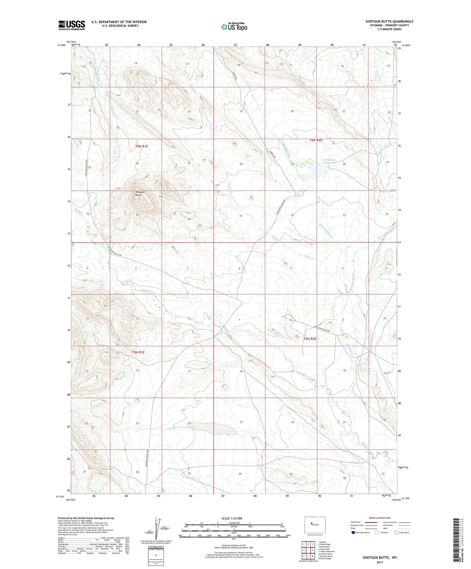
Shotgun Butte Wyoming US Topo Map
Couldn't load pickup availability
2021 topographic map quadrangle Shotgun Butte in the state of Wyoming. Scale: 1:24000. Based on the newly updated USGS 7.5' US Topo map series, this map is in the following counties: Fremont. The map contains contour data, water features, and other items you are used to seeing on USGS maps, but also has updated roads and other features. This is the next generation of topographic maps. Printed on high-quality waterproof paper with UV fade-resistant inks.
Quads adjacent to this one:
West: Eagle Point
Northwest: Bargee
North: Sheep Ridge
Northeast: Kates Basin
East: Jenkins Mountain
Southeast: Harris Bridge
South: Pavillion Butte
Southwest: Lookout Butte
Contains the following named places: Arapahoe Ranch, Arapahoe Reservoir, Cannonball Ranch, Deer Creek, East Fork Sheep Creek, McKee Grave Creek, Merriam Ranch, Sheep Creek, Shotgun Butte, Shotgun Creek, Shotgun Ranch, West Fork Sheep Creek