MyTopo
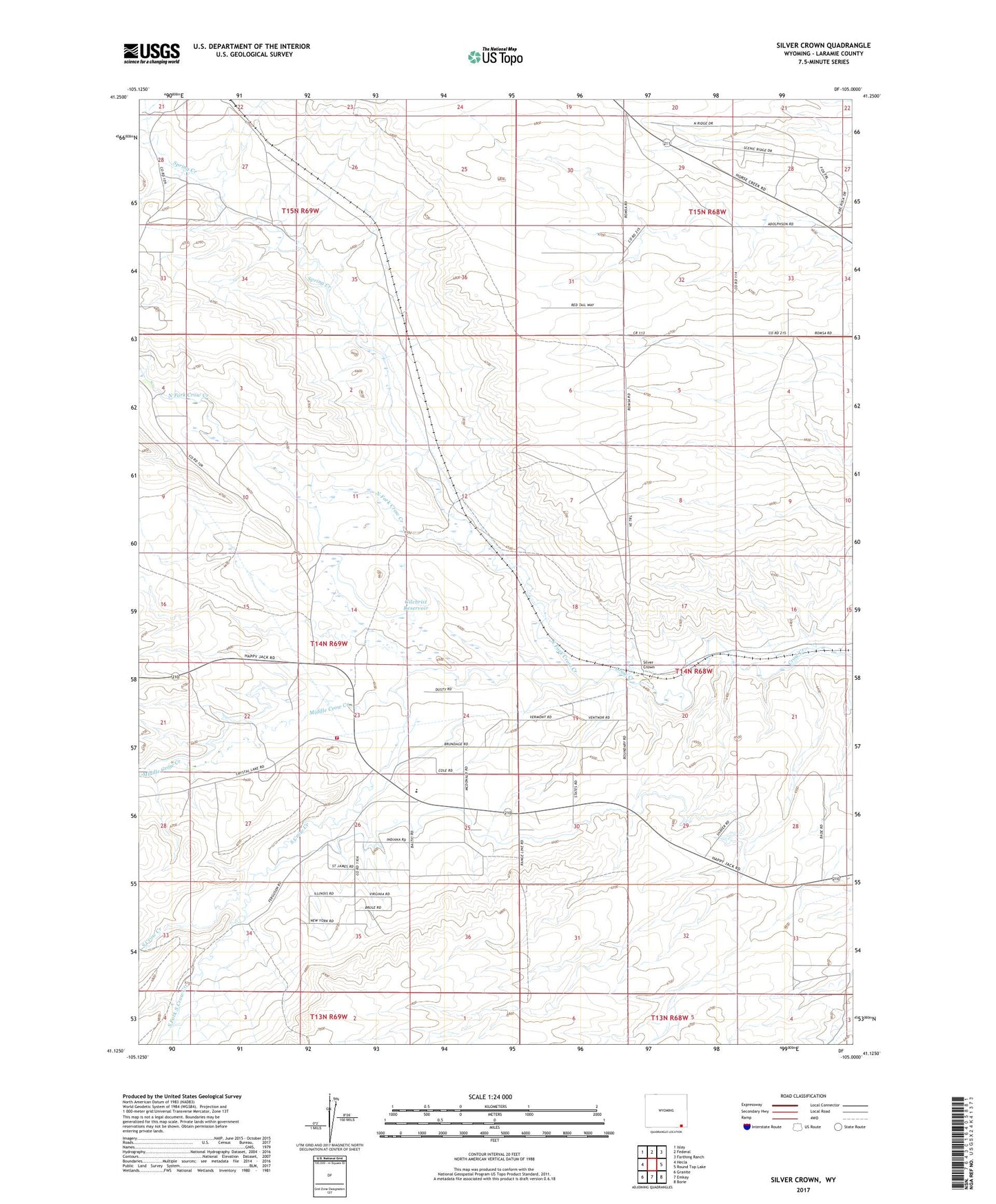
Silver Crown Wyoming US Topo Map
Couldn't load pickup availability
2021 topographic map quadrangle Silver Crown in the state of Wyoming. Scale: 1:24000. Based on the newly updated USGS 7.5' US Topo map series, this map is in the following counties: Laramie. The map contains contour data, water features, and other items you are used to seeing on USGS maps, but also has updated roads and other features. This is the next generation of topographic maps. Printed on high-quality waterproof paper with UV fade-resistant inks.
Quads adjacent to this one:
West: Hecla
Northwest: Islay
North: Federal
Northeast: Farthing Ranch
East: Round Top Lake
Southeast: Borie
South: Emkay
Southwest: Granite
Contains the following named places: Adolphson Ranch, Cole Ranch, Ferguson Ranch, Gilchrist Ditch Number 4, Gilchrist Ditch Number 9, Gilchrist Reservoir, Gilchrist School, J Francis Ranch, Laramie County Fire District 8 - Table Mountain, Middle Crow Creek, North Fork Crow Creek, O'Conner Ranch, Old Francis Ranch, Romsa Ranch, Silver Crown, South Crow Creek, South Fork South Crow Creek, Spring Creek