MyTopo
Borie Wyoming US Topo Map
Couldn't load pickup availability
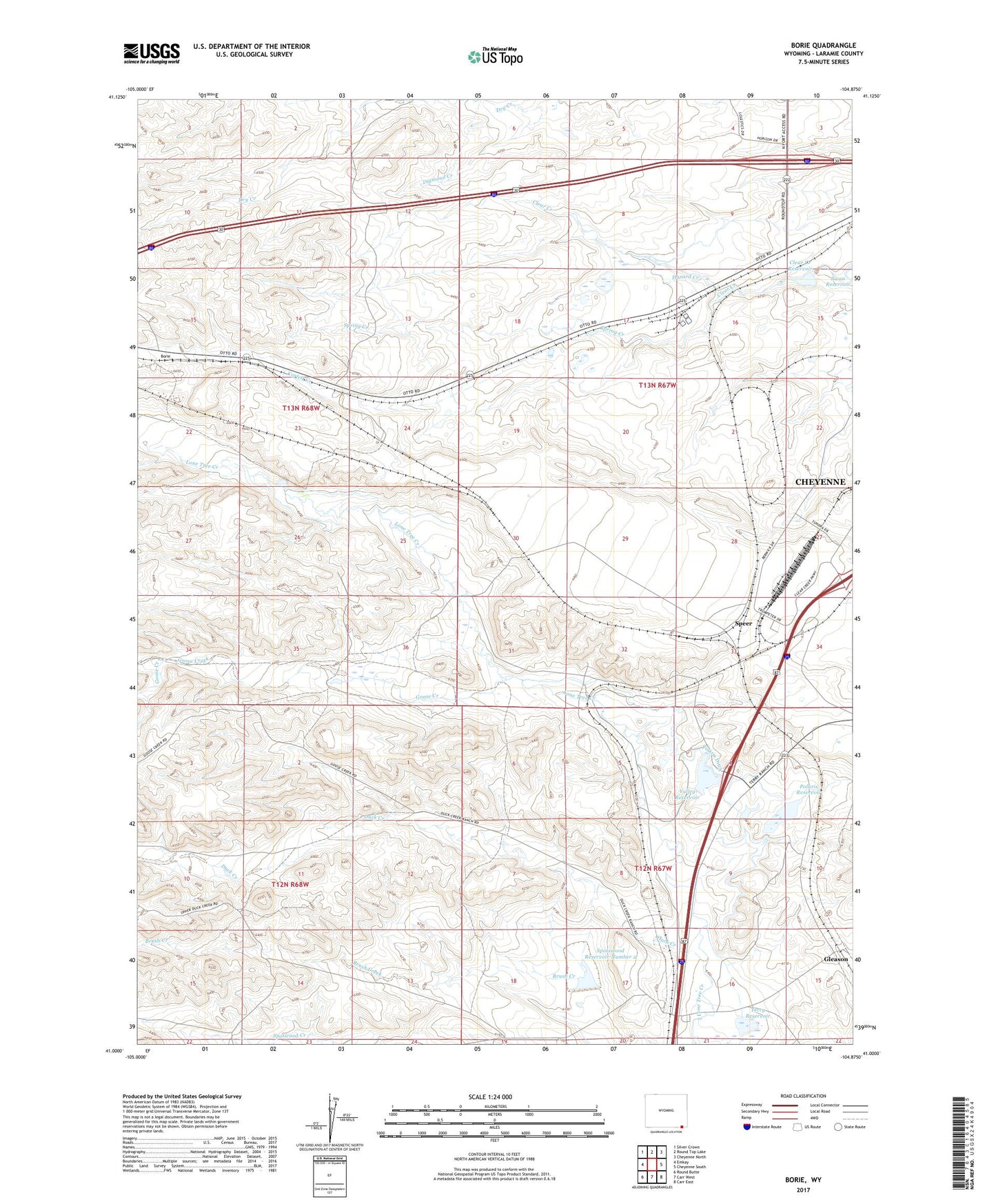
2021 topographic map quadrangle Borie in the state of Wyoming. Scale: 1:24000. Based on the newly updated USGS 7.5' US Topo map series, this map is in the following counties: Laramie. The map contains contour data, water features, and other items you are used to seeing on USGS maps, but also has updated roads and other features. This is the next generation of topographic maps. Printed on high-quality waterproof paper with UV fade-resistant inks.
Quads adjacent to this one:
West: Emkay
Northwest: Silver Crown
North: Round Top Lake
Northeast: Cheyenne North
East: Cheyenne South
Southeast: Carr East
South: Carr West
Southwest: Round Butte
This map covers the same area as the classic USGS quad with code o41104a8.
Contains the following named places: 7XL Dam, 7XL Reservoir, 82001, Belvoir Ranch, Borie, Borie Oil Field, Brush Creek, Clear Creek Dam, Clear Creek Reservoir, Corlett Creek, Dry Creek, Duck Creek, Duck Creek Camp, Elkar Well, Finnerty Well, Gleason Number 2 Dam, Goose Creek, Hashknife Camp, Hazard Creek, KLWY-TV (Cheyenne), Polaris Dam, Polaris Ditch, Polaris Reservoir, Rees Ranch, South Triangle Windmill, Speer, Speer Windmill, Spotswood Number 2 Dam, Spotswood Reservoir Number 2, Spring Creek, Terry Ranch, Terry Reservoir, Triangle Camp, Triangle Windmill, Valley Camp, Valley Reservoir, Webber Well, West Triangle Windmill, Willow Creek, Willow Creek Camp