
MyTopo
Squaretop Mountain Wyoming US Topo Map
Couldn't load pickup availability
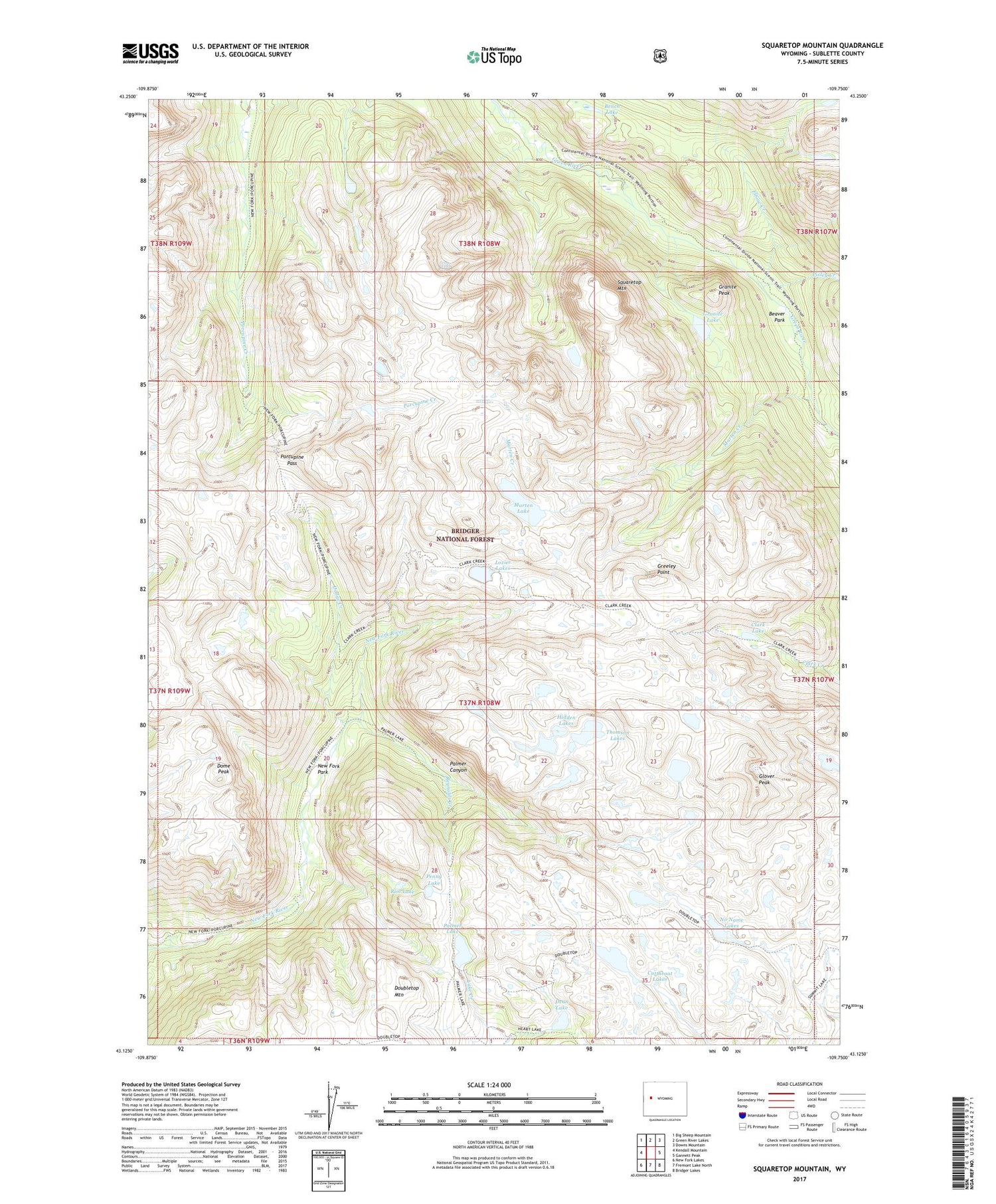
2021 topographic map quadrangle Squaretop Mountain in the state of Wyoming. Scale: 1:24000. Based on the newly updated USGS 7.5' US Topo map series, this map is in the following counties: Sublette. The map contains contour data, water features, and other items you are used to seeing on USGS maps, but also has updated roads and other features. This is the next generation of topographic maps. Printed on high-quality waterproof paper with UV fade-resistant inks.
Quads adjacent to this one:
West: Kendall Mountain
Northwest: Big Sheep Mountain
North: Green River Lakes
Northeast: Downs Mountain
East: Gannett Peak
Southeast: Bridger Lakes
South: Fremont Lake North
Southwest: New Fork Lakes
Contains the following named places: Beaver Park, Bench Lake, Clark Lake, Cutthroat Lakes, Dean Lake, Dodge Creek, Dome Peak, Doubletop Mountain, Doubletop Mountain Trail, Elbow Creek, Glover Peak, Granite Lake, Granite Peak, Greeley Point, Hidden Lakes, Jim Creek Trail, Kenny Lake, Lozier Lakes, Marten Creek, Marten Lake, New Fork Park, New Fork Trail, No Name Lakes, Palmer Canyon, Palmer Lake, Palmer Lake Trail, Penny Lake, Pixley Creek, Porcupine Pass, Porcupine Trail, Reynolds Creek, Rim Lake, Squaretop Mountain, Thomson Lakes


