MyTopo
Bridger Lakes Wyoming US Topo Map
Couldn't load pickup availability
Also explore the Bridger Lakes Forest Service Topo of this same quad for updated USFS data
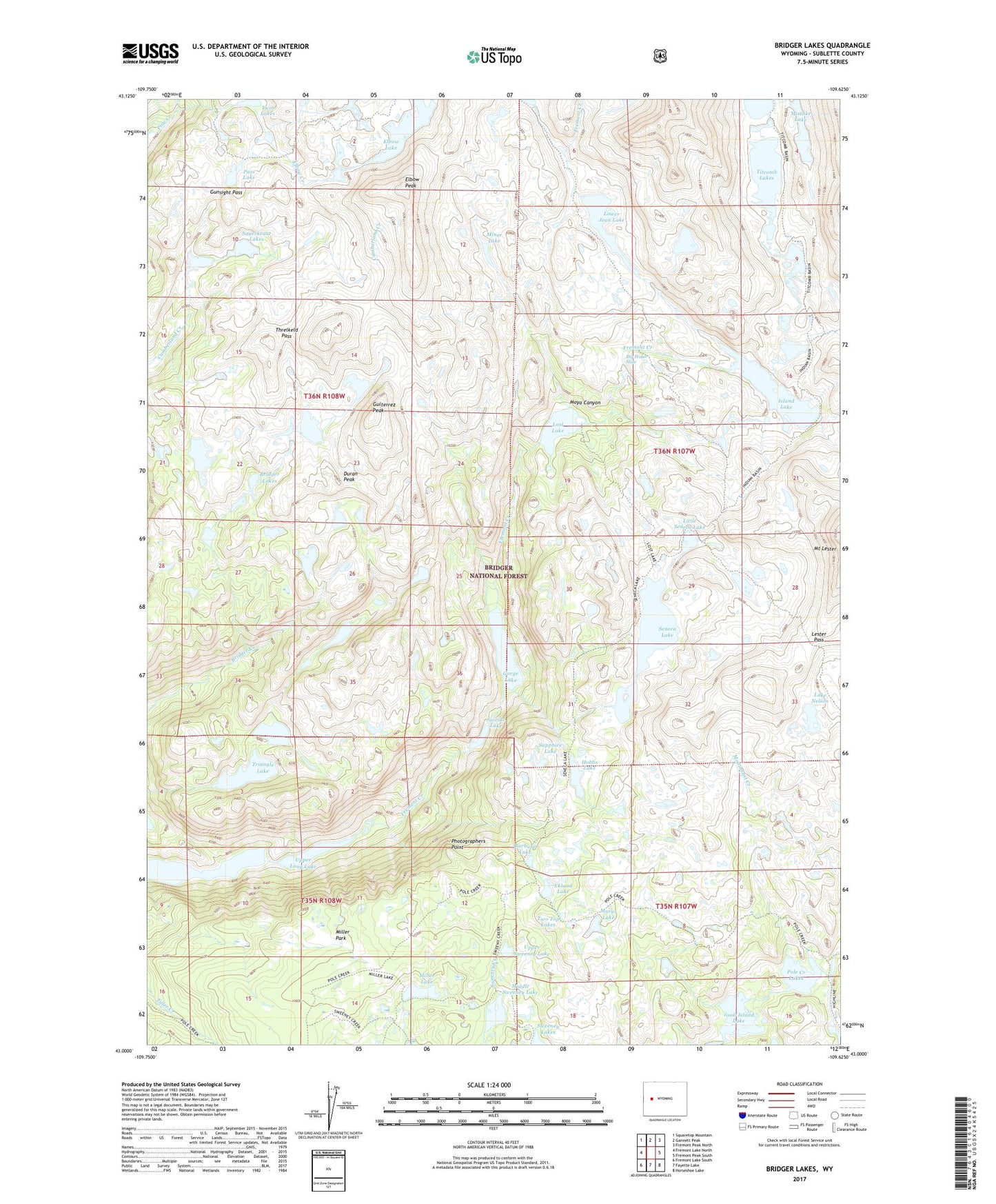
2021 topographic map quadrangle Bridger Lakes in the state of Wyoming. Scale: 1:24000. Based on the newly updated USGS 7.5' US Topo map series, this map is in the following counties: Sublette. The map contains contour data, water features, and other items you are used to seeing on USGS maps, but also has updated roads and other features. This is the next generation of topographic maps. Printed on high-quality waterproof paper with UV fade-resistant inks.
Quads adjacent to this one:
West: Fremont Lake North
Northwest: Squaretop Mountain
North: Gannett Peak
Northeast: Fremont Peak North
East: Fremont Peak South
Southeast: Horseshoe Lake
South: Fayette Lake
Southwest: Fremont Lake South
This map covers the same area as the classic USGS quad with code o43109a6.
Contains the following named places: 1000 Island Lake, Barbara Lake, Big Water Slide, Bridger Lakes, Duran Peak, Eklund Lake, Elbow Creek, Elbow Lake, Elbow Peak, Fremont Crossing, Gorge Lake, Guiterrez Peak, Gunsight Pass, Hobbs Lake, Indian Pass Trail, Island Lake, Lake Nelson, Lester Pass, Little Seneca Lake, Long Lake, Lost Lake, Lower Jean Lake, Marys Lake, Middle Sweeney Lake, Miller Lake, Miller Park, Miner Lake, Mistake Lake, Monument Creek, Moya Canyon, Pass Lake, Photographers Point, Pole Creek Lakes, Pole Creek Trail, Sapphire Lake, Sauerkraut Lakes, Seneca Lake, Seneca Lake Trail, Suicide Lake, Sweeney Lakes, Threlkeld Pass, Titcomb Basin Trail, Titcomb Lakes, Triangle Lake, Twin Lakes, Two Top Lakes, Upper Long Lake, Upper Sweeney Lake