MyTopo
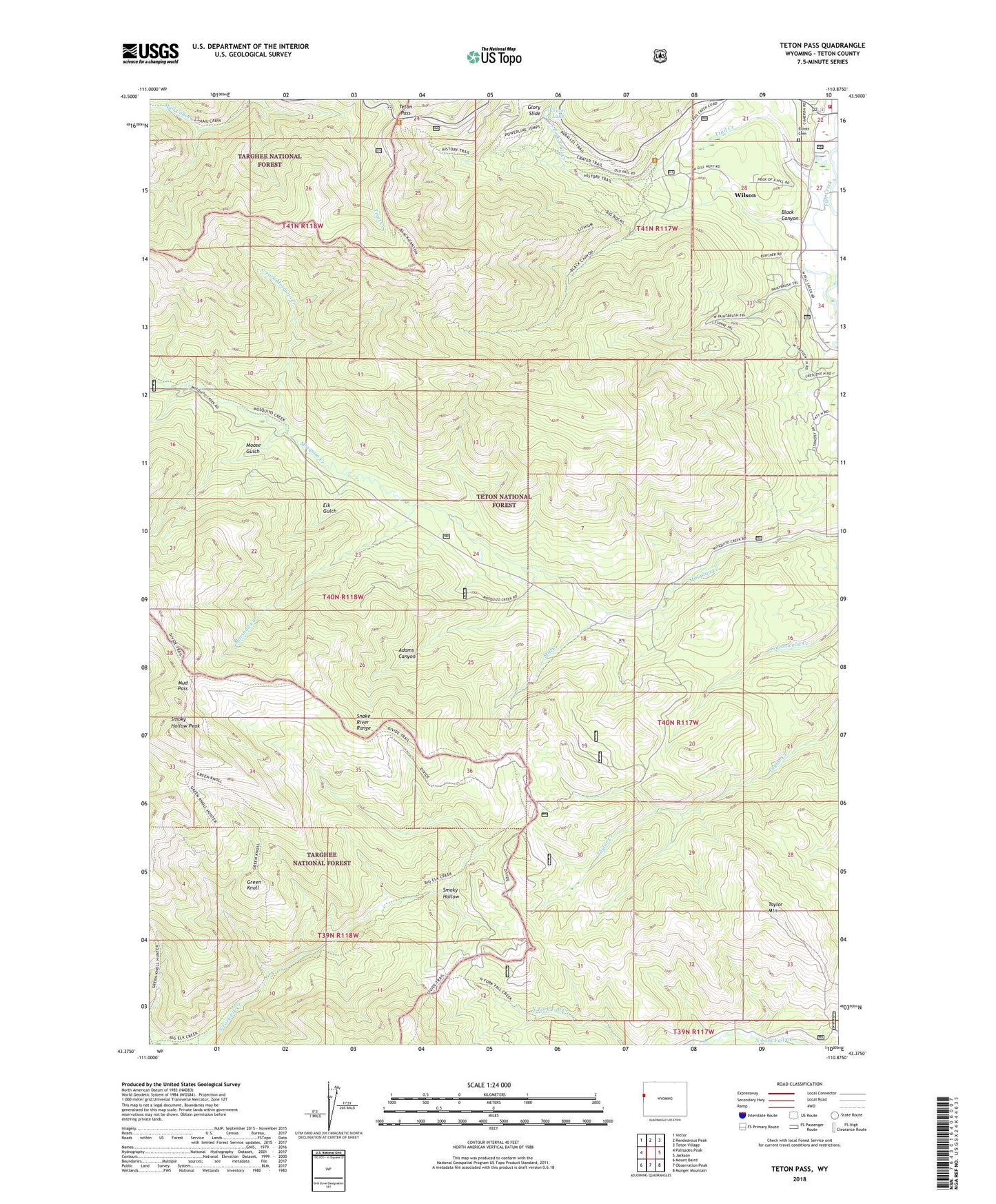
Teton Pass Wyoming US Topo Map
Couldn't load pickup availability
2021 topographic map quadrangle Teton Pass in the state of Wyoming. Scale: 1:24000. Based on the newly updated USGS 7.5' US Topo map series, this map is in the following counties: Teton. The map contains contour data, water features, and other items you are used to seeing on USGS maps, but also has updated roads and other features. This is the next generation of topographic maps. Printed on high-quality waterproof paper with UV fade-resistant inks.
Quads adjacent to this one:
West: Palisades Peak
Northwest: Victor
North: Rendezvous Peak
Northeast: Teton Village
East: Jackson
Southeast: Munger Mountain
South: Observation Peak
Southwest: Mount Baird
Contains the following named places: Adams Canyon, Black Canyon, Crater Lake, Elk Gulch, Elliott Cemetery, Fish Creek, Glory Slide, Green Knoll, Jackson Hole Fire and Emergency Medical Services - Firehouse 2 Wilson, Lee Guard Station, Marshall Creek, Mill Creek, Moose Gulch, Mud Pass, North Fork Mosquito Creek, North Fork Trail Creek, Smoky Hollow, Smoky Hollow Peak, Taylor Mountain, Teton Pass, Trail Creek Ranch, Wilson Census Designated Place, Wilson South Pit and Plant Mine, ZIP Code: 83014