MyTopo
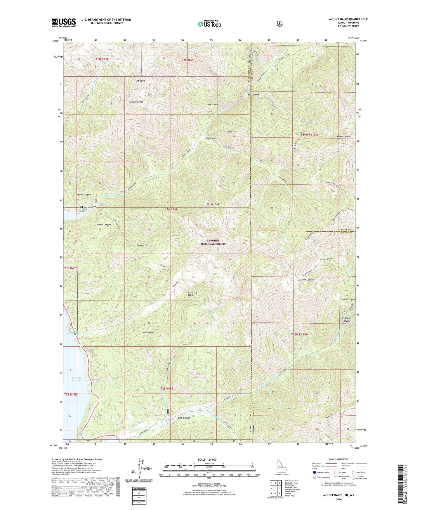
Mount Baird Idaho US Topo Map
Couldn't load pickup availability
Also explore the Mount Baird Forest Service Topo of this same quad for updated USFS data
2024 topographic map quadrangle Mount Baird in the states of Idaho, Wyoming. Scale: 1:24000. Based on the newly updated USGS 7.5' US Topo map series, this map is in the following counties: Bonneville, Lincoln, Teton. The map contains contour data, water features, and other items you are used to seeing on USGS maps, but also has updated roads and other features. This is the next generation of topographic maps. Printed on high-quality waterproof paper with UV fade-resistant inks.
Quads adjacent to this one:
West: Palisades Dam
Northwest: Thompson Peak
North: Palisades Peak
Northeast: Teton Pass
East: Observation Peak
Southeast: Ferry Peak
South: Alpine
Southwest: Poker Peak
Contains the following named places: Big Basin Canyon, Big Elk Creek, Big Elk Creek Campground, Blowout Canyon, Box Canyon, Cabin Creek, Dry Canyon, Elkhorn Peak, Garden Canyon, Hells Hole, Jack Branch Canyon, Mount Baird, Needle Peak, North Fork Indian Creek, Paul Peak, Powder Peak, Quaker Flat, Siddoway Fork, Skunk Canyon, Smith Canyon, South Fork Indian Creek, Spaulding Basin