MyTopo
Victor Idaho US Topo Map
Couldn't load pickup availability
Also explore the Victor Forest Service Topo of this same quad for updated USFS data
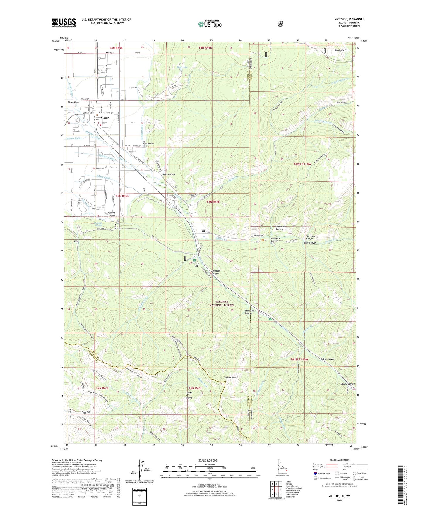
2023 topographic map quadrangle Victor in the states of Idaho, Wyoming. Scale: 1:24000. Based on the newly updated USGS 7.5' US Topo map series, this map is in the following counties: Teton, Bonneville. The map contains contour data, water features, and other items you are used to seeing on USGS maps, but also has updated roads and other features. This is the next generation of topographic maps. Printed on high-quality waterproof paper with UV fade-resistant inks.
Quads adjacent to this one:
West: Fourth of July Peak
Northwest: Bates
North: Driggs
Northeast: Mount Bannon
East: Rendezvous Peak
Southeast: Teton Pass
South: Palisades Peak
Southwest: Thompson Peak
Contains the following named places: Allen Creek, Baldy Knoll, Bear Canyon, Burbank Creek, City of Victor, Elbow Fork, Fogg Hill, Game Creek, Hungry Creek, Kearsley Canal, Kimball Canal, Mike Harris Camnpground, Mike Harris Creek, Mikesell Canyon, Moose Creek, Mud Lake, Nordell Canyon, Nordwall Canyon, North Fork Game Creek, Oliver Peak, Plummer Canyon, Pole Canyon, Sherman Canyon, Sherman Springs, South Fork Game Creek, Squaw Canyon, Stateline Canyon, String Canal, Sweet Hollow, Talbot Canyon, Teton County Fire Protection District Station 2, The String, Trail Creek Campground, Victor, Victor Cemetery, Victor Elementary School, Victor Post Office, West Burbank Creek