MyTopo
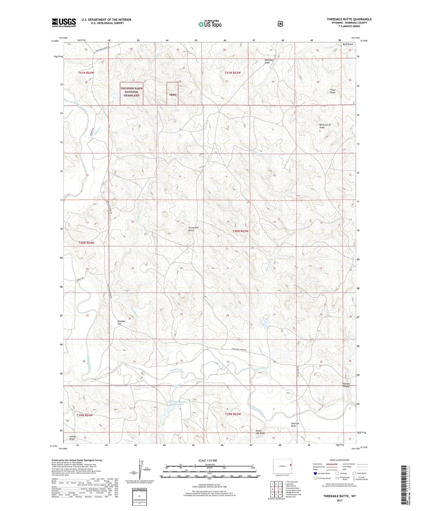
Threemile Butte Wyoming US Topo Map
Couldn't load pickup availability
Also explore the Threemile Butte Forest Service Topo of this same quad for updated USFS data
2021 topographic map quadrangle Threemile Butte in the state of Wyoming. Scale: 1:24000. Based on the newly updated USGS 7.5' US Topo map series, this map is in the following counties: Niobrara. The map contains contour data, water features, and other items you are used to seeing on USGS maps, but also has updated roads and other features. This is the next generation of topographic maps. Printed on high-quality waterproof paper with UV fade-resistant inks.
Quads adjacent to this one:
West: Horseshoe Bend
Northwest: The Nose East
North: Morrisey
Northeast: Morrisey SE
East: Little Alkali Creek
Southeast: Bowen Flat
South: Greasewood Creek
Southwest: Boggy Reservoir
This map covers the same area as the classic USGS quad with code o43104d4.
Contains the following named places: Boggy Creek, Charlies Draw, Count Creek, Crooked Creek, Dutch Joe Draw, Hanson Dam, Hanson Number 2 Reservoir, Hanson Reservoir, Hungry Hollow, Mrs W E White Dam, Mrs W E White Reservoir, New Deal Number 1 Dam, New Deal Number 1 Reservoir, Seven Mile Number 1 Dam, Seven Mile Number 1 Reservoir, Sevenmile Creek, Sevenmile School, Sheldon Hill, Threemile Butte