MyTopo
Twentymile Butte Wyoming US Topo Map
Couldn't load pickup availability
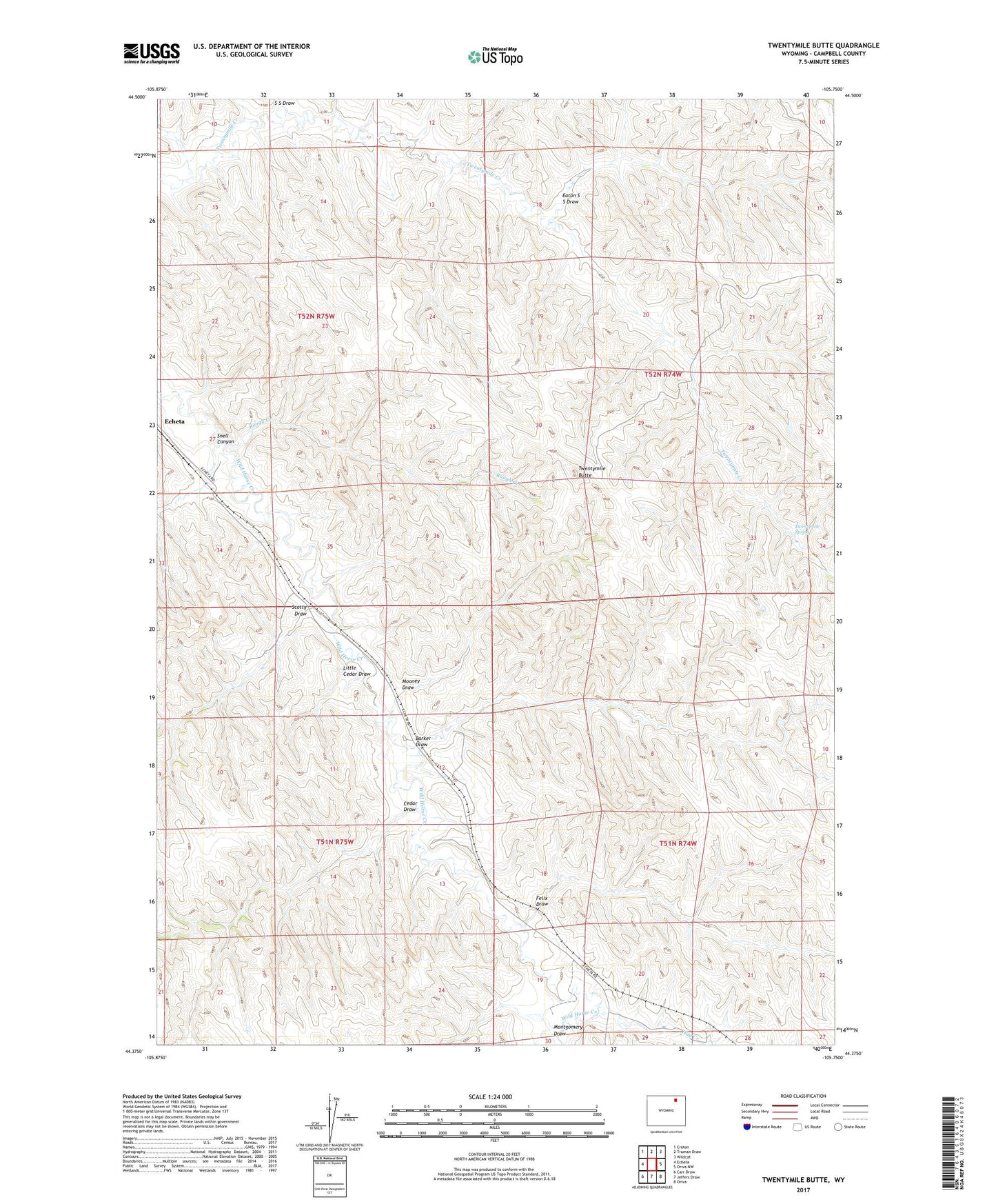
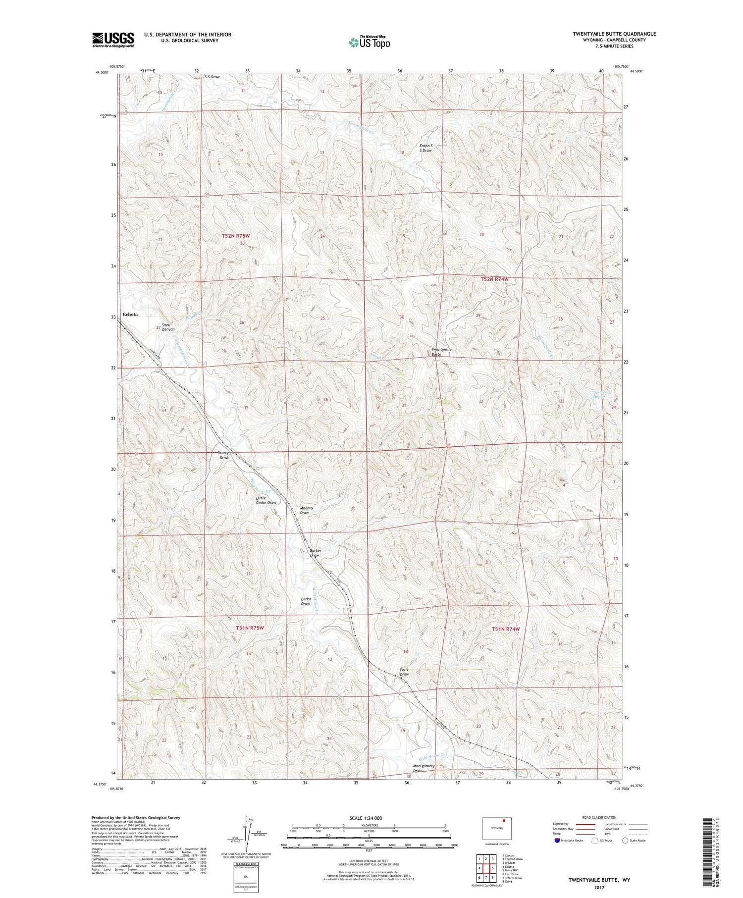
2021 topographic map quadrangle Twentymile Butte in the state of Wyoming. Scale: 1:24000. Based on the newly updated USGS 7.5' US Topo map series, this map is in the following counties: Campbell. The map contains contour data, water features, and other items you are used to seeing on USGS maps, but also has updated roads and other features. This is the next generation of topographic maps. Printed on high-quality waterproof paper with UV fade-resistant inks.
Quads adjacent to this one:
West: Echeta
Northwest: Croton
North: Truman Draw
Northeast: Wildcat
East: Oriva NW
Southeast: Oriva
South: Jeffers Draw
Southwest: Carr Draw
Contains the following named places: Barker Draw, Cedar Draw, Eaton S S Draw, Echetah Dam, Echetah Reservoir, Felix Draw, Hay Creek, Little Cedar Draw, Montgomery Draw, Mooney Draw, Rough Creek, S S Draw, Scotty Draw, Snell Canyon, Twentymile Butte, Twentymile Spring