MyTopo
Truman Draw Wyoming US Topo Map
Couldn't load pickup availability
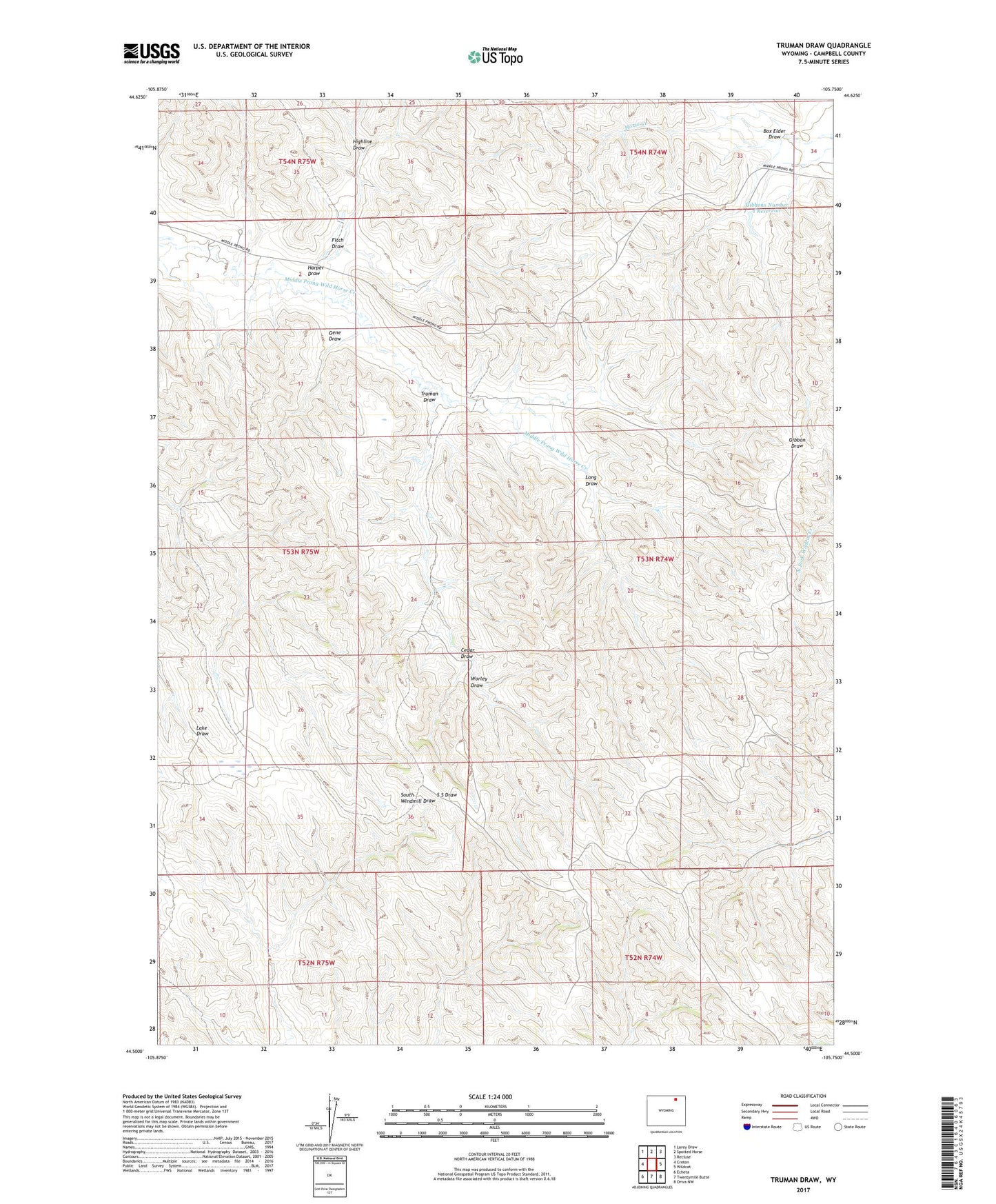
2021 topographic map quadrangle Truman Draw in the state of Wyoming. Scale: 1:24000. Based on the newly updated USGS 7.5' US Topo map series, this map is in the following counties: Campbell. The map contains contour data, water features, and other items you are used to seeing on USGS maps, but also has updated roads and other features. This is the next generation of topographic maps. Printed on high-quality waterproof paper with UV fade-resistant inks.
Quads adjacent to this one:
West: Croton
Northwest: Larey Draw
North: Spotted Horse
Northeast: Recluse
East: Wildcat
Southeast: Oriva NW
South: Twentymile Butte
Southwest: Echeta
This map covers the same area as the classic USGS quad with code o44105e7.
Contains the following named places: Box Elder Draw, Cedar Draw, Fitch Draw, Gene Draw, Gibbon Number 1 Dam, Gibbons Number 1 Reservoir, Harper Draw, Highline Draw, Long Draw, P R Dam, P R Reservoir, Scott Storage Dam, Scott Storage Reservoir, Truman Draw, Worley Draw