MyTopo
Ucross Wyoming US Topo Map
Couldn't load pickup availability
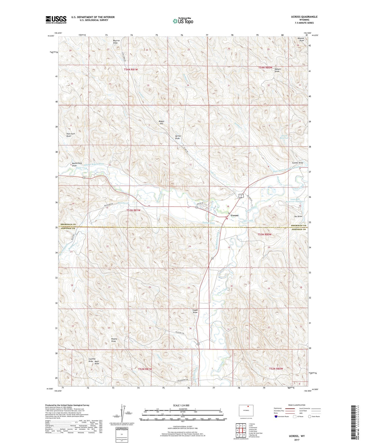
2021 topographic map quadrangle Ucross in the state of Wyoming. Scale: 1:24000. Based on the newly updated USGS 7.5' US Topo map series, this map is in the following counties: Sheridan, Johnson. The map contains contour data, water features, and other items you are used to seeing on USGS maps, but also has updated roads and other features. This is the next generation of topographic maps. Printed on high-quality waterproof paper with UV fade-resistant inks.
Quads adjacent to this one:
West: Horse Hill
Northwest: Verona
North: Ulm
Northeast: Clearmont
East: Julio Draw
Southeast: Fredrick Draw
South: Buffalo NE
Southwest: Lake De Smet East
Contains the following named places: Athorpe Rogers Ditch, Big Bonanza Ditch, Blazer Hill, Bourret Draw, Boxelder Creek, Boxelder Ditch, Butterfield Draw, Clearmont Fire District - Ucross, Coal Creek, Copps Draw, Deep Creek, Donkey Creek, Dunlap Ditch, Fowler Draw, Garretson Mine, Holmberg Mine, Ike Draw, Little Red Dam, Little Red Number 2 Dam, Little Red Reservoir, Little Red Reservoir Number 2, Piney Creek, Pitsch Reservoir, Spring Draw, Twin Fork Draw, Ucross