MyTopo
Clearmont Wyoming US Topo Map
Couldn't load pickup availability
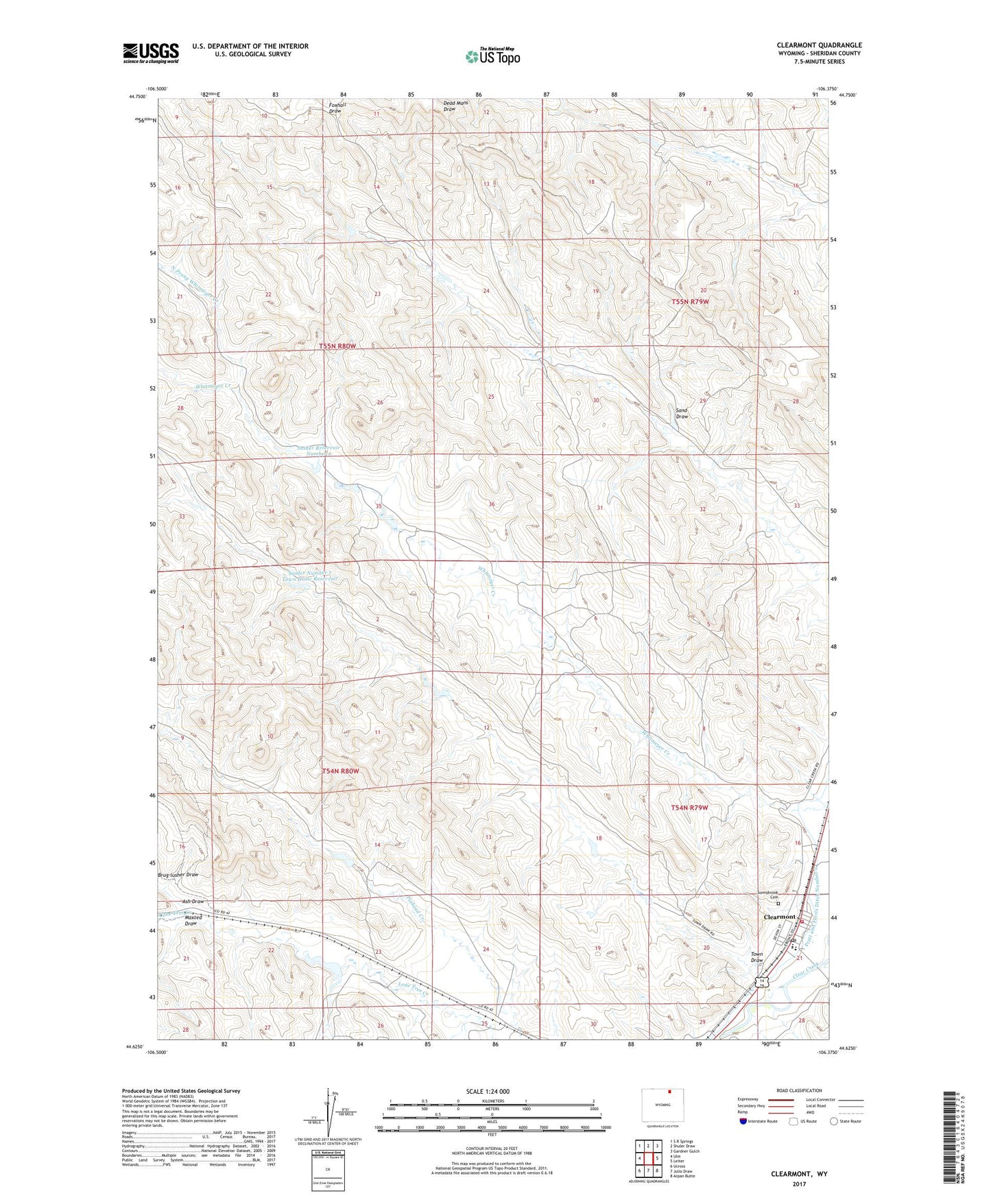
2021 topographic map quadrangle Clearmont in the state of Wyoming. Scale: 1:24000. Based on the newly updated USGS 7.5' US Topo map series, this map is in the following counties: Sheridan. The map contains contour data, water features, and other items you are used to seeing on USGS maps, but also has updated roads and other features. This is the next generation of topographic maps. Printed on high-quality waterproof paper with UV fade-resistant inks.
Quads adjacent to this one:
West: Ulm
Northwest: S R Springs
North: Shuler Draw
Northeast: Gardner Gulch
East: Leiter
Southeast: Arpan Butte
South: Julio Draw
Southwest: Ucross
This map covers the same area as the classic USGS quad with code o44106f4.
Contains the following named places: Arvada-Clearmont High School, Arvada-Clearmont Junior High School, Ash Draw, Clearmont, Clearmont Fire District - Clearmont, Clearmont Post Office, Clearmont School, Hanging Woman School, Jacob Lang Prospect Mine, Kirkman Prospect Mine, Maxted Draw, North Prong Whitmeyer Creek, Pence Dam, Pence Reservoir, Rate and Huson Dam, Rate and Huson Reservoir, Robert Black Stump Dam, Robert Black Stump Reservoir, Sand Draw, Snider Number 1 Town Draw Dam, Snider Number 1 Town Draw Reservoir, Snider Number 6 Dam, Snider Reservoir Number 6, Sunnybrook Cemetery, Thompson Creek, Town Draw, Town of Clearmont, Zinge Mine