MyTopo
Walker Draw SE Wyoming US Topo Map
Couldn't load pickup availability
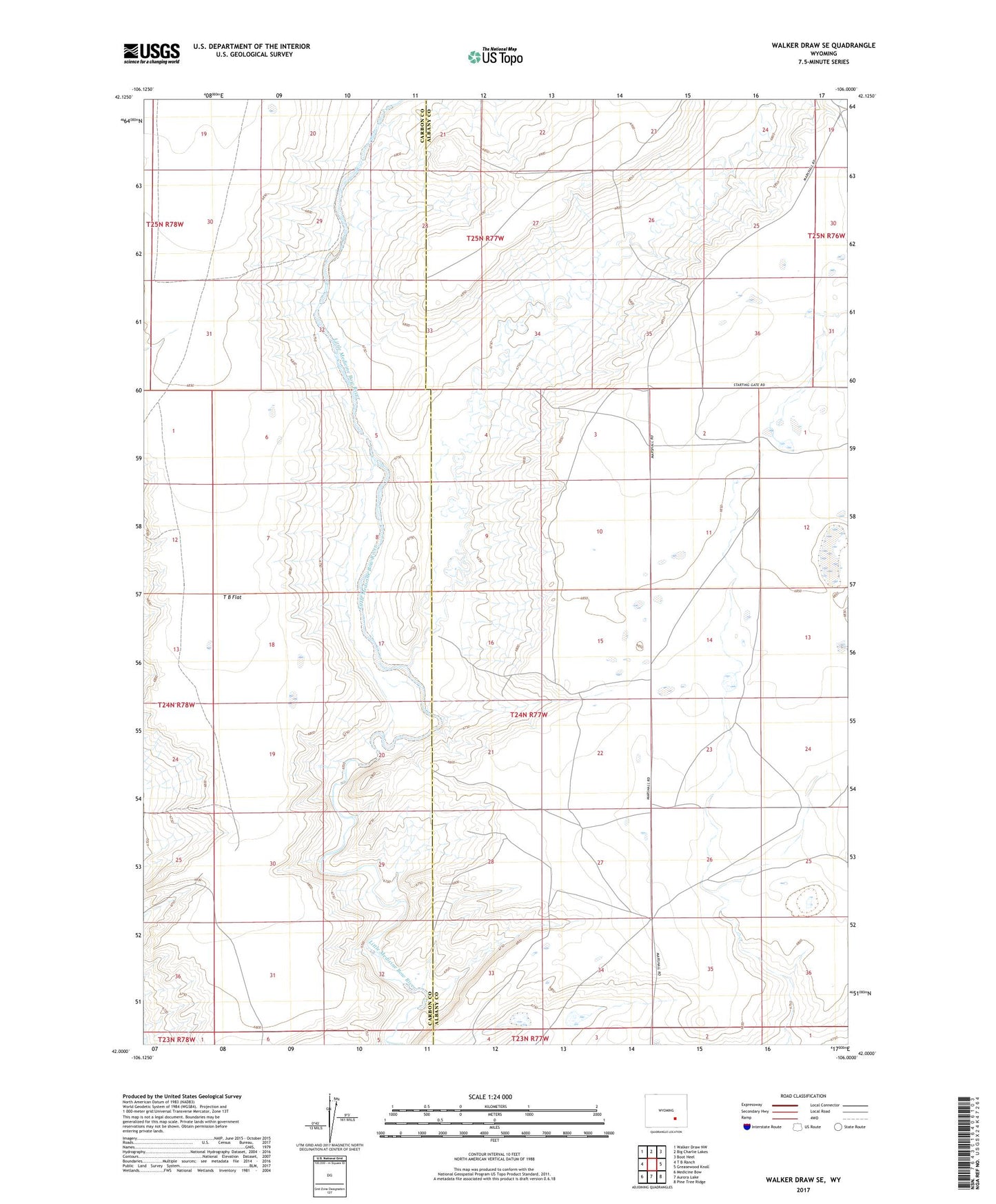
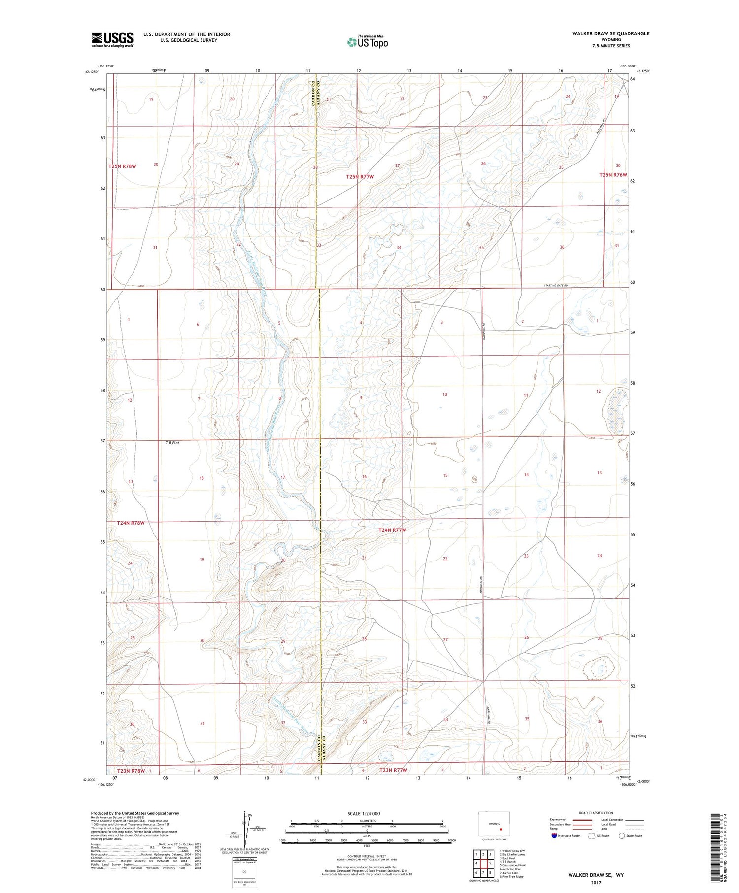
2021 topographic map quadrangle Walker Draw SE in the state of Wyoming. Scale: 1:24000. Based on the newly updated USGS 7.5' US Topo map series, this map is in the following counties: Albany, Carbon. The map contains contour data, water features, and other items you are used to seeing on USGS maps, but also has updated roads and other features. This is the next generation of topographic maps. Printed on high-quality waterproof paper with UV fade-resistant inks.
Quads adjacent to this one:
West: T B Ranch
Northwest: Walker Draw NW
North: Big Charlie Lakes
Northeast: Boot Heel
East: Greasewood Knoll
Southeast: Pine Tree Ridge
South: Aurora Lake
Southwest: Medicine Bow
Contains the following named places: Griffith Ranch, T B Flat, ZIP Code: 82329