MyTopo
Boot Heel Wyoming US Topo Map
Couldn't load pickup availability
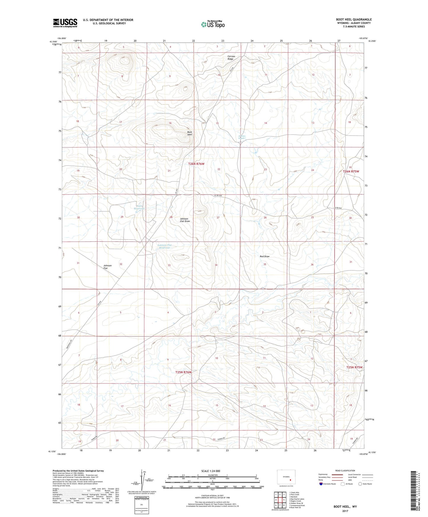
2021 topographic map quadrangle Boot Heel in the state of Wyoming. Scale: 1:24000. Based on the newly updated USGS 7.5' US Topo map series, this map is in the following counties: Albany. The map contains contour data, water features, and other items you are used to seeing on USGS maps, but also has updated roads and other features. This is the next generation of topographic maps. Printed on high-quality waterproof paper with UV fade-resistant inks.
Quads adjacent to this one:
West: Big Charlie Lakes
Northwest: Chalk Hills
North: Pass Creek
Northeast: Marshall
East: Rogers Creek
Southeast: Boot Heel SE
South: Greasewood Knoll
Southwest: Walker Draw SE
This map covers the same area as the classic USGS quad with code o42105b8.
Contains the following named places: Arrowtail Ranch, Arsenic Geyser, Boot Heel, Carcass Ridge, Cowboy Claim Number One, Indian Talking Rocks, Johnson Flat, Johnson Flat Reservoir, Priet Reservoir, Red Draw