MyTopo
T B Ranch Wyoming US Topo Map
Couldn't load pickup availability
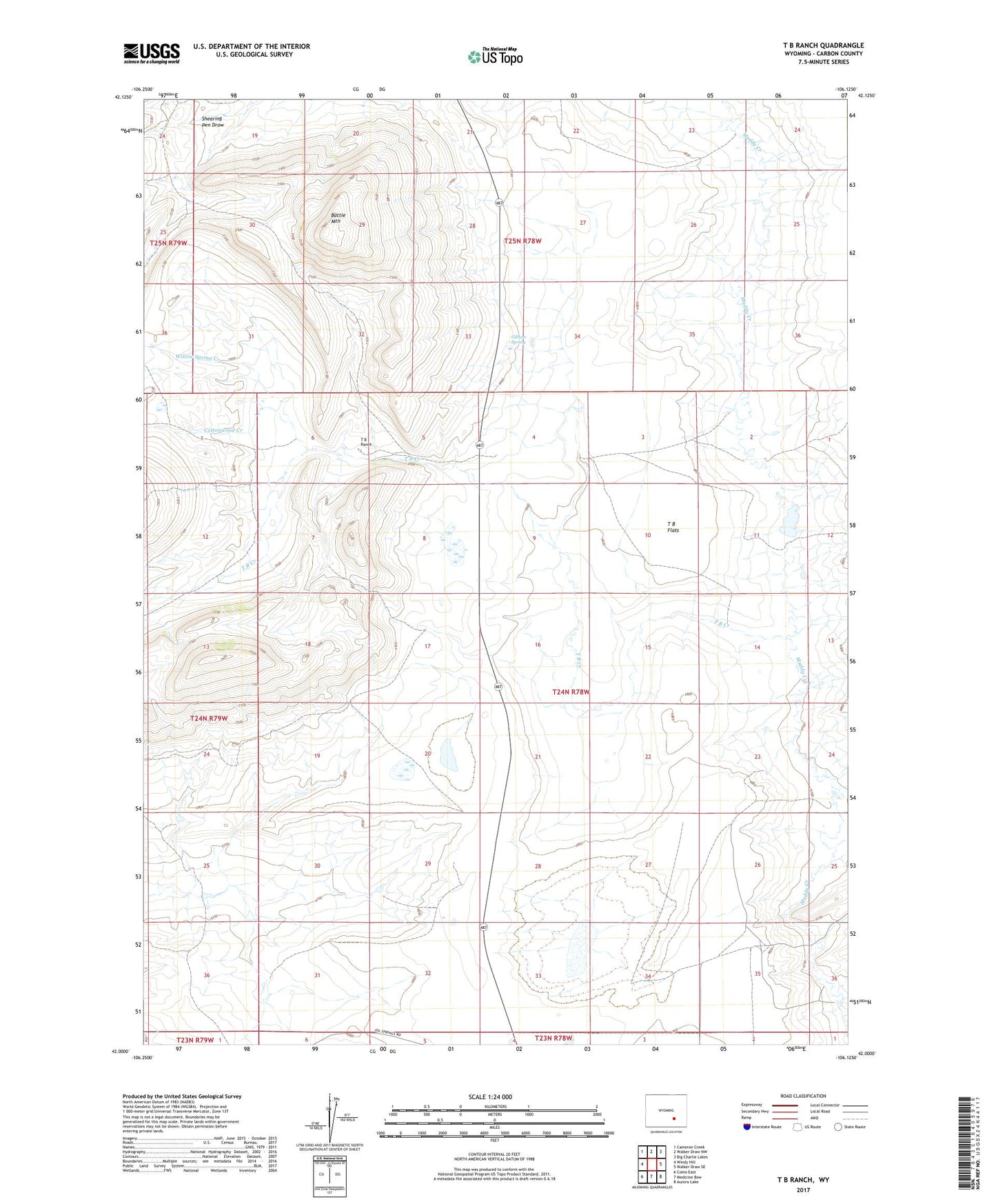
2021 topographic map quadrangle T B Ranch in the state of Wyoming. Scale: 1:24000. Based on the newly updated USGS 7.5' US Topo map series, this map is in the following counties: Carbon. The map contains contour data, water features, and other items you are used to seeing on USGS maps, but also has updated roads and other features. This is the next generation of topographic maps. Printed on high-quality waterproof paper with UV fade-resistant inks.
Quads adjacent to this one:
West: Windy Hill
Northwest: Cameron Creek
North: Walker Draw NW
Northeast: Big Charlie Lakes
East: Walker Draw SE
Southeast: Aurora Lake
South: Medicine Bow
Southwest: Como East
This map covers the same area as the classic USGS quad with code o42106a2.
Contains the following named places: Battle Mountain, Cottonwood Creek, Gibson Spring, T B Creek, T B Flats, T B Ranch, Willow Spring Creek