MyTopo
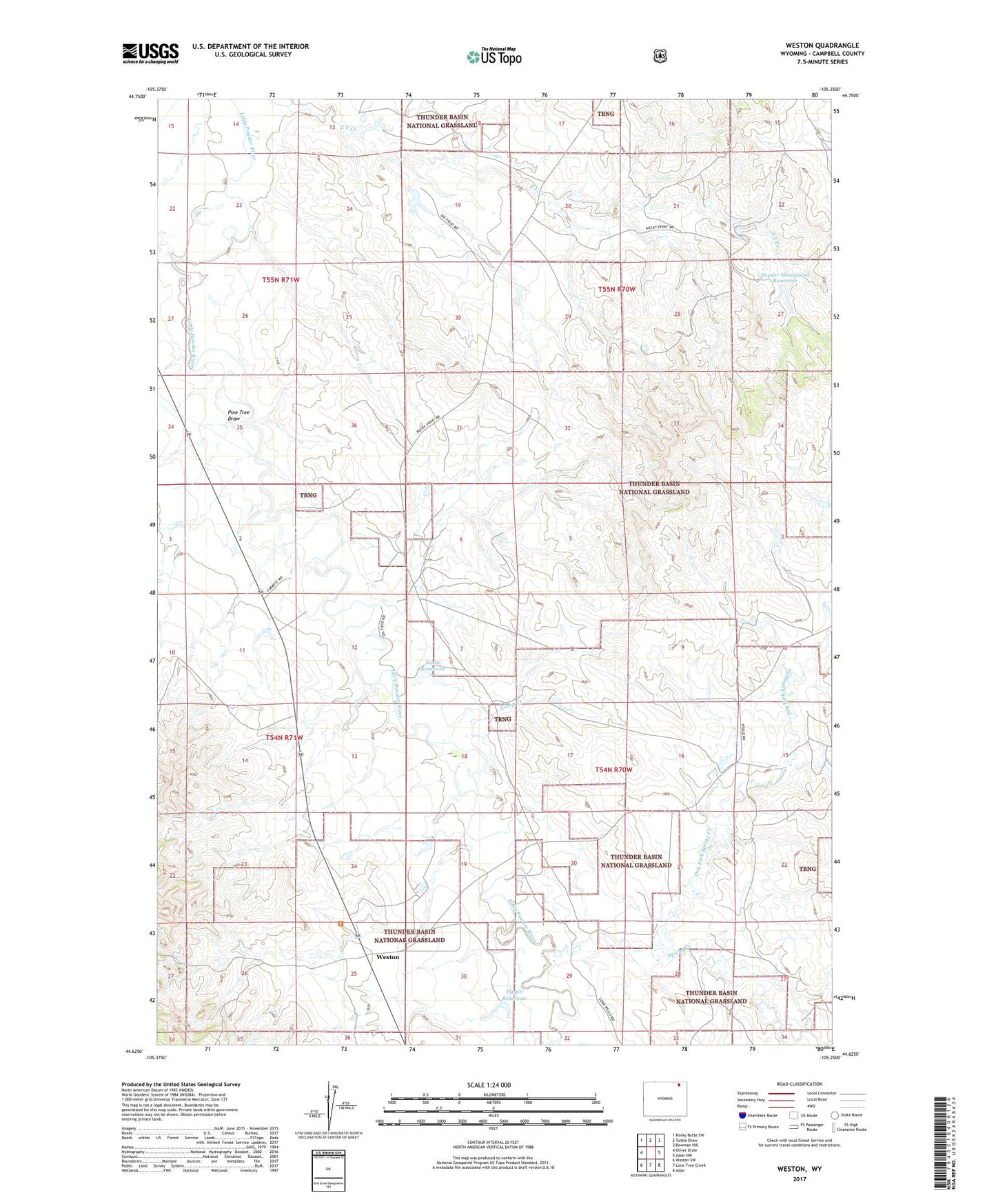
Weston Wyoming US Topo Map
Couldn't load pickup availability
Also explore the Weston Forest Service Topo of this same quad for updated USFS data
2021 topographic map quadrangle Weston in the state of Wyoming. Scale: 1:24000. Based on the newly updated USGS 7.5' US Topo map series, this map is in the following counties: Campbell. The map contains contour data, water features, and other items you are used to seeing on USGS maps, but also has updated roads and other features. This is the next generation of topographic maps. Printed on high-quality waterproof paper with UV fade-resistant inks.
Quads adjacent to this one:
West: Oliver Draw
Northwest: Rocky Butte SW
North: Tuttle Draw
Northeast: Bowman Hill
East: Adon NW
Southeast: Adon
South: Lone Tree Creek
Southwest: Weston SW
This map covers the same area as the classic USGS quad with code o44105f3.
Contains the following named places: Camp Creek, Dry Fork Spring Creek, Eveland Mine, Gleason Ranch, Hauber Ranch, Horse Creek, Kennedy Ranch, Little Powder Middle School, Little Powder School, Nettie Dam, Nettie Reservoir, Norfolk Ranch, Pine Tree Draw, Pippin Dam, Pippin Reservoir, Snyder Homestead Dam, Snyder Homestead Reservoir, Soda Well, Spring Creek, Weston, Z V Creek