MyTopo
White Lake Wyoming US Topo Map
Couldn't load pickup availability
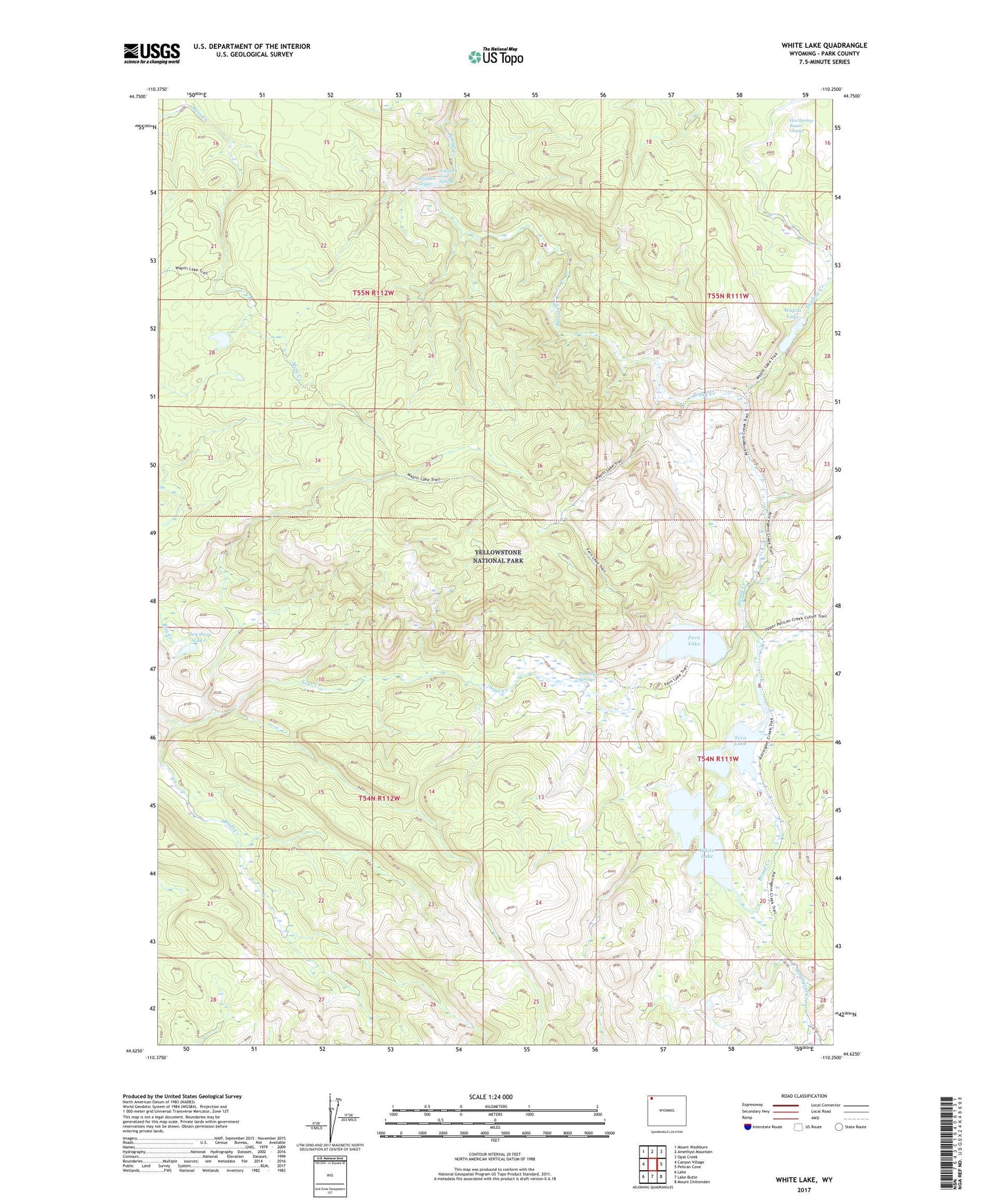
2021 topographic map quadrangle White Lake in the state of Wyoming. Scale: 1:24000. Based on the newly updated USGS 7.5' US Topo map series, this map is in the following counties: Park. The map contains contour data, water features, and other items you are used to seeing on USGS maps, but also has updated roads and other features. This is the next generation of topographic maps. Printed on high-quality waterproof paper with UV fade-resistant inks.
Quads adjacent to this one:
West: Canyon Village
Northwest: Mount Washburn
North: Amethyst Mountain
Northeast: Opal Creek
East: Pelican Cone
Southeast: Mount Chittenden
South: Lake Butte
Southwest: Lake
Contains the following named places: Bluff Creek, Dewdrop Lake, Fern Lake, Hot Spring Basin Group, Josephs Coat Springs, Ponuntpa Springs, Tern Lake, Tern Lake Trail, Wapiti Lake, Wapiti Lake Trail, Whistler Geyser, White Lake