MyTopo
Canyon Village Wyoming US Topo Map
Couldn't load pickup availability
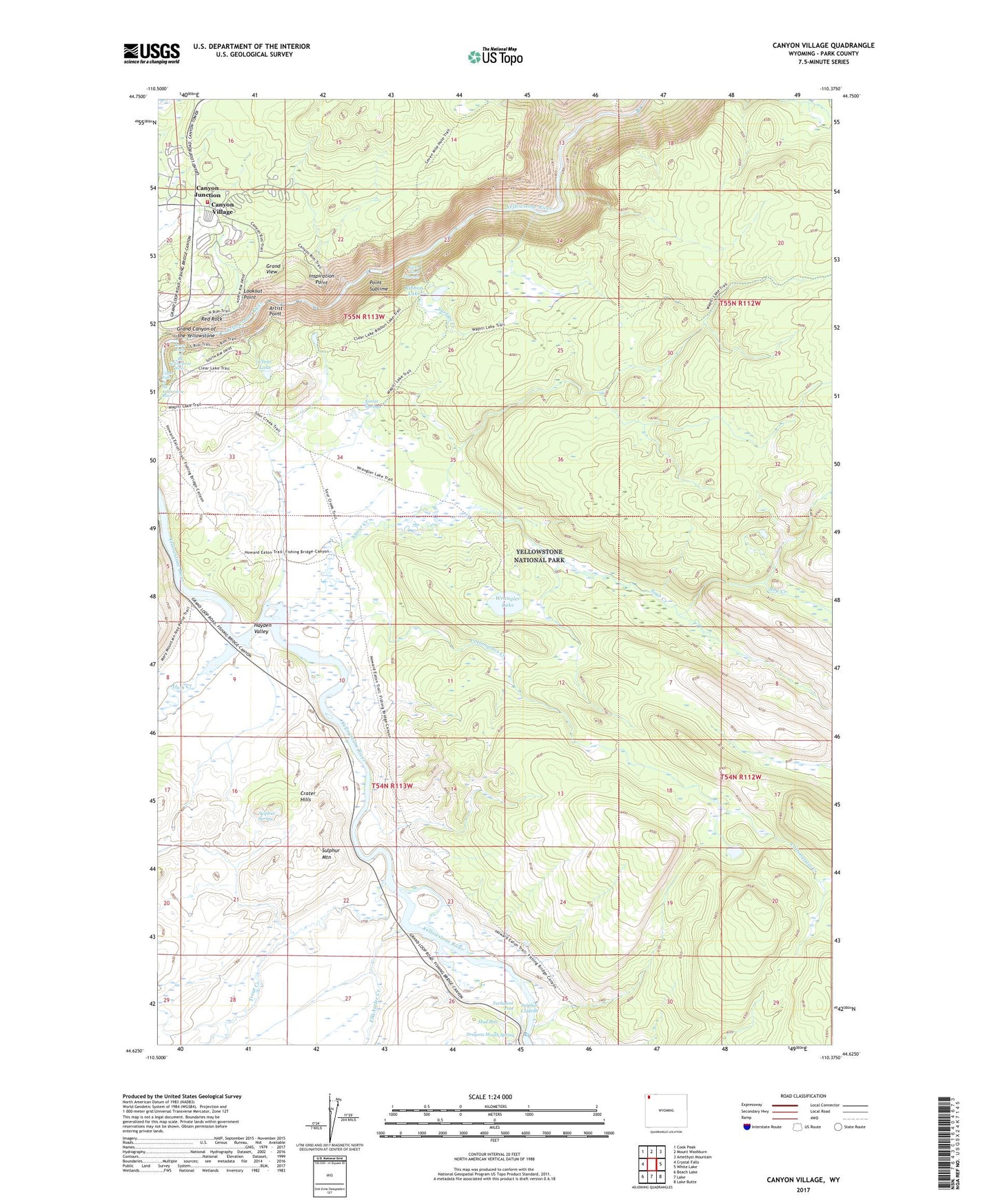
2021 topographic map quadrangle Canyon Village in the state of Wyoming. Scale: 1:24000. Based on the newly updated USGS 7.5' US Topo map series, this map is in the following counties: Park. The map contains contour data, water features, and other items you are used to seeing on USGS maps, but also has updated roads and other features. This is the next generation of topographic maps. Printed on high-quality waterproof paper with UV fade-resistant inks.
Quads adjacent to this one:
West: Crystal Falls
Northwest: Cook Peak
North: Mount Washburn
Northeast: Amethyst Mountain
East: White Lake
Southeast: Lake Butte
South: Lake
Southwest: Beach Lake
This map covers the same area as the classic USGS quad with code o44110f4.
Contains the following named places: Alum Creek, Artist Point, Bog Creek, Canyon Junction, Canyon Village, Cascade Creek, Clear Lake, Cottongrass Creek, Crater Hills, Dragons Mouth Spring, Elk Antler Creek, Forest Springs, Glacial Boulder, Glacial Boulder Trail, Grand View, Hayden Valley, Inspiration Point, Lookout Point, Lower Falls of the Yellowstone River, Mud Pots, Point Sublime, Red Rock, Ribbon Lake, Ribbon Lake Trail, Silver Cord Cascade, Sour Creek, Sour Creek Trail, Sulphur Caldron, Sulphur Mountain, Sulphur Spring, Surface Creek, Trout Creek, Turbulent Pool, Upper Falls of the Yellowstone River, Wrangler Lake, Yellowstone National Park Division, Yellowstone National Park Fire Department Canyon Station