MyTopo
Zimmerman Buttes Wyoming US Topo Map
Couldn't load pickup availability
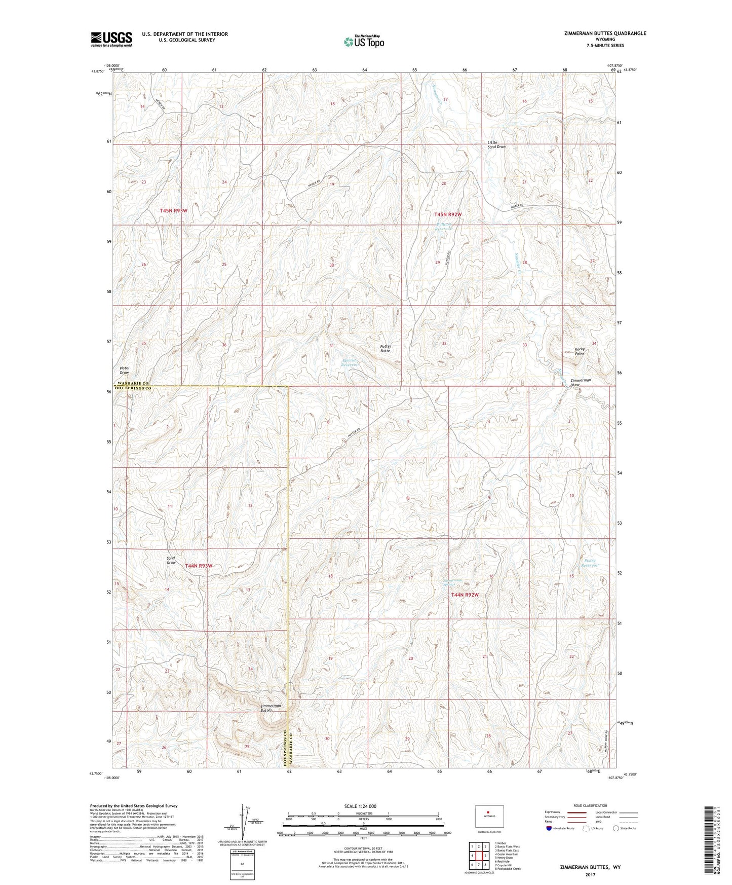
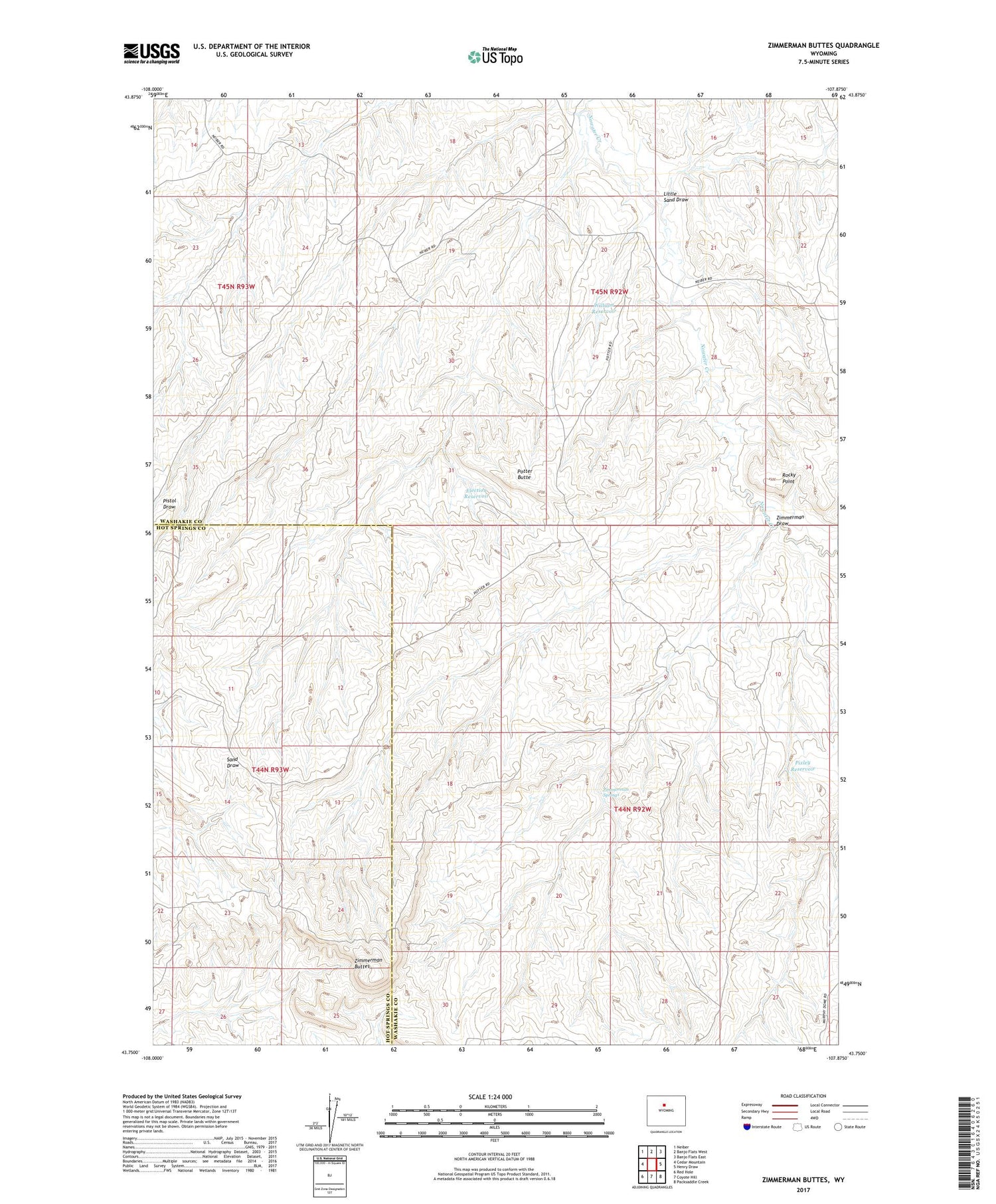
2021 topographic map quadrangle Zimmerman Buttes in the state of Wyoming. Scale: 1:24000. Based on the newly updated USGS 7.5' US Topo map series, this map is in the following counties: Washakie, Hot Springs. The map contains contour data, water features, and other items you are used to seeing on USGS maps, but also has updated roads and other features. This is the next generation of topographic maps. Printed on high-quality waterproof paper with UV fade-resistant inks.
Quads adjacent to this one:
West: Cedar Mountain
Northwest: Neiber
North: Banjo Flats West
Northeast: Banjo Flats East
East: Henry Draw
Southeast: Packsaddle Creek
South: Coyote Hill
Southwest: Red Hole
Contains the following named places: Election Reservoir, Little Sand Draw, Pixley Reservoir, Potter Butte, Rocky Point, William Reservoir, Zimmerman Buttes, Zimmerman Draw, Zimmerman Springs