MyTopo
Banjo Flats West Wyoming US Topo Map
Couldn't load pickup availability
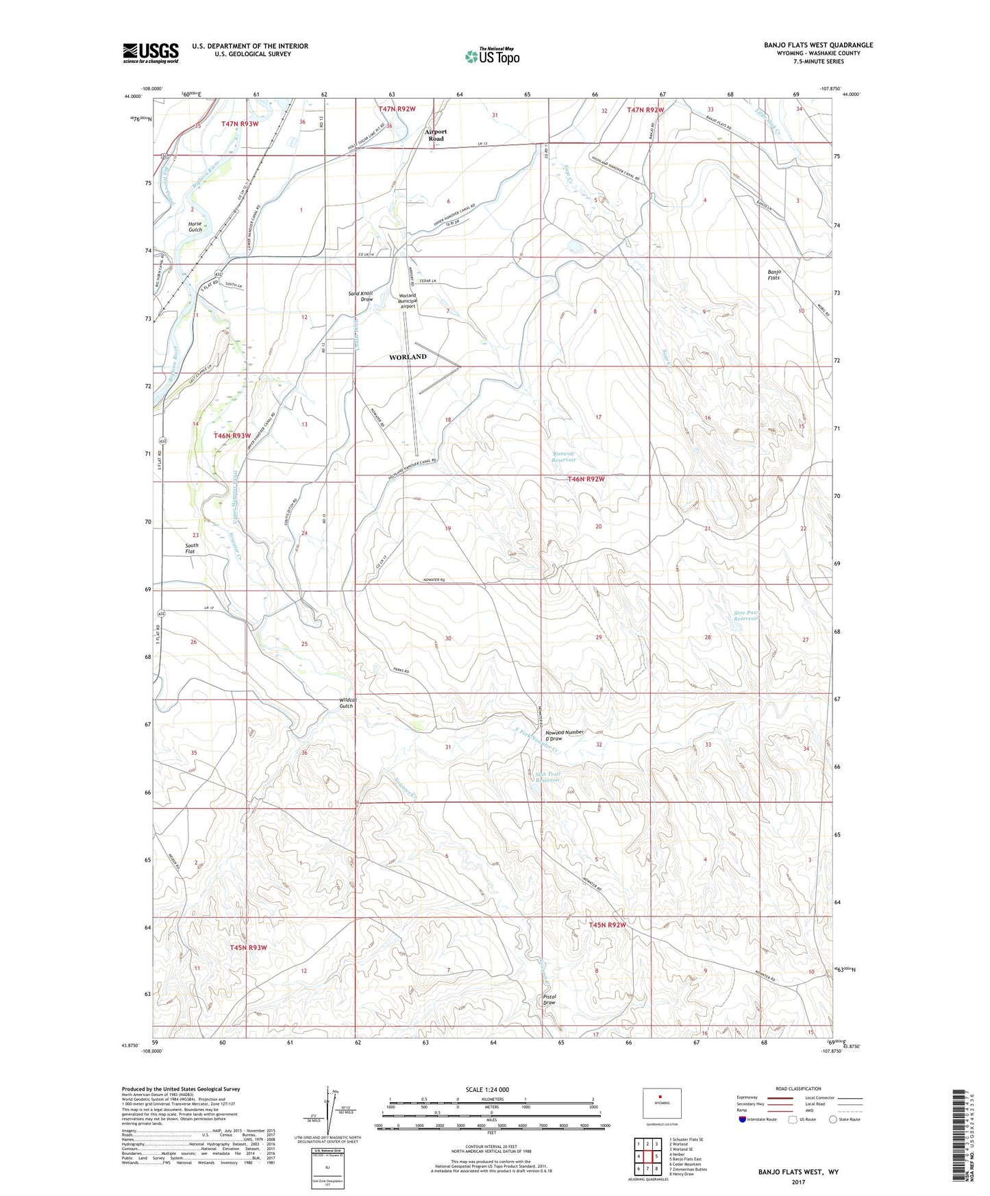
2021 topographic map quadrangle Banjo Flats West in the state of Wyoming. Scale: 1:24000. Based on the newly updated USGS 7.5' US Topo map series, this map is in the following counties: Washakie. The map contains contour data, water features, and other items you are used to seeing on USGS maps, but also has updated roads and other features. This is the next generation of topographic maps. Printed on high-quality waterproof paper with UV fade-resistant inks.
Quads adjacent to this one:
West: Neiber
Northwest: Schuster Flats SE
North: Worland
Northeast: Worland SE
East: Banjo Flats East
Southeast: Henry Draw
South: Zimmerman Buttes
Southwest: Cedar Mountain
This map covers the same area as the classic USGS quad with code o43107h8.
Contains the following named places: Airport Road, Airport Road Census Designated Place, Banjo Flats, Banjo Ranch, Coutis Ditch, East Fork Nowater Creek, Green Hills Dam, Green Hills Reservoir, Horse Gulch, Nowater Creek, Nowood Number 0 Draw, Pistol Draw, Runway Reservoir, Sand Knoll Draw, Slab Trail Reservoir, Sore Paw Reservoir, South Flat, Upper Hanover Canal, Washakie Memorial Hospital Heliport, Wildcat Gulch, Worland Municipal Airport