MyTopo
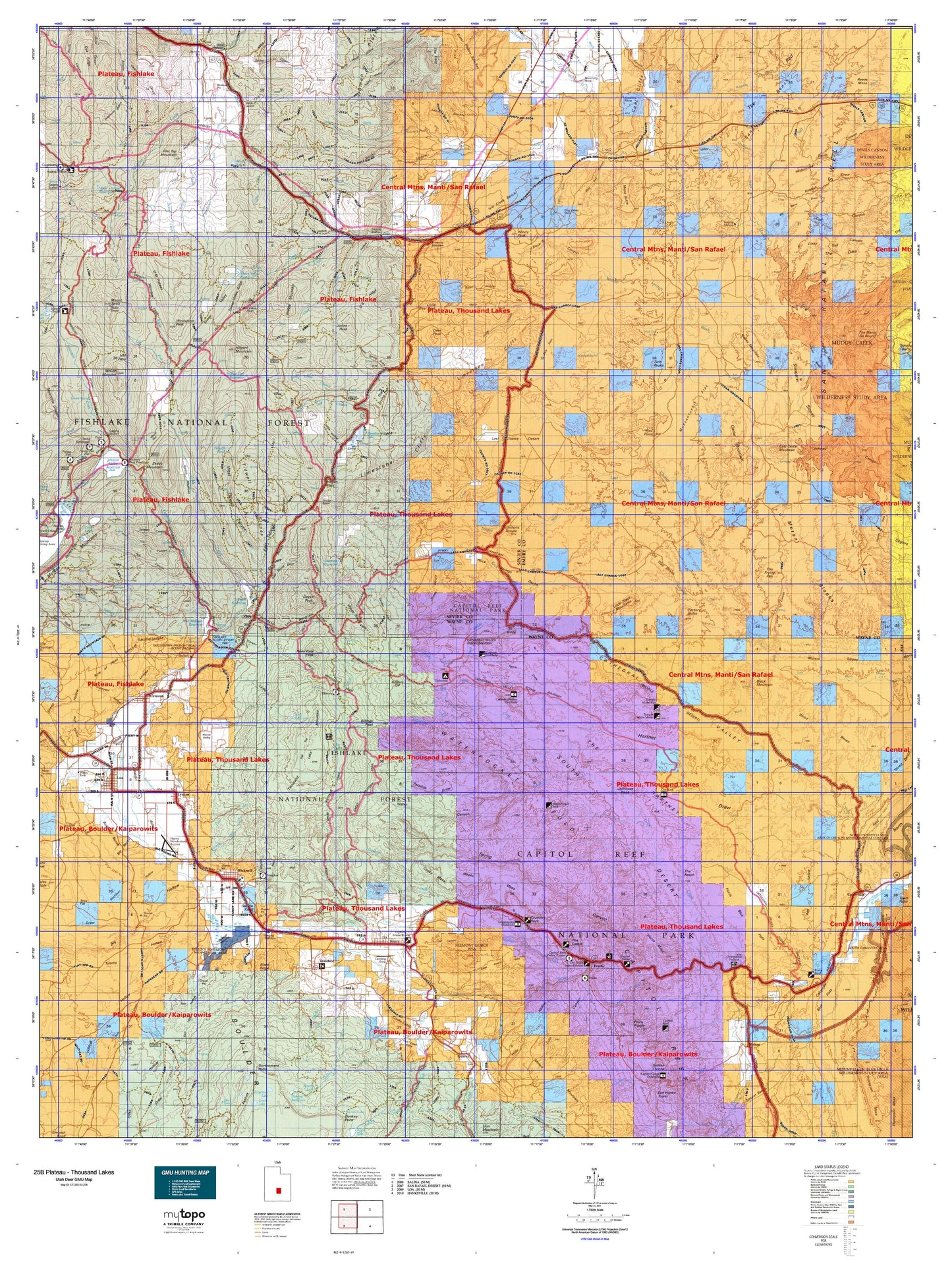
Utah Deer GMU 25B Plateau - Thousand Lakes Map
Couldn't load pickup availability
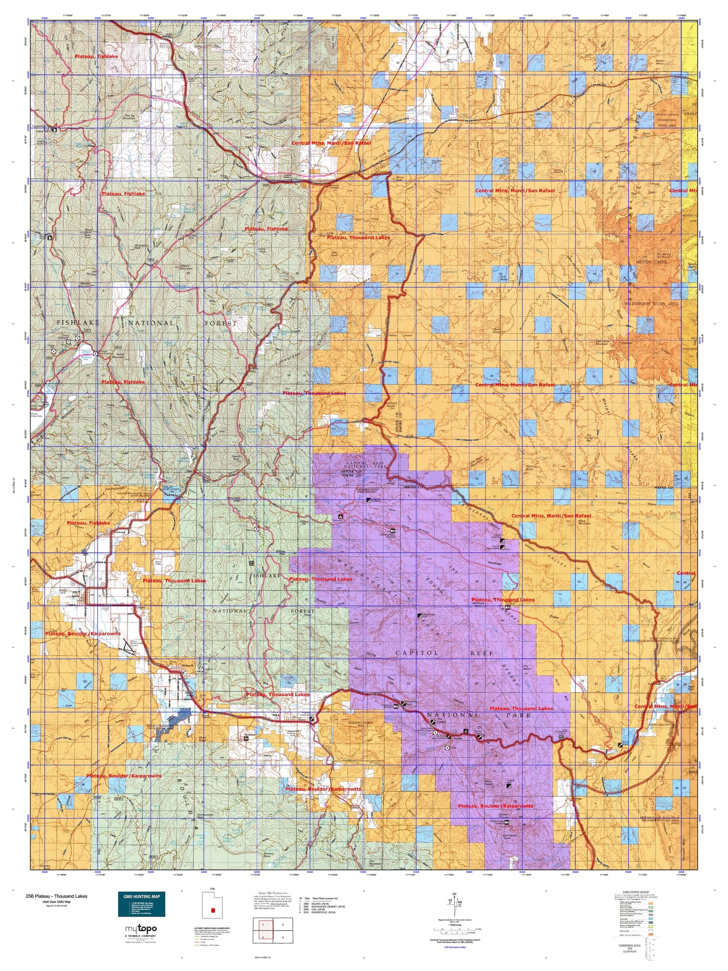
Hunting unit map of Utah Game Management Unit D-25B with topographic lines and unit boundaries. This topo map features UTM / MGRS and Latitude/Longitude grids, plus public land ownership. It comes folded on waterproof paper. Be fully prepared for your hunt with a MyTopo GMU map!.
This map contains the following named places: Abes Creek,Abes Reservoir,Acklin Peak,Aldrich,Alice Mount,Alkali Lake,Allred Point,Aquarius Mobile and RV Campground,Beaver Creek,Beaver Dams,Bicknell,Bicknell Reservoir,Big Hollow Reservoir,Birch Creek,Black Flat,Black Mountain,Blackham Creek,Blind Lake,Blue Flat Reservoir,Blue Lake,Boulder Creek,Brinkerhoff Pond,Broken Pond,Bullberry Creek,Bullberry Lakes,Caineville,Caineville Wash,Capitol Reef National Park Visitor Center,Capitol Wash,Carcass Creek,Carlyle Wash,Cathedral Mountain,Cathedral Valley,Cathedral Valley View Area,Cedar Creek,Cedar Mountain,Chimney Rock,Chris Pond,Christiansen Wash,Clear Creek,Clear Creek Guard Station,Clyde and Neils Pond,Coal Mine Creek,Coal Wash,Coleman Reservoir,Cooks Mesa,Cottonwood Creek,Crater Lakes,Danish Hill,Deadman Peak,Deep Creek,Deep Creek Lake,Deer Peak,Desert View Area,Dinner Pond,Dog Valley Wash,Donkey Creek,Draw Creek,Dry Wash,East Bicknell Sand Wash Pond,East Cedar Mountain,Elk Campground,Elkhorn Campground,Elkhorn Guard Station,Elkhorn Ranger Station and Forest Camp,Emerald Lakes,Emery-Ferron Division,Factory Butte,Farnsworth Reservoir,Farrell Pond,Ferns Nipple,Fish Creek,Flat Top,Flat Top Mountain,Flatiron Lakes,Floating Island Lake,Forsyth Reservoir,Fremont,Fremont Junction,Fruita,Fruita Campground,Frying Pan Flat,Geyser Peak,Glass Mountain,Goosenecks Overlook,Gottfredsen Creek,Government Creek,Government Lake,Grover,Hamilton Reservoir,Harves River Reservoir,Heart Lake,Hebes Mountain,Hens Hole Peak,Hilgard Mountain,Horse Fork,Horse Heaven Reservoir,Horse Heaven Summit,Horse Mesa,Ireland Mesa,Ivie Creek,Jailhouse Rock,Jeffery Reservoir,Jensen Place,Johns Peak,Johnson Reservoir Campground,Johnson Valley Reservoir,KE Bullock Waterfowl Management Area,Kinneys Peak,Lake Creek,Lane Tree,Last Chance Creek,Last Chance Ranch,Lava Lake,Left Fork U M Creek,Little Black Mountains,Little Creek,Little Deer Peak,Loa,Loa District Ranger Station,Loa Division,Loa Fish Hatchery,Lone Tree Crossing,Lone Tree Wedge,Lost Lake,Lower Group,Lyman,Meadow Creek,Meadow Gulch Administrative Site,Meeks Lake,Meeks Mesa,Mesa Butte,Middle Mountain,Mill Field,Mill Meadow Reservoir,Moroni Peak,Morrell Pond,Mount Marvine,Mount Terrill,Mud Lake,Mussentuchit Reservoir,Mytoge Mountains,Ned Reservoir,Needle Mountain,Neff Reservoir,North Creek,North Fork Clear Creek,North Last Chance Creek,Notom,Oak Spring Creek,Oak Spring Ranch,Oles Pond,Pah Ga Ne A Campground,Paraboo Campground,Paradise Valley Lake,Peacocks Place,Pectols Pyramid,Petes Pond,Pine Creek,Pitchforth Spring,Piute Campground,Pleasant Creek,Point Lookout,Pole Campground,Pole Canyon Reservoir,Polk Creek,Quitchupah Creek,Red Cliff Oasis,Red Creek,Red Point,Reeds Mesa,Reeds Pond,Reese Creek,Right Fork U M Creek,Right Fork Wildcat Reservoir,Rim Rock Resort Ranch,Road Creek,Road End Reservoir,Rock Lake,Rock Springs Wash,Round Lake,Saddle Knoll,Saleratus Creek,Saleratus Reservoir,Salina Reservoir,Salvation Creek,Sand Creek,Sandy Creek,Santa Fe Creek,School House Historical Site,Sheep Valley Reservoir,Slaughter Slopes Reservoir,Snow Fence Pond,Snow Lake,Solomon Reservoir,Solomons Temple,South Desert Overlook,Spring Reservoir,Sunglow Forest Camp,Table Mountain,Tasha Recreation Site,Teasdale,Teasdale District Ranger Station,Temple of the Moon,Temple of the Sun,The Ant Hill,The Castle,The Dike,The Frying Pan,The Hartnet,The Merry-Go-Round,The Potholes,The Wedge,Thousand Lake Mountain,Tidwell Pond,Tidwell Reservoir,Toats Campground,Torrey,Town of Bicknell,Town of Loa,Town of Lyman,Town of Torrey,Twin Peaks,Twin Ponds,Twin Rocks,West Bicknell Pond,Wests Reservoir,Whipup,Wide Hollow Reservoir,Willies Flat Reservoir,Windstorm Peak,Windy Peak,Woodys Reservoir,Zedds Campground,Zedds Mountain


