MyTopo
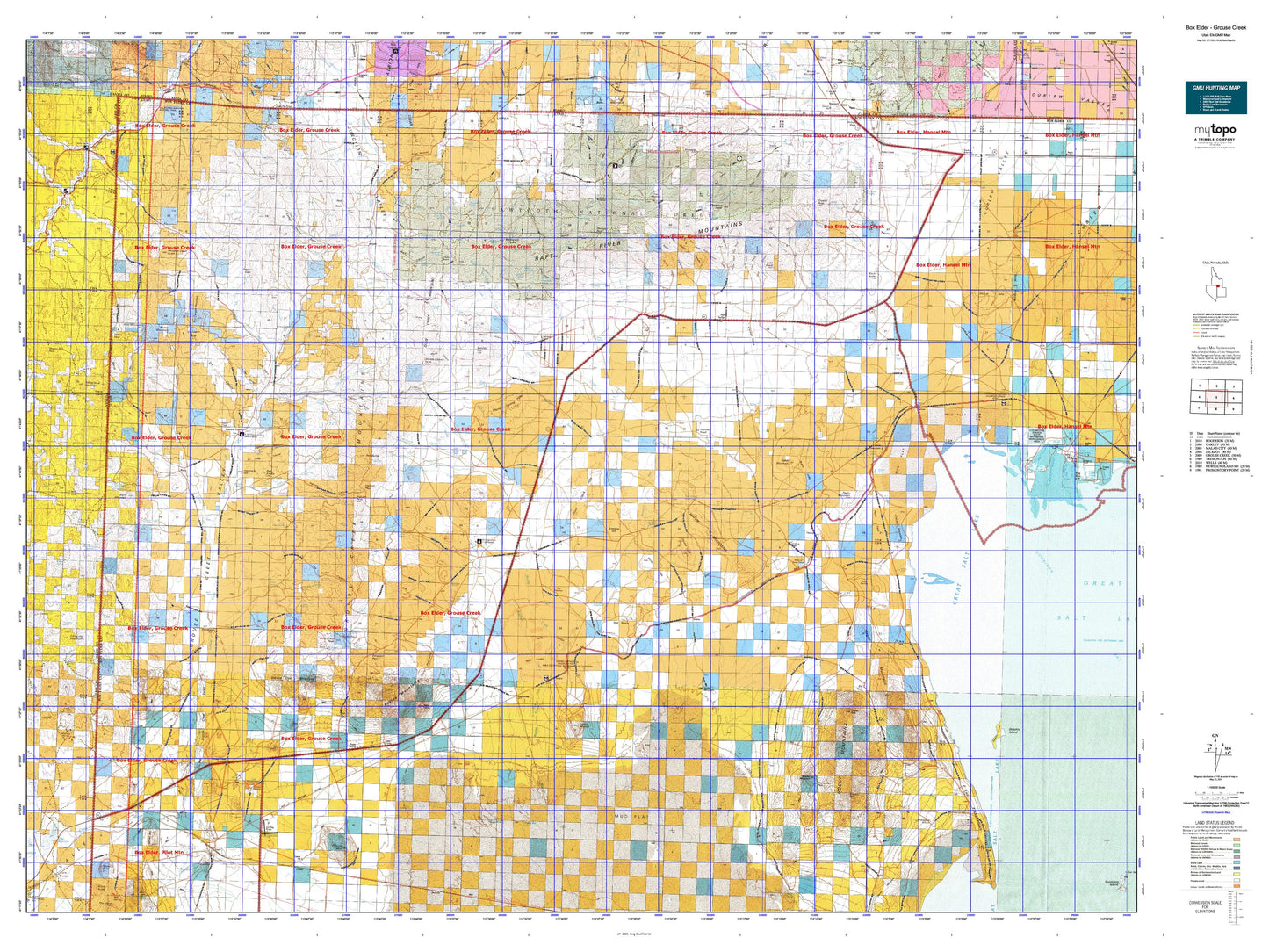
Utah Elk GMU Box Elder - Grouse Creek Map
Couldn't load pickup availability
Hunting unit map of Utah Game Management Unit ELK-BoxElderGr with topographic lines and unit boundaries. This topo map features UTM / MGRS and Latitude/Longitude grids, plus public land ownership. It comes folded on waterproof paper. Be fully prepared for your hunt with a MyTopo GMU map!.
This map contains the following named places: 83312,84313,84329,Airplane Hill,Baker Hills,Baker Hills Reservoir,Baker Mountain,Bald Knoll,Bally Mountains,Bar F Ranch,Basin Creek,Beatty Mountain,Big Pole Creek,Birch Creek,Black Butte,Black Hills,Black Hills Creek,Board Ranch,Bovine,Bovine Mountains,Box Elder County,Bull Lake,Burnt Mountain,Burnt Reservoir,California Trail,Camp Creek,C-Bar Ranch,Cedar Creek,Cedar Hill,Century Mine,Charleston Creek,China Jim Mountain,Clarks Basin,Clarks Basin Creek,Clear Creek,Clear Creek Campground,Cliff Reservoir,Cotton Creek,Cottonwood Creek,Coyote Hill,Crocodile Mountain,Crystal Peak,Cucchi Fork,Curlew Junction,Dairy Valley Creek,Dake Reservoir,Dake Reservoir Dam,Deadman Knoll,Deans Pass Reservoir,Death Creek,Death Creek Reservoir,Deep Creek,Dennis Hill,Devils Playground,Dipping Vat,Dolly Clark Mine,Dolphin Island,Dove Creek,Dove Creek Hills,Dove Creek Mountains,Dry Basin,Dry Canyon Basin,Dry Canyon Mountain,Duffy Creek,Durham Mine,East Fork Spring Creek,Ed Richie Creek,Etna,Etna Creek,Etna Reservoir,First Creek,Fisher Lake,Gartney Mountain,George Peak,Granite Creek,Grouse,Grouse Creek,Grouse Creek Junction,Grouse Creek Mountains,Hardesty Creek,Hardup,Harrison Tunnel,Haystack Hill,Hershey Ranch,Hogup Mountains,Holt Basin,Horse Hills,Horse Mountain Reservoir,Hubbard Creek,Hubbard Grove,Indian Creek,Ingham Peak,Jackson Dam,Jackson Mines,Jackson Siding,James Brothers Ranch,Jay Creek,Joe Dahar Creek,Jones Creek,Judd Mountain,Junction Creek,Kelton,Kilgore Basin,Kimbell Creek,Kimber Ranch,Kunzlers Ranch,Lake Fork,Lambert Ranch,Left Hand Fork Dove Creek,Left Hand Fork Johnson Creek,Left Hand Fork Pine Creek,Little Basin,Little Birch Creek,Little Pole Creek,Long Birch Creek,Long Creek,Long Moore Creek,Loray Wash,Lucin,Lucin Pit,Lynn,Lynn Creek,Lynn Reservoir,Mahogany Creek,Mahogany Peaks,Marble Canyon Peak,Matlin,Matlin Basin,Matlin Mountains,Meadow Creek,Meadow Creek Butte,Mecham Creek,Middle Creek,Middle Fork Dove Creek,Monte Basin,Morris Ranch,Mud Basin,Muddy Creek,Muddy Creek Reservoir,Muddy Ranch,Muddy Range,North Fork Hardesty Creek,North Fork Indian Creek,North Fork Red Butte Creek,Nut Pine Hills,Old Emigrant Trail,Old Stage Station,Ombey,Onemile Guard Station,Palmer Ranch,Park Valley,Peg Leg Mine,Peplin,Peplin Flats,Peplin Mountain,Peplin Pond,Pigeon Mountain,Pilot Springs Stage Station,Pine Creek,Pinnacle,Poison Creek,Pole Creek,Potters Creek,Pugsley Reservoir,Quaking Aspen Creek,Queen of the West Mine,Rabbit Spring Reservoir,Raft River Mountains,Red Butte,Red Butte Creek,Red Dome,Red Knolls,Right Fork Clear Creek,Right Fork Onemile Creek,Right Hand Fork Dove Creek,Right Hand Fork Johnson Creek,Right Hand Fork Pine Creek,Rocky Pass Peak,Rosebud BLM Field Station,Rosebud Creek,Rosebud Ranch,Rosette,Rosevere Fork,Round Birch Creek,Russian Knoll,Sawtooth National Forest - Raft River Division,Scorpio Peak,Sheep Mountain,Shelter Mountain,Short Creek,Sinks of Dove Creek,Skoro Mine,South Creek,South Fork George Creek,South Fork Hardesty Creek,South Fork Indian Creek,South Fork Johnson Creek,South Fork Junction Creek,South Fork Pine Creek,South Fork Red Butte Creek,South Fork Reservoir,Spring Creek,Standrod,Straight Fork Creek,Table Mountain,Tangent Peak,Tecoma Mining District,Tenmile Creek,Terrace,Terrace Mountain,The Buttes,The Tenmile Place,Thousand Springs Creek,Tom Sherry Creek,Toms Cabin Creek,Trail Pass Reservoir,Trout Creek,Trout Creek Ranch,Twin Peaks,Upper Raft River Valley,Vals Camp,Vern Steeds Ranch,Vipont Mine,Warm Creek,Warm Spring Hills,Warm Spring Reservoir,Watercress,West Box Elder Division,West Fork Spring Creek,White Rock Creek,White Rock Mountain,Wildcat Creek,Wildcat Hills,Yost,Youngs Corral


