MyTopo
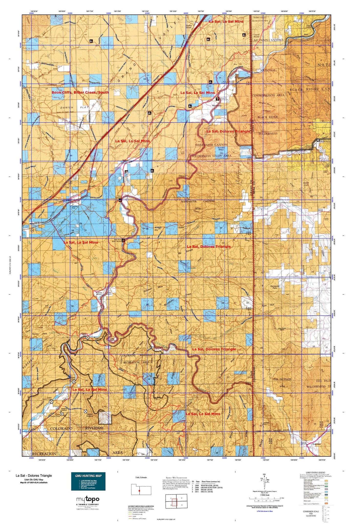
Utah Elk GMU La Sal - Dolores Triangle Map
Couldn't load pickup availability
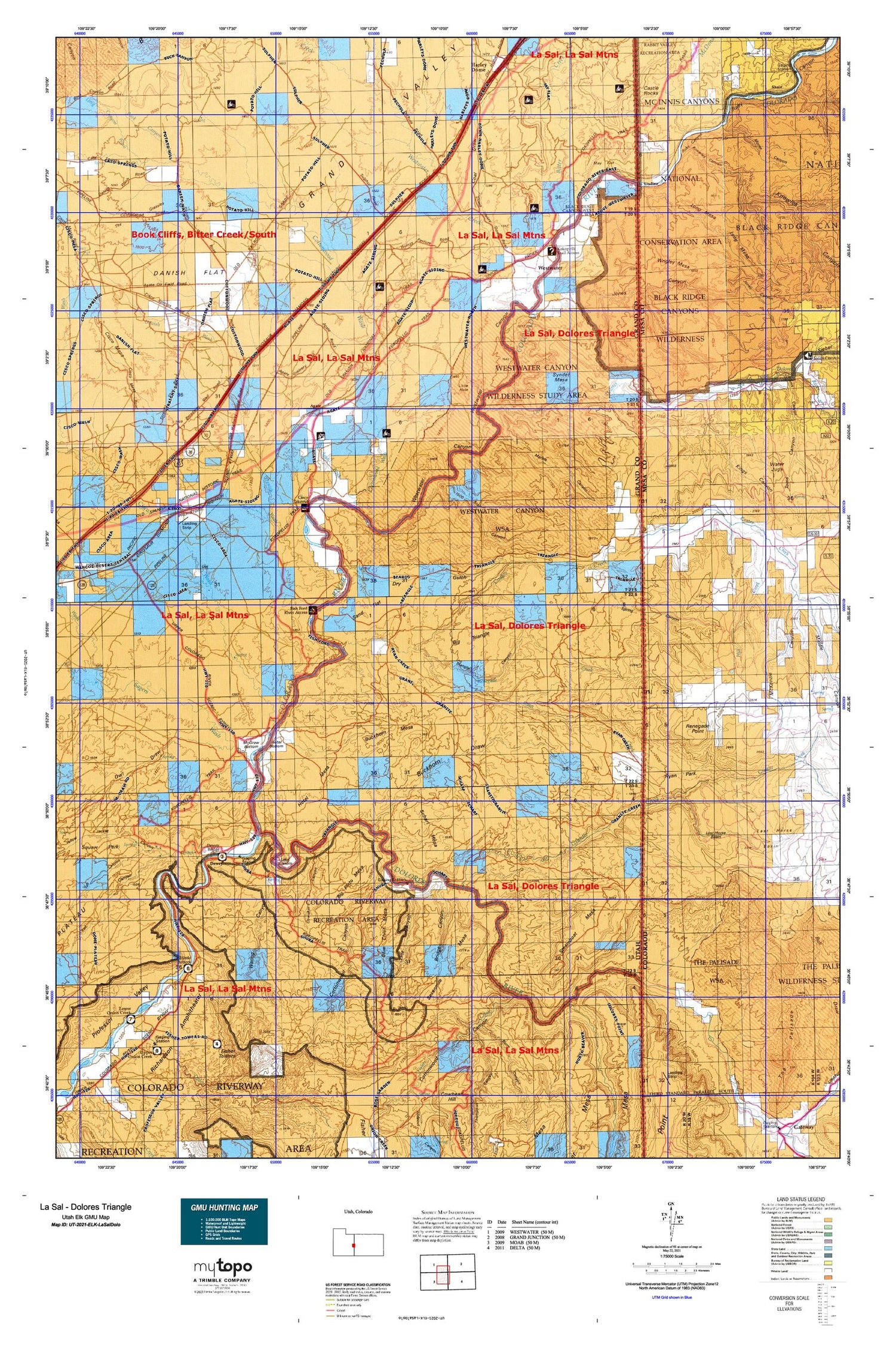
Hunting unit map of Utah Game Management Unit ELK-LaSalDolo with topographic lines and unit boundaries. This topo map features UTM / MGRS and Latitude/Longitude grids, plus public land ownership. It comes folded on waterproof paper. Be fully prepared for your hunt with a MyTopo GMU map!.
This map contains the following named places: 84515,Agate,Agate Oil Field,Agate Wash,Arrowhead Arch,Beaver Creek,Big Hole,Big Pinto Mesa,Big Triangle,Bitter Creek,Black Rocks,Blue Chief Mesa,Bridge Canyon,Buck Canyon Wash,Buck Spring,Buckhorn Basin,Buckhorn Draw,Buckhorn Mesa,Bull Canyon,Burro Canyon,Cane Spring,Castle Rocks,Cato Ranch,Cato Springs,Cisco,Cisco Landing,Cisco Mesa,Cisco Springs Gas and Oil Field,Cisco Wash,Coach Creek,Coal Draw,Coates Creek,Coates Creek School,Cook Canyon,Cottonwood,Cottonwood Canyon,Cottonwood Wash,Cow Canyon,Cow Creek,Cowskin Spring,Danish Flat,Danish Wash,Danish Wash Gas and Oil Field,Dewey,Dewey Bridge,Dewey Spring,Dolores River,Dry Gulch,Fish Park,Fisher Creek,Fisher Towers Picnic Area,Flatiron Hill,Funnel Falls,Gavin Ranch,Gordon Ranch,Grand Valley,Granite Creek,Gravel Pile Oil Field,Hallet Ranch,Haystack Peaks,Hells Hole,Hill Creek,Hittle Bottom,Hogan Spring,Horseshoe Spring,Hotel Bottom,Hotel Mesa,Jones Canyon,Kings Canyon,Knowles Canyon,Knowles Ranch,Lake Bottom,Last Chance Rapids,Line Canyon,Little Dolores River,Little Hole,Little Pinto Mesa,Little Triangle,Long Canyon,Long Canyon Wash,Long Mesa,Lost Horse Basin,Marble Canyon,May Flat,McDonald Creek,McGraw Bottom,Moore Bottom,Moore Canyon,Mule Shoe,Ninemile Bottom,Onion Creek,Onion Creek Rapids,Owl Draw,Picture Gallery Ranch,Pole Canyon,Rae Marie Mine,Red Gap,Renegade Creek,Renegade Point,Revoir Ranch,Richardson Amphitheater,Roberts Bottom,Roberts Mesa,Ruby Canyon,Ryan Creek,Ryan Park,Sagers Wash,Sand Flat,Scharf Mesa,Sevenmile Canyon,Sevenmile Mesa,Shale,Skull Rapids,Snyder Mesa,Sock-It-To-Me Rapids,Spring Canyon,Spring Creek,Spring Creek Ranch,Star Canyon,Stateline Rapids,Steamboat Mesa,Sulphur Creek,Tar Bucket,The Grassies,The Slide,Thompson Canyon,Toms Canyon,Trail Canyon,Triangle Canyon,Tub Canyon,Utah Bottoms,Utaline,Waring Canyon,Westwater,Westwater Airport,Westwater Canyon,Westwater Creek,Westwater River Ranger Station and Put In Site,Wolverton Ranch,Wrigley Mesa,Yellow Jacket Canyon


