MyTopo
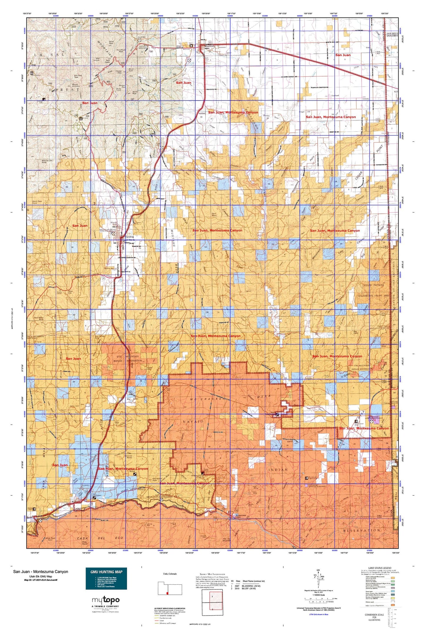
Utah Elk GMU San Juan - Montezuma Canyon Map
Couldn't load pickup availability
Hunting unit map of Utah Game Management Unit ELK-SanJuanM with topographic lines and unit boundaries. This topo map features UTM / MGRS and Latitude/Longitude grids, plus public land ownership. It comes folded on waterproof paper. Be fully prepared for your hunt with a MyTopo GMU map!.
This map contains the following named places: 84511,Abajo Mountains,Abajo Peak,Alkali Canyon,Alkali Creek,Alkali Point,Alkali Ridge Historical Marker,Aneth Chapter,Aspen Flat,Baker Guard Station,Baker Ranger Station,Bankhead Creek,Bayles Cabin,Bayles Ranch,Bear Creek,Big Bench,Big Canyon,Bigwater Canyon,Black Mesa,Black Rock Canyon,Black Steer Canyon,Black Steer Park,Blanding,Blanding City Number Four Dam,Blanding City Number Three Dam,Blanding City Number Three Reservoir,Blanding City Reservoirs,Blanding Heliport,Blanding Municipal Airport,Blanding Radar Site,Blue Creek Cabin,Blue Creek Point,Blue Creek Reservoir,Blue Mountain Dude Ranch,Blue Mountain Ski Area,Bluff Bench,Bluff Census Designated Place,Bob Park Peak,Boulder Canyon,Boulder Creek,Boulder Point,Bradford Canyon,Browns Canyon,Browns Point,Brushy Basin,Brushy Basin Wash,Buckboard Campground,Buckboard Flat,Bug Canyon,Bug Park,Bull Canyon,Bull Hollow,Bulldog Canyon,Bullpen Swale,Bullpup Canyon,Cactus Park,Cajon Mesa,Calf Canyon,Camp Jackson,Camp Jackson Dam,Camp Jackson Reservoir,Carrol Canyon,Cave Canyon,CCC Corral,Cedar Park,Cedar Point,Cherry Creek,Chief Poseys Indian Battle Historical Marker,Chimney Rock Draw,Chimney Rocks,City of Blanding,City of Monticello,Cliff Dwellers Pasture,Coal Bed Canyon,Cold Springs Electronic Site,Cool Spring House,Cooley Gulch,Cooley Pass,Corral Canyon,Corral Creek,Cottonwood Canyon,Cowboy Pasture,Cross Canyon,Dalton Spring Campground,Dalton Trailer Camp,Daltons Ranch,Deadman Canyon,Decker Cove,Decker Ranch,Delicate Arch Trail,Devil Canyon,Devil Mesa,Devils Canyon Campground,Dickson Gulch,Dickson Pass,Dodge Canyon,Dodge Point,Dream Mine,Dry Wash Number Two Dam,Dry Wash Number Two Reservoir,Dry Wash Reservoir,Duckett Cabin,Duckett Ridge,East Fork Coal Bed Canyon,Eastland,Edge of the Cedars State Park,Eroded Bowlder House,Fiddlers Green,Ford Mine Shaft,Ginger Hill,Gold Queen Basin,Gold Queen Gulch,Gold Queen Mine,Halfway Hollow,Hatch Trading Post,Horse Canyon,Horse Canyon Reservoir,Horse Creek,Horsehead Canyon,Horsehead Peak,Horsehead Point,Hovenweep Castle,Hovenweep National Monument,Hovenweep Ranger Station,Indian Canyon,Indian Creek Ranger Station,Ismay Oil Field,Jackson Camp,Jackson Ridge,Jennys Canyon,Johnny Benal Canyon,Johnson Creek,Kampark Campground,Keeley Canyon,Lake Canyon,L-C Ranch,Lems Draw,Little Nancy Canyon,Lloyds Lake,Lockerby,Long Canyon,Long Canyon Point,Long Draw Canyon,Long Point,Manti-La Sal National Forest - La Sal Division,McCracken Mesa,McCracken Point,Montezuma Canyon,Montezuma Creek Overlook,Monticello,Monticello City Number One Dam,Monticello City Number One Reservoir,Monticello District Ranger Office,Monticello Golf Course,Monument Canyon,Monument Creek,Mount Linnaeus,Mountain View Trailer Park,Murphy Point,Mustang Canyon,Mustang Mesa,Nancy Patterson Canyon,Natural Arch Point of Interest,Natural Bridge,Navajo Canyon,No-Mans Island,North Canyon,North Creek,North Creek Pass,North Fork South Creek,North Fork Verdure Creek,North Peak,Oak Creek Canyon,Papoose Canyon,Pearson Canyon,Pearson Point,Pearson Wash,Perkins Ranch,Pickett Corral Canyon,Pinenut Knoll,Pole Creek,Poor Cow Canyon,Prairie Dog Knoll,Recapture Pocket,Recapture Reservoir,Red Bluff Campground,Red Bluffs,Red Ledges,Right Hand Fork Cottonwood Wash,Road Canyon,Road Canyon Point,Robertson Pasture,Rocky Top,Roundup Hollow,Rowleys Trailer Park,Ruin Spring Point,Shay Ridge,Shingle Mill Draw,Shumway Point,South Creek,South Peak,Spring Canyon,Square Tower,Square Tower Canon,Square Tower Ruins Campground,Squaw Canyon,Stronghold House,Table Top,Tank Canyon,The Causeway,The Horn,The Park,Three Kiva Pueblo,Tin Cup Mesa,Trail of the Ancients,Turners Bluff,Twin Peaks,Twin Towers,Ucolo,Unit Type House,Ute Canyon,Ute Point,Vega Creek,Verdure,Verdure Creek,Water Storage Reservoir Number-Four,West Boulder Point,West Mountain,Westerner Trailer Park,Westwater Creek,Whipstock Draw,White Mesa,White Mesa Census Designated Place,White Mesa Overlook,Zekes Hole


