MyTopo
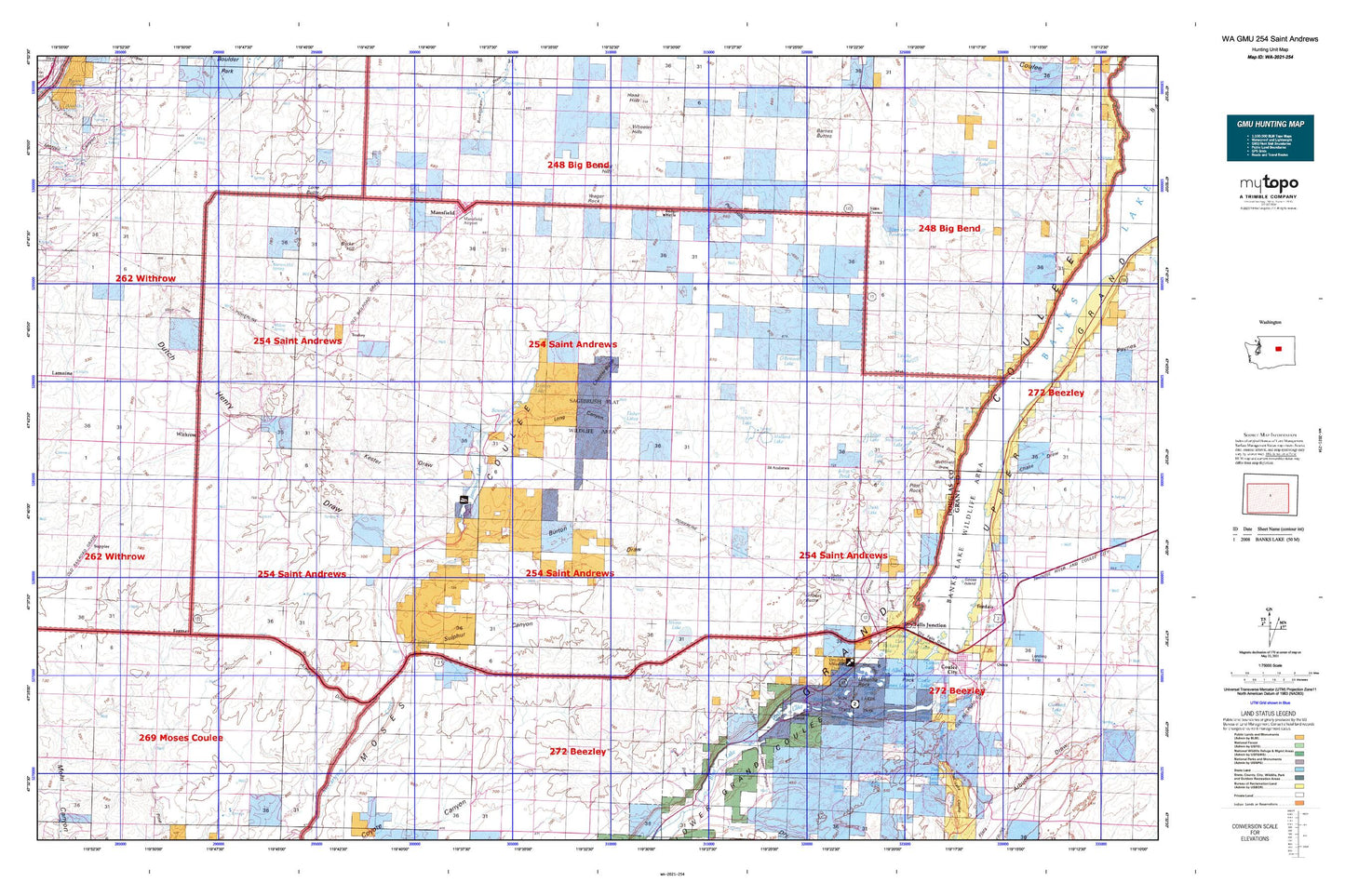
Washington GMU 254 Saint Andrews Map
Couldn't load pickup availability
Hunting unit map of Washington Game Management Unit 254 with topographic lines and unit boundaries. This topo map features UTM / MGRS and Latitude/Longitude grids, plus public land ownership. It comes folded on waterproof paper. Be fully prepared for your hunt with a MyTopo GMU map!.
This map contains the following named places: 99115,Armour Draw,Atkins Lake,Bacon Siphon,Bacon Tunnel,Badger Wells,Baird,Bennett Lake,Big Rock Island,Blue Lake,Burke Hill,Burton Draw,Castle Lake,Chester Butte,Churchill Draw,Coulee Lake,Danish Cemetery,Deep Lake,Deep Lake Dam,Deer Canyon,Delany Spring,Don Paul Draw,Douglas County,Douglas County Fire Protection District 5,Dry Falls,Dry Falls Dam,Dry Falls Heritage Area,Dry Falls Junction,Dry Falls Lake,Durk Lake,Dutch Henry Draw,Evangelical Emanuel Cemetery,Falls Lake Dam,Farmer,Farmer Happy Home Cemetery,Fisher Lakes,Gilbert Butte,Granny Draw,Green Lake,Grimes Lake,Haynes Canyon,Haynes Lake,Heinlen Lake,Highland,Highland Cemetery,Highland School,Hudson Spring,Jameson,Jameson Cemetery,Jameson Lake,Jasper Canyon,Jenkins-Webley Dam,Jollys Lake,Jollys Pond,Jorgensen Dam,Junction Lake,Kester Draw,Lena Lake,Lone Butte,Long Canyon,Ludtke Lake,Mansfield,Mansfield Airport,Mansfield Elementary School,Mansfield High School,Mansfield Post Office,Marion Hill Spring,Matthiesen,Matthiesen School,McDonald Draw,Meadow Creek,Meadow Lake,Mirror Lake,Mold,Mold Cemetery,Mud Spring,Mud Spring Community Club,Park Lake,Perch Lake,Perk Lake,Perry Spring,Piersol Hills,Pilot Rock,Pot Hills,Purdue Draw,Rainbow Lake,Red Alkali Lake,Rickard Lake,Saint Andrews,Saint Andrews Cemetery,Saint Andrews Substation,Saint Hubert,Saint Hubert Church,Seepage Spring,Sims Coner Dam,Sims Corner,Sims Corner Reservoir,Spring Creek,Stallard Lake,Stark Springs,Sullivan Lake,Sulphur Canyon,Sulphur Spring,Sun Lakes State Park,Table Lake,Table Rock,Touhey,Town of Mansfield,Tub Springs Lake,Tule Lake,Twin Lakes,Umatilla Rock,Upper Grand Coulee,Wall Spring,Waterville Division,Willow Spring,Withrow,Wolf Draw,Yeager Rock


