MyTopo
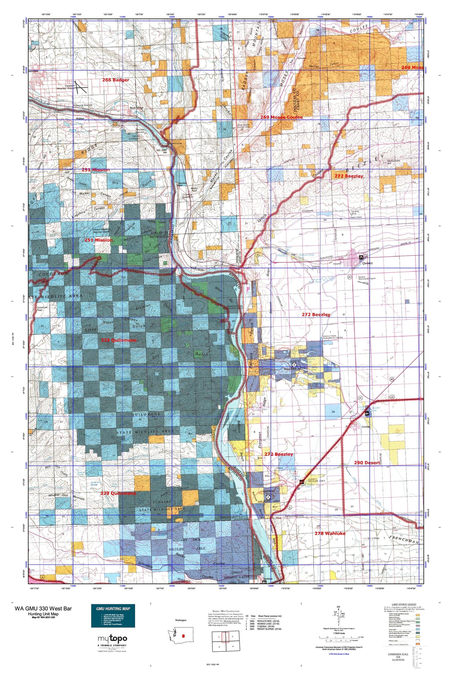
Washington GMU 330 West Bar Map
Couldn't load pickup availability
Hunting unit map of Washington Game Management Unit 330 with topographic lines and unit boundaries. This topo map features UTM / MGRS and Latitude/Longitude grids, plus public land ownership. It comes folded on waterproof paper. Be fully prepared for your hunt with a MyTopo GMU map!.
This map contains the following named places: 98824,98828,98845,98848,98850,Adrian,Ancient Lake,Ancient Lakes Elementary School,Appledale,Babcock Bench,Babcock Pumping Station,Babcock Ridge,Babcock Ridge Lake,Badger Mountain,Baird Springs,Beaver Creek,Blue Heron Lake,Bohinkleman Spring,Bonspur,Box Canyon,Brewton Gulch,Brushy Creek,Bryant Creek,Bryant Spring,Burke,Burke Lake,Burke Substation,Cabin Lake,Cabinet Rapids,Caliche Lakes,Cape Horn,Cascade Lake,Chelan County Fire District 1 Station 17 Malaga Complex,City of George,City of Quincy,City of Rock Island,Cliff Lake,Collins Spring,Colockum Creek,Colockum Game Range,Colockum Game Range Headquarters,Colockum Research Unit Washington State University,Columbia River,Columbia Substation,Crater,Crater Coulee,Crater Lake,Cree Lake,Crescent Bar,Crescent Bar Census Designated Place,Crescent Bar Recreational Area,Crescent Bar Resort and Golf Course,Crystal Lake,Cup Lake,Davies Canyon,Dot Lake,Douglas County Fire District 2 Station 222 Pangborn Airport,Douglas County Fire District 2 Station 3,Douglas Creek,Dry Gulch,Dusty Lake,East Wenatchee Division,Evergreen Pumping Plant,Evergreen Reservoir,Evergreen Ridge,Flat Lake,Francis Canyon,Frenchman Coulee,Frenchman Spring,Frenchman Springs Pumping Plant,George,George Elementary School,George Lake,George Post Office,Government Springs,Grant County Fire District 3,Grant County Fire District 3 Quincy Station 30 - 31,Grant County Fire District 3 Station 35,Grant County Fire District 3 Station 36,Grant County Fire District 3 Station 37,H Lake,Hammond Lake,Hartman Creek,Hideaway Lake,Hillton Lake,Hinkleman Canyon,Hinkleman Spring,Horse Canyon,Hunt Creek,Ivy Walker Canyon,Jackknife Creek,Judith Pool,Judkins Spring,Keokuk,Keokuk Substation,Kingsbury Canyon,Kohler Spring,KWNC-AM (Quincy),Little Bohinkleman Creek,Little Brushy Creek,Lone Pine Canyon,Lone Rock,Lynch Coulee,Malaga,Malaga Post Office,Martha Lake,Meadow Lake,Meadow Lake Dam,Moses Coulee,Mountain Valley School,Mountain View Elementary School,Nickles Canyon,Nixon Rapids,North Fork Brushy Creek,North Fork Colockum Creek,North Fork Hunt Creek,North Fork Perkins Fork,North Fork Skookumchuck Creek,North Fork Whiskey Dick Creek,Palisades,Palisades Elementary School,Palisades Post Office,Pangborn Memorial Airport,Patte Canyon,Perkins Fork,Petrified Canyon,Pine Spring,Pioneer Elementary School,Potholes Coulee,Putters Lake,Quilomene Creek,Quilomene Creek Dam,Quilomene Wildlife Recreation Area,Quincy,Quincy Division,Quincy Flying Service,Quincy Golf Course,Quincy High School,Quincy Lake,Quincy Municipal Airport,Quincy Police Department,Quincy Post Office,Quincy Rifle Club,Quincy Valley Medical Center,Qunicy Valley Ambulance - Quincy Valley Medical Center Emergency Medical Services,Reynolds Spring,Robinson Canyon,Rock Island,Rock Island Creek,Rock Island Dam,Rock Island Elementary School,Rock Island Post Office,Rock Island State Park,Rocky Point,Rollinger Creek,Scammon Landing,Schaake State Wildlife Recreation Area,Scroggie Canyon,Sheridan Spring,Skookumchuck Canyon,Skookumchuck Creek,Skookumchuck Heights Spring,Skookumchuck Spring,South Fork Brushy Creek,South Fork Colockum Creek,South Fork Hunt Creek,South Fork Tarpiscan Creek,Spike Spring,Spring Cayuse Creek,Spring Lakes,Stan Coffin Lake,Straight Hollow,Stray Gulch,Sumac Spring,Sunland Estates,Sunland Estates Census Designated Place,Sutherland Canyon,Tarpiscan Creek,Tekison Creek,Thorn Spring,Three Lakes Reservoir Dam,Thrifty Villa Shopping Center,Trinidad,Upper North Fork Skookumchuck Creek,Valhala Substation,Voltage,Vulcan,Walling Canyon,Wanapum Lake,West Bar,West Canal,Whiskey Dick Creek,Whitson Canyon,Whitson Spring,Wide Hollow Creek,Wild Horse Spring,Willow Springs,Wood Gulch


