MyTopo
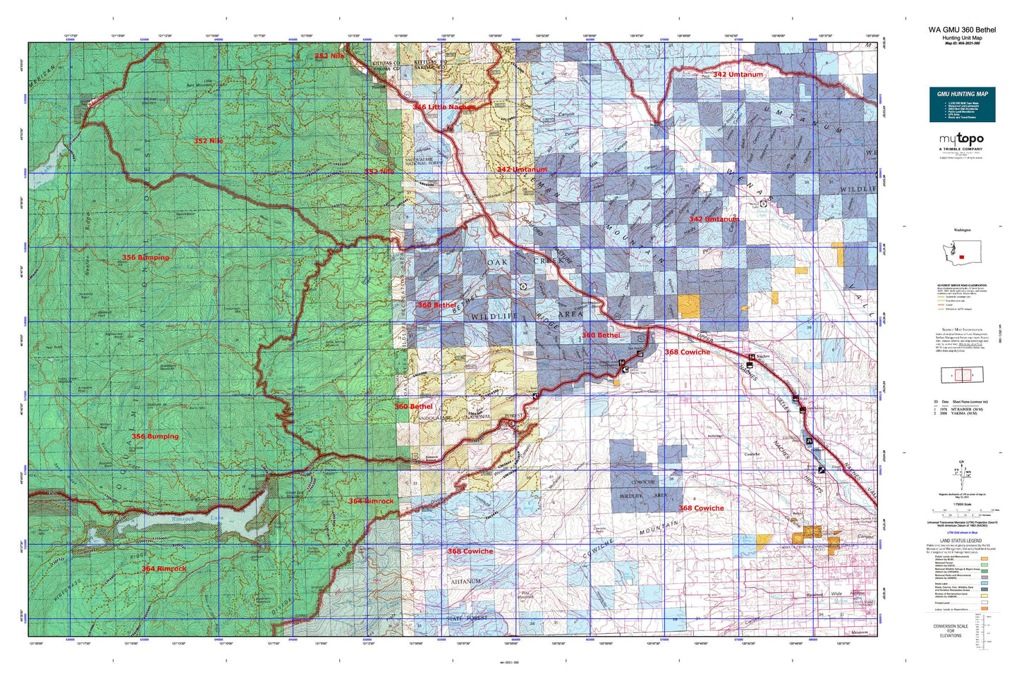
Washington GMU 360 Bethel Map
Couldn't load pickup availability
Hunting unit map of Washington Game Management Unit 360 with topographic lines and unit boundaries. This topo map features UTM / MGRS and Latitude/Longitude grids, plus public land ownership. It comes folded on waterproof paper. Be fully prepared for your hunt with a MyTopo GMU map!.
This map contains the following named places: 98908,98923,98937,98947,Andy Creek,Angel Lake,Arnesons Peak,Bakeoven Flats,Barton Creek,Bear Canyon,Bear Creek,Bear Lake,Bear Lake Campground,Benton Creek,Bethel Ridge,Big Burn Canyon,Bismarck Peak,Bismarck Trail,Bootjack Rock,Boundary Lake,Box Spring Canyon,Buck Lake,Bumping Crossing Campground,Burn Canyon,Burnt Mountain,Cabin Creek,Camp Dudley,Carmack Canyon,Carmelita Basin,Carrol Flats,Cash Prairie,Cedar Creek,Cheney Ranch,Chimney Peaks,City of Tieton,Clear Creek,Clear Creek Dam,Clear Lake,Clear Lake Campground,Clear Lake Guard Station,Clear Lake North Campground,Clear Lake Picnic Area and Boat Landing,Clear Lake South Campground,Cleman Mountain,Clint Canyon,Clover Springs Lookout,Cold Creek,Coral Meadow,Cougar Canyon,Counterfeit Creek,Cow Canyon,Cowiche Basin,Cowiche Mountain,Cowpuncher Ridge,Devils Canyon,Devils Table,Dog Creek,Dry Creek,Eagle Rock,East Fork Short and Dirty Creek,Elkhorn Creek,Evans Canyon,Fish Creek,Fish Flats,Fish Lake,Fisher Flat,Fox Meadow,French Canyon,Garrett Canyon,Glass Creek,Golden Meadow,Goose Egg Mountain,Grey Creek,Grouse Heaven,Hanging Tree Campground,Hart Creek,Hause Creek,Hause Creek Campground,Hindoo Creek,Holtzinger,Hoover Canyon,Horse Creek,Horse Ridge,Horse Trough Canyon,Horseshoe Bend,Indian Creek,Indian Creek Campground,Indian Creek Corrals,Indian Creek Trailhead,Ironstone Mountain,Ironstone Mountain Trail,Jayhawk Flats,Johnson Canyon,Jones Canyon,Jumpoff Meadows,Kamiakan Butte,Kitten Creek,Kloochman Rock,Lateral A,Lateral B,Lateral C,Lateral E,Lateral F,Lateral G,Lemon Canyon,Lightning Lake,Little Hindoo Creek,Little Mud Lake,Little Rattlesnake Creek,Little Wildcat Creek,Little Wildcat Trail,Logger Canyon,Lonesome Cove,Lonesome Cove Campground,Long Lake,Lookout Creek,Lost Lake,Lost Lake Campground,Lynne Lake,Mal Lake,McDaniel Canyon,McDaniel Lake,McNeil Creek,McNeil Peak,Meeks Table,Meeks Table Natural Area,Meloy Canyon,Meystre Canyon,Middle Fork Canyon,Milk Canyon,Milk Creek,Mill Canyon,Mount Aix,Mount Aix Trail,Mount Aix Vista,Mud Flat,Mud Lake,Muddy Creek,Nelson Butte,Nelson Creek,Nelson Ridge,Nile,Nile Creek,Nile Valley,North Fork Nile Creek,North Fork Oak Creek,North Fork Rattlesnake Creek,North Fork Tieton River,North Fork Wenas Creek,Northwest Yakima Division,NPK Canyon,Oak Creek,Oak Creek State Wildlife Area,Orr Creek,Peninsula Campground,Pickle Prairie Meadows,Pine Creek,Pine Tree Canyon,Rattlesnake Creek,Rattlesnake Forks,Rattlesnake Guard Station,Rattlesnake Meadows,Rattlesnake Peaks,Rattlesnake Ranger Station,Rattlesnake Trail,Red Rock,Reynolds Creek,Richmond Lake,Richmond Mine Trail,Rimrock,Rimrock Lake,Rimrock Lake Resort and Marina,Rimrock Landing,Rimrock Public Campground and Boat Landing,Rimrock Retreat,River Bend Campground,Rock Creek,Rocky Prairie,Russell Creek,Russell Creek Picnic Area,Russell Ridge,Sand Ridge,Sand Ridge Trailhead,Sanford Canyon,Sanford Pasture,Sentinel Creek,Sentinel Rock,Shell Creek,Shellrock Peak,Short and Dirty Creek,Silver Beach,Silver Cove Resort,Silver Salmon Cove,Sleepy Park Meadow,Soup Creek,South Fork Campground,South Fork Oak Creek,South Fork Tieton River,South Fork Wenas Creek,Spencer Creek,Spring Creek,Spruce Creek,State College of Washington Survey Camp,State University Survey Camp,Strobach Mountain,Tasker,Tepee Creek,Three Creeks,Thunder Creek,Thunder Lake,Tieton,Tieton Basin,Tieton Dam,Tieton Pond,Tieton Ranger Station,Tieton River,Tieton Work Center,Tim Ponds,Timberwolf Mountain,Trout Lodge,Twelve Point Resort,Ty Lake,Watering Trough Canyon,Waterworks Canyon,Weddle Canyon,Wenas,Westfall Rocks,Wild Rose Campground,Wildcat Creek,Wildcat Post Piles,Willows Campground,Windy Point,Windy Point Campground,Woodcamp Canyon,Yakima Tieton Main Canal


