MyTopo
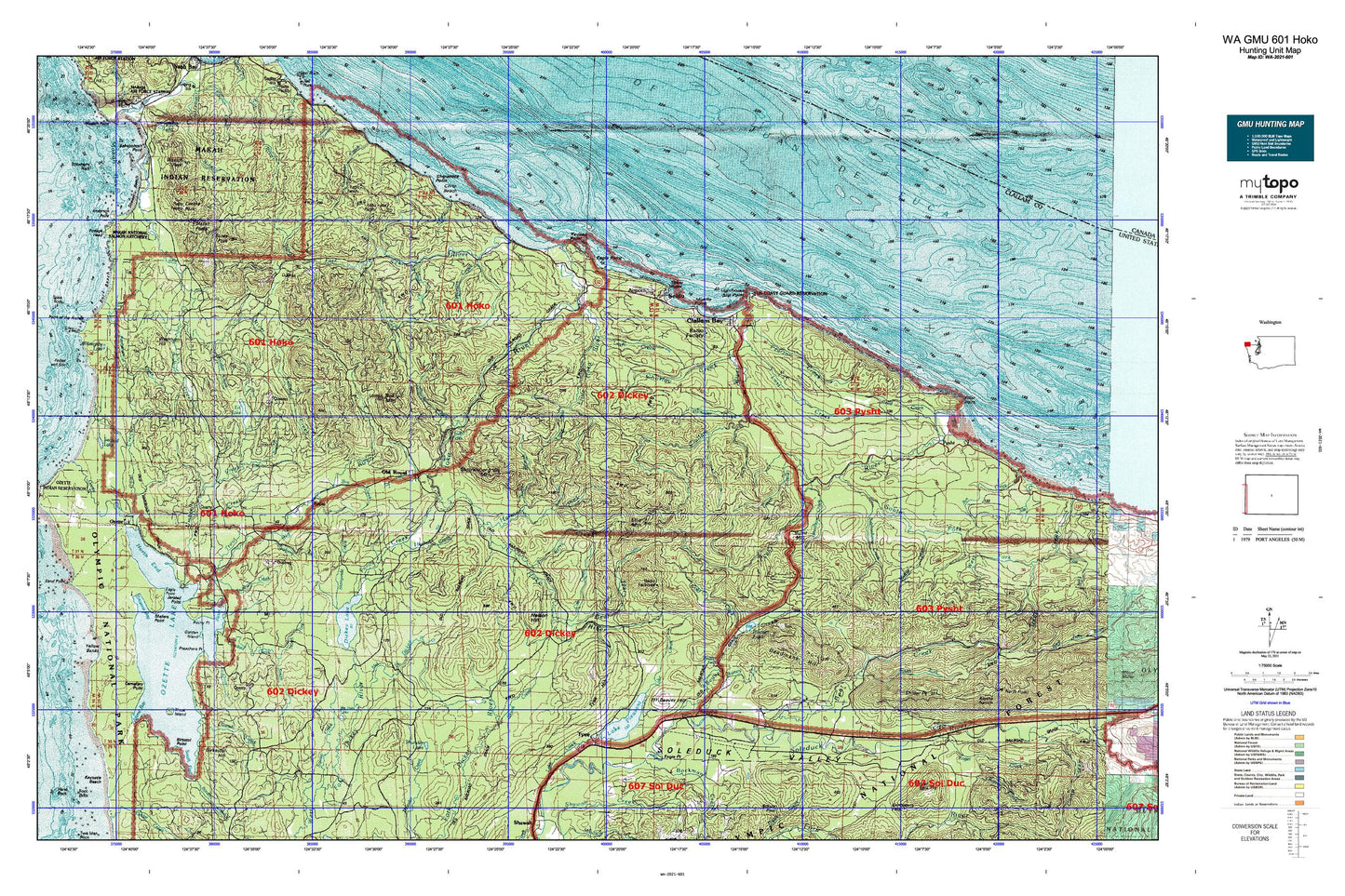
Washington GMU 601 Hoko Map
Couldn't load pickup availability
Hunting unit map of Washington Game Management Unit 601 with topographic lines and unit boundaries. This topo map features UTM / MGRS and Latitude/Longitude grids, plus public land ownership. It comes folded on waterproof paper. Be fully prepared for your hunt with a MyTopo GMU map!.
This map contains the following named places: 98305,98326,98381,Allens Bay,Allens Bay Trail,Allens Slough,Anderson Point,Aview Mobile Home Park,Baby Island,Barbour Creek,Bayview Mobile Park,Bayview Recreational Vehicle Park,Bear Creek,Bear Creek Campground,Bear Creek Falls,Bear Springs Rearing Pond,Beaver,Beaver Creek,Beaver Falls,Beaver Fire Department,Beaver Hill,Beaver Lake,Beaver Post Office,Beaver Prairie,Beaver Sand and Gravel Quarry,Beaver School,Bensons Point,Big Joes Lake,Big River,Bigler Mountain,Birkestol Hill,Birkestol Point,Blooms Bay,Blowder Creek,Blue Canyon,Bockman Creek,Boe Creek,Boot Bay,Brown Creek,Brownes Creek,Burnt Mountain,Carpenters Creek,Cemetery Point,Charley Creek,Cheeka Creek,Cheeka Peak,Chito Beach,Clallam Bay,Clallam Bay Census Designated Place,Clallam Bay Correction Center Sewage Treatment Plant,Clallam Bay Corrections Center,Clallam Bay Post Office,Clallam Bay Presbyterian Church,Clallam Bay Public Library,Clallam Bay School,Clallam Bay Sewage Treatment Plant,Clallam Bay Spit,Clallam Bay-Neah Bay Division,Clallam County Fire District 5 Headquarters Station 1,Clallam County Fire District 5 Station 2,Clallam Honor Camp,Clallam River,Clallam River Campground,Coal Creek,Coke Creek,Colby Creek,Cold Creek,Crooked Creek,Crown Zellerback Landing Area,Cub Creek,Deadmans Hill,Deer Bay,Deer Point,Dickey Camp,Dickey Hoko Summit,Dickey Lake,Dunham Creek,Eagle Point,East Branch Herman Creek,East Branch Umbrella Creek,Elk Creek,Elk Lake,Ellis Creek,Ellis Lookout,Ellis Mountain,Ericksons Bay Campground,Ericsons Bay,Evergreen Lookout,Falls Creek,Floe Quarry,Garden Island,Green Creek,Grimes Creek,Haehule Creek,Herman Creek,Herman Falls,Hoko,Hoko Camp,Hoko Falls,Hoko River,Holden Creek,Indian Creek,Iverson Ranch,Jansen Creek,Jersted Point,Kabusie Creek,Kayostia Beach,Klahowa Campground,Kugel Creek,Kydaka Point,Lake Pleasant,Lake Pleasant Boat Launch Ramp,Lake Pleasant Mobile Home,Lake Pleasant Recreation Area,Lake Pleasant Recreational Vehicle Park,Lamb Creek,Last Creek,Leyh Creek,Little Hoko River,Lizard Lake,Loop Tavern Quarry,Makah Bay,Makah Indian Reservation,Makah National Fish Hatchery,Makah National Salmon Hatchery,Makah Peaks,Mannys Prairie,Mary Clark Quarry,Middle Creek,Middle Fork Dickey River,Middle Point,Miller Creek,Needham Creek,Nelson Hill,No Name Creek,North Branch Herman Creek,North End,North Fork Crooked Creek,North Fork Sekiu River,Norwegian Memorial,Old Cemetery,Old Clallam Bay Cemetery,Old Royal,Olsen Creek,Olson's Resort Marina,Ozette,Ozette Campground,Ozette Lake,Palmquist Creek,Pearson Creek,Person Ranch,Petroleum Creek,Pilchuck Creek,Ponds Creek,Preachers Point,Pysht,Quinn Creek,Rainey Creek,Reed Creek,Rocky Point,Royal,Royal School,Salmonberry Creek,Sams Trailer Park,Sands Creek,Sappho,Sappho Quarry,Sekiu,Sekiu Airport,Sekiu Census Designated Place,Sekiu Mountain,Sekiu Point,Sekiu Post Office,Sekiu River,Sekiu Sewage Treatment Plant,Shafers Point,Shafter Creek,Shipwreck Point,Shi-Shi Beach,Siwash Creek,Skunk Creek,Slip Point,Slip Point Lighthouse,Snag Creek,Snag Peak,Snider Creek,Snider Forest Service Station,Snider Peak,Solberg Creek,Soleduck Salmon Hatchery,South Creek,South End,South Fork Bear Creek,South Fork Crooked Creek,South Fork Pysht River,South Fork Sekiu River,South Sand Point Trail,Stampede Creek,Stolzenburg Mountain,Swan Bay,Thirty Cent Creek,Thunder Lake,Tivoli Island,Trout Creek,Tsoo-Yess,Tsoo-Yess Beach,Tsoo-Yess Peak,Tsoo-Yess River,Tumbling Rapids Recreation Area,Tyee Hill,Tyee Prairie,Tyler Creek,Umbrella Bay,Umbrella Creek,Umbrella Point,Waatch Peak,Washburn Hill,Washburn Ranch,Wesseler Ranch,West Fork Pysht River,Willoughby Lake


