MyTopo
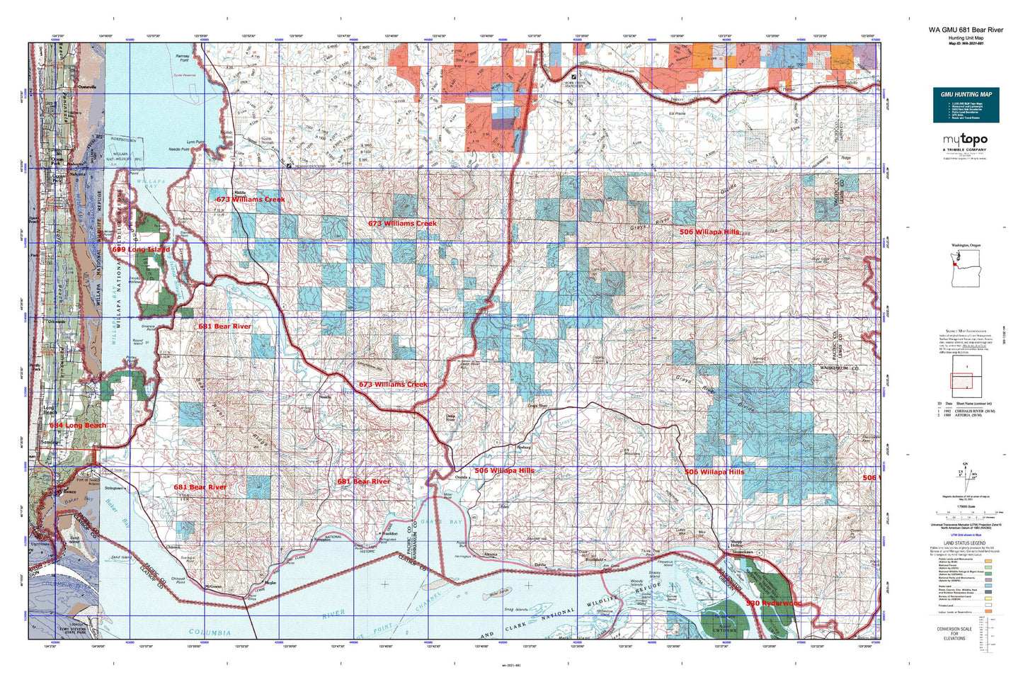
Washington GMU 681 Bear River Map
Couldn't load pickup availability
Hunting unit map of Washington Game Management Unit 681 with topographic lines and unit boundaries. This topo map features UTM / MGRS and Latitude/Longitude grids, plus public land ownership. It comes folded on waterproof paper. Be fully prepared for your hunt with a MyTopo GMU map!.
This map contains the following named places: 98614,98621,98624,98638,98643,Adamson Ranch,Albers Slough,Alder Creek,Altoona,Altoona Hill,Baldwin Slough,Beacon Number Five,Bean Creek,Bear Branch,Bear Mountain,Bear River,Beare Hill,Beaver Creek,Beeker Ranch,Blaney Creek,Brix Bay,Brock Creek,Brookfield,Brookfield Point,Brooks Slough,Burnham Creek,Cabin Creek,Cadman Creek,Camp Brix,Campbell Creek,Cannery Light,Carlson Landing,Cedar Creek,Cement Creek,Chetlo Harbor,Chinook,Chinook Jetty,Chinook Marina,Chinook Point,Chinook River,Christon Ranch,City of Ilwaco,Clearwater Creek,Cliff Point,Cowan Peak Lookout,Cranberry Marsh,Crooked Creek,Dahlia,Davis Creek,Deep River,Deep River Hill,Dell Creek,Diamond Point,East Fork Grays River,Eden,Eggman Creek,Elk Mountain,Elkhorn Creek,Elliott Point,Ellis Creek,Ellsworth Creek,Ellsworth Slough,Empi Creek,Entrance Rear Range Light,Fall Creek,Falls Creek,Fink Creek,Finn Creek,Fitzpatrick Island,Fort Columbia State Park,Fossil Creek,Frank Born Creek,Frankfort,Freshwater Creek,Gile Ranch,Giles Slough,Goose Island,Goulter Ranch,Grassy Island,Grays Bay,Grays Bay Light,Grays Point,Grays Point Light,Grays River,Grays River Division,Grays River Salmon Pond,Grays River State Fish Hatchery,Halaya Slough,Harlows Creek,Harrington Point,Heldt Creek,Hendrickson Creek,High Point,Hitchcock Creek,Holm Creek,Holm Ranch,Honey Creek,Hull Creek,Hull Creek Lookout,Hungry Harbor,Jensen Point,Johnson Creek,Johnson Ranch,Johnsons Landing,Kaffee Slough,Kelly Creek,Kessel Creek,King Creek,Klints Creek,KM Mountain,Knappton,Kyle Ranch,Lagergren Ranch,Lane Creek,Lassila Creek,Left Fork Skamokawa Creek,Lewis Slough,Little East Fork Naselle River,Long Island,Long Island Slough,Longfellow Hill,Louse Rocks,Lutes Mountain,Lynn Point,Malone Creek,McGowan,McGowan Pond,Megler,Middle Nemah,Middle Nemah River,Mill Ranch,Miller Point,Miller Sands,Mitchell Creek,Moe Hill,Mountain Spring Reservoir,Naselle,Naselle Division,Naselle River,Naselle State Salmon Hatchery,Naselle Substation,Needle Point,Nemah,Nemah Hatchery,Nemah Junction,Nikka Creek,Noe Creek,North Fork South Fork Crooked Creek,North Fork Williams Creek,North Naselle River,North Nemah,North Nemah River,O'Conner Creek,Old Camp Brix,Oman Ranch,O'Meara Point,Oneida,Paradise Point,Parpala Ranch,Patton Creek,Person Creek,Petes Creek,Pillar Rock Island,Point Ellice,Porter Point,Portuguese Point,Quinns Island,Raine Ranch,Rangila Hill,Rangila Slough,Rasmason Ranch,Reef Ranch,Ring Ranch,Rocky Point,Rocky Point Light,Rosburg,Round Island,Russian Creek,S Ring Ranch,Salme Creek,Salme Hill,Salmon Creek,Sand Island,Sand Island Dike Light,Sand Island Dike Middle Light,Scarboro Hill,Schlick Creek,Seal Creek,Seal Slough,Shannon Creek,Shoalwater Bay,Silver Creek,Silvola Ranch,Sisson Creek,Skamokawa,Skamokawa Creek,Skamokawa Vista Park,Sleepy Hollow,Smith Creek,Smoky Hollow,South Burnham Creek,South Creek,South Fork Crooked Creek,South Fork Grays River,South Naselle River,South Nemah River,Stanley Peninsula,Stanley Point,Steamboat Slough,Stringtown,Sunshine,Sunshine Point,Svensens Landing,Sweigiler Creek,Tarlatt Slough,Teal Slough,Thadbar Creek,Three Tree Point,Trap Creek Lookout,Upper Naselle Ranger Station,Upper Salmon Junction,Wahkiakum County Fairgrounds,Wallacut River,Welch Island,West Fork Ellis Creek,West Fork Grays River,West Fork Skamokawa Creek,West Valley Creek,Willapa Camp,Willapa National Wildlife Refuge,Williams Creek,Wilme Slough,Wirkkala Lake,Wirkkala Ponds,Woody Island


