MyTopo
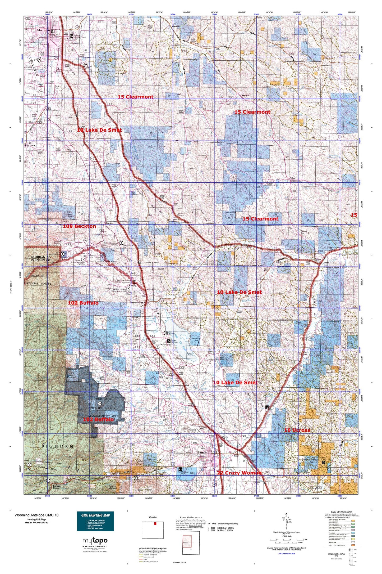
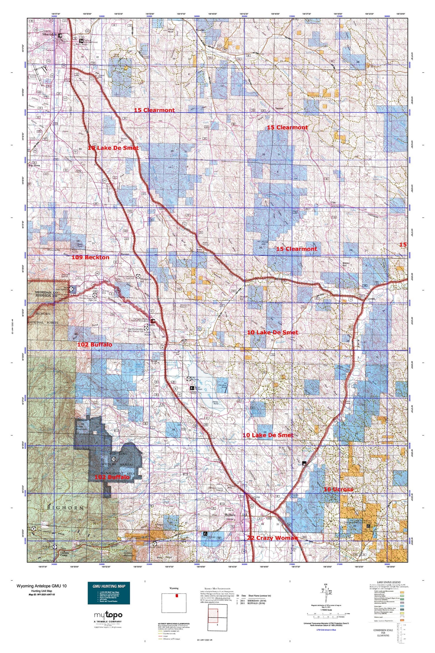
Wyoming Antelope GMU 10 Map
Couldn't load pickup availability
Hunting unit map of Wyoming Game Management Unit ANT-10 with topographic lines and unit boundaries. This topo map features UTM / MGRS and Latitude/Longitude grids, plus public land ownership. It comes folded on waterproof paper. Be fully prepared for your hunt with a MyTopo GMU map!.
This map contains the following named places: 82832,82842,82845,Allens Draw,Arkansas Creek,Athorpe Rogers Ditch,Balm of Gilead Creek,Banner,Barkey Ditch,Barnes Draw,Barr Draw,Beaver Creek,Betheurem Prospect Mine,Big Bonanza Ditch,Big Draw,Big Draw Reservoir,Big Piney Divide Ditch,Blazer Hill,Bob Dam,Bond Draw,Bourret Draw,Boxelder Creek,Boxelder Ditch,Brown and Foster Ditch,Brush Creek,Bud Love Big Game Winter Range,Buffalo Mine,Buffalo Run Creek,Bull Creek,Burlington Reservoir,Butterfield Draw,Cameron Gulch,Center Draw,Chapparal Draw,Charles Mine,City Pit,Clear Creek Mine,Coal Bank Gulch,Coleman Draw,Connley Ditch,Connley Draw,Cook Draw,Copps Draw,Coyote Draw,Dawson Draw,Dead Indian Draw,Deep Creek,Des Moines Ditch,Dodd Dam,Dodd Reservoir,Dow Prong,Dry Creek,Duncan Dam,Duncan Reservoir,Dunlap Ditch,Dutch Creek,East Fork Dow Prong Dutch Creek,East Healy Draw,Fairbanks Draw,Father DeSmet Historical Monument,Fetterman Monument,Fields Draw,Fish Lateral,Flat Draw,Flying E Creek,Fort Phil Kearny Historical Site,Four Draw,Four H Dam,Four H Draw,Four H Reservoir,Fox Ditch,Garretson Mine,Grinnell Ditch,Grouse Draw,H A Creek,H F Bar Ranch,Haley Draw,Hallie Ditch,Hamburger Draw,Hamilton Draw,Hanes Fork,Hanes Reservoir,Harper Draw,Healy Dam,Healy Draw,Healy Reservoir,Hearney Pit Mine,Helvey Draw,Highline Ditch,Hodges Draw,Holmberg Mine,Hopkins Ditch,Horse Hill,Husen Pit Number A,Husen Pit Number B,Huson Dam,Huson Reservoir,Irene Dam,Irene Reservoir,Iron Gulch,J A Creek,Jenks Creek,Jennings Gulch,Jim Creek,Jim Crow Creek,Jim Crow Ditch,John Draw,Johnson Creek,Johnson Creek Ditch,Jones Draw,Junk Draw,Karl Dam,Karl Reservoir,Kaufman Dam,Kaufman Reservoir,Kearny,Kempton Ditch,Krezelok Mine,Kumor Draw,Lake De Smet,Lake De Smet Mine,Lake Desmet,Lake DeSmet Canal,Lake Desmet Dam,Lanters Draw,Larison Swale,Last Chance Ditch,Lawrence Draw,Leiter Ditch,Lewis Draw,Lily Ditch,Little North Fork,Little Piney Creek,Lodge Trail Ridge,Lower Flying E Ditch,Martin Prospect Mine,Massacre Hill,Maverick Ditch,Maxwell Dam,Maxwell Reservoir,May Draw,McDonald Creek,McGrath Ditch,Meade Coffeen Ditch,Meade Creek,Meade Creek Ranch,Menardi and White Dam,Menardi and White Reservoir,Middle Fork Arkansas Creek,Middle Fork Dow Prong Dutch Creek,Mitchell Mine,Moeller Ditch,Moeller Ditch Number 1,Moncreiffe Dam,Moncreiffe Reservoir,Moore Dam,Moore Reservoir,Mountain Reservoir,Mowry Basin,Mowry Basin Ditch,Mowry Creek,Mowry Dam,Mowry Reservoir,Negro Creek,Ninemile Ditch,North Fork Sayles Creek,North Fork Shell Creek,North Piney Creek,North Prong Arkansas Creek,North Prong S R Creek,North Prong Shell Creek,North Rock Creek,North Rock Creek Mine,Parken Fork,Paul Number 3 Dam,Pelloux Pit,Peno Creek,Penrose Ditch,Pheasant Creek,Pierson Ditch,Pilot Knob,Pompey Creek,Prairie Dog Kruse Ditch,Pride of the Valley Ditch,Red Creek,Redman Ditch,Reynolds Piney Creek Diversion Dam,Rifle Creek,Ritchey Ditch,Rock Creek,Ruby Ditch,S R Creek,Saddlestring,Sand Creek,Sayles Creek,Schmidt Pit Mine,Seney Point,Senff Ditch,Shell Creek,Shell Creek Mine,Shell Creek Reservoir,Sheridan County,Silver Lake,Snake Hill,South Fork Sayles Creek,South Fork Shell Creek,South Piney Creek,South Rock Creek,South Sayles Dam,South Sayles Reservoir,Sparks Reservoir,Spring Creek,Stanley Creek,Steven Number 2 Dam,Stone Mountain,Story,Story Creek,Sturdevant Ditch,Sullivant Hill,The Speedway,Thorn Rider Camp,Ucross,Ulm,Upper Flying E Ditch,Upper Phil Kearny Ditch,Verona,Verona Dam,Verona Reservoir,Wagner Prong Dutch Creek,Wagon Box,Wagon Box Battle Monument,Walters Mine,West Fork Wildcat Creek,WJD Ditch,Yarwood Ditch


