MyTopo
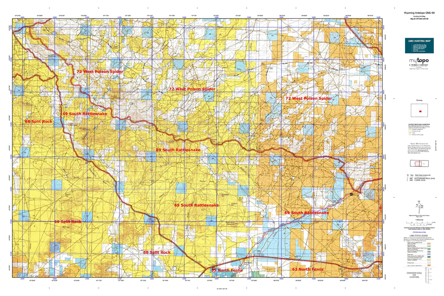
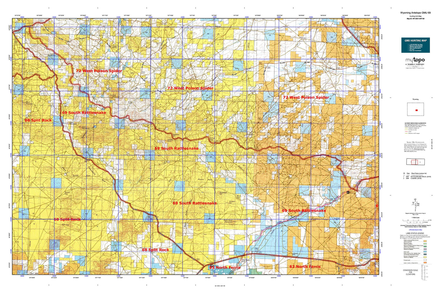
Wyoming Antelope GMU 69 Map
Couldn't load pickup availability
Hunting unit map of Wyoming Game Management Unit ANT-69 with topographic lines and unit boundaries. This topo map features UTM / MGRS and Latitude/Longitude grids, plus public land ownership. It comes folded on waterproof paper. Be fully prepared for your hunt with a MyTopo GMU map!.
This map contains the following named places: Asbell Homestead Site,Bald Mountain,Barlow Gap,Barlow Springs,Barlow Springs Draw,Black Gap,Black Mountain,Black Rock Mountain,Black Rock Springs,Boyle Reservoir,Breadpan Hill,Brush Creek,Bug Ranch,Burnt Wagon Draw,Burnt Wagon Draw Mine,C R I Ranch,C R I School,Cabin Creek,Cabin Creek Dam,Cabin Creek Reservoir,Chokecherry Creek,Circle Bar Ranch,Claytor Ranch,Cottonwood Creek,Cottonwood Ranch,Crilly Gap,Deer Creek-Dry Creek Divide,Dodds Ranch,Dry Creek,Dry Fork,Eagles Nest Canyon,Eightmile Draw,Fish Creek,Forgery Ranch,French Rocks,Garfield Peak,Goat Mountain,Goat Mountain Area Mine,Greasewood Draw,Henderson Creek,Holiday Draw,Holiday Homestead,Horse Creek Springs,Horse Heaven,Keester Basin,Lady Emma Reservoir,Little Cottonwood Creek,Luten Reservoir,McClanahan Lake,McCleary Reservoir,McDougal Gulch,McKenzie Bogs,McKenzie Spring,Murphy Creek,Oil City Ranch,Peach Creek,Pino Draw,Rattlesnake Hills,Rattlesnake Mountains Mine,Rhobaugh Draw,Riddle Ranch,Roberts Draw,Saddle Rock,Sagehen Hill,Seven D Ranch,Shell Creek,Shell Creek Reservoir,Six Mile Dam,Six Mile Reservoir,Snider Basin,Soap Creek,Spear Ranch,Stinking Water Creek,Strawhaker Corral,Sun Ranch,The Dry Lake,The Meadows,U C Ranch,U T Creek,U T Pass,Vermiculite Sales Corporation Deposit Number One,Verna Bell Claim,Vide Homestead,Vinegar Hill,West Poison Spider Camp,Wolf Gap,Woodard Basin