MyTopo
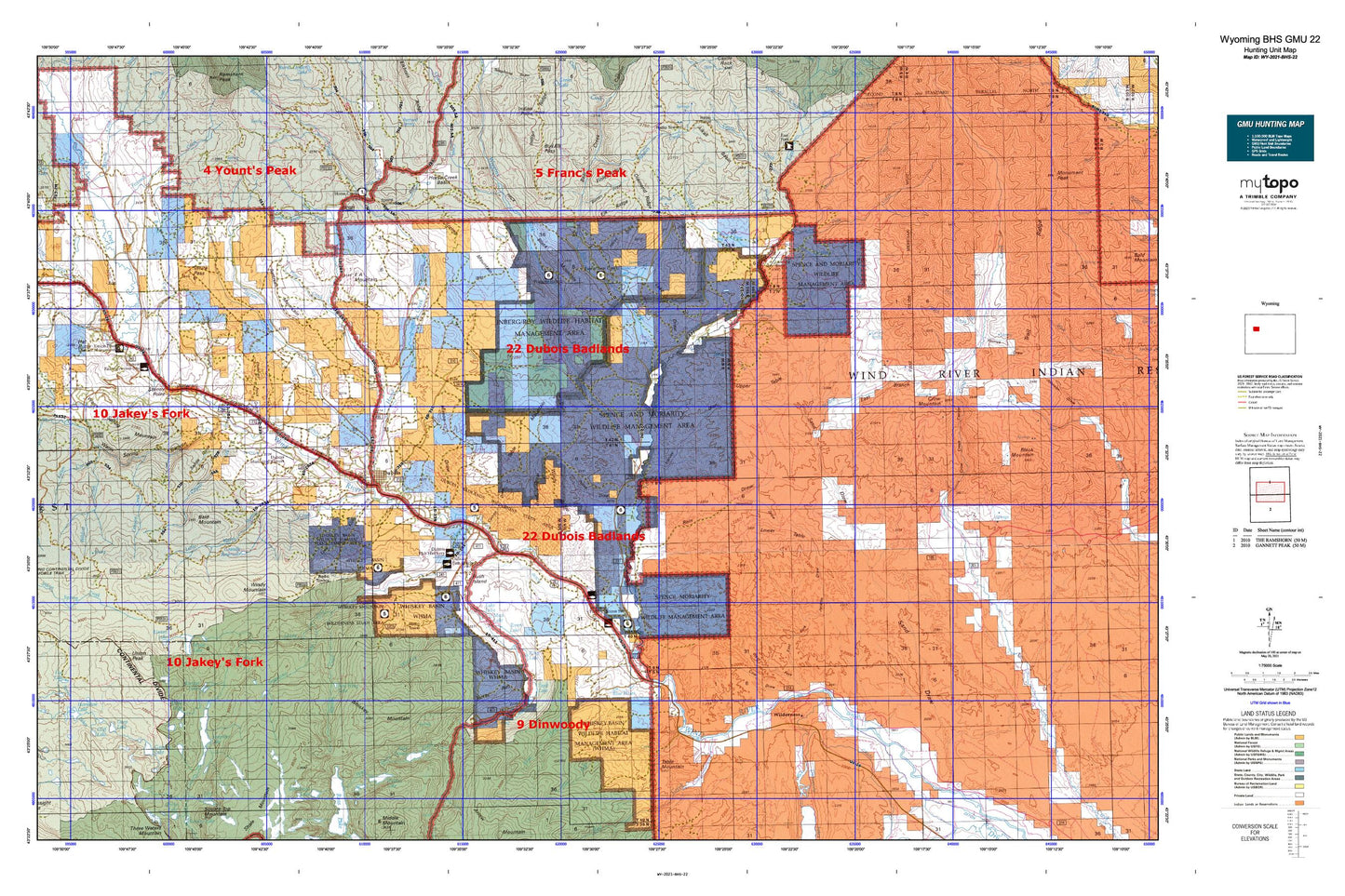
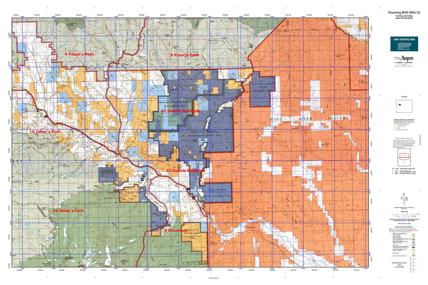
Wyoming Bighorn Sheep GMU 22 Map
Couldn't load pickup availability
Hunting unit map of Wyoming Game Management Unit BHS-22 with topographic lines and unit boundaries. This topo map features UTM / MGRS and Latitude/Longitude grids, plus public land ownership. It comes folded on waterproof paper. Be fully prepared for your hunt with a MyTopo GMU map!.
This map contains the following named places: 82513,Abernathy Deposit Number Four Mine,Abernathy Deposit Number Three Mine,Adams Ranch,Alice Lake,Alkali Basin,Alkali Bog,Alkali Creek,Ann Lake,Arm Group Mine,Bachelor Creek,Bain Cabin,Bain Creek,Bain Draw,Bain Place,Bald Mountain,Battrum Mountain,Bear Creek,Bear Creek Canyon,Beaver Creek,Beck Cow Camp,Bench Creek,Big Horn Claims Mine,Big Horn Number One Mine,Bitterroot Number 1 Dam,Black Mountain,Blanket Lakes,Blue Hole Creek,Blue Hole Creek Mine,Blue Holes,Blueberry Lake,Boone Lake,Boundary Trail,Brent Creek,Buck Creek,Burroughs Creek,Bush Island,Butler Draw,Button Draw,Byrd Draw,C M Trail,Cabin Creek,Canyon Creek,Carson Ditch,Carson Draw,Castle Creek,Charlie Creek,Chimney Rock Gulch,Circle Ditch,Cliff Lake,Cm Ranch,Coal Draw,Cony Lake,Cow Camp,Crooked Creek,Cross Ranch,Crow Creek Canyon,Crow Mountain,Deacon Flat,Dead Horse Lake,Deep Lake,Diamond Ditch,Diamond Ridge,Dinwoody Creek,Dish Lake,Divide Lake,Dollar Lake,Double Diamond Number 1 Reservoir Dam,Double Diamond Ranch,Du Noir Creek,Dubois,Dubois Claim Mine,Dubois Division,Dubois Number One Mine,DuNoir,Dyke Creek,Dyke Lake,E A Mountain,E A Ranch,East Branch Sand Draw,East Fork Elk Winter Pasture,East Fork Elk Winter Pasture Headquarters,East Fork Guard Station,East Fork Jenkins Draw,East Fork Mine,East Fork Wind River,East Fork Wind River Mine,East Torrey Creek,Eastman Place,Elk Ridge,Enlargement of Grandy Dam,Finley Ranch,Finley Ridge,Fish Ranch,Fivemile Creek,Flying T Ranch,Fourmile Creek,Geyser Creek,Geyser Creek Park,Geyser Creek Trail,Glacier Primitive Area,Glade Ranch,Goose Lake,Grandy Reservoir,Granite Lake,Grass Lake,Gray Ghost Group Mine,Green Ditch,Harrison Ranch,Hart Reservoir,Harvey Draw,Hat Butte,Helt Claims Mine,Hidden Lake,High Acres Ranch,Highland Meadow Ranch,Holmes Number 1 Ditch,Horse Creek,Horse Creek Basin,Horse Creek Ranger Station,Horse Draw,Horseshoe Lake,Houg Ranch,Jakeys Fork,Jakeys Fork Trail,Jenkins Draw,Johnson Camp,Jones Ranch,Kitten Creek,Lake Draw,Lake Julia,Lake Louise,Leseburg Ditch,Lime Kiln Gulch,Little Alkali Creek,Little Horse Creek,Little Red Creek,Little Warm Spring Canyon,Little Warm Spring Creek,Little Warm Springs Creek Mine,Livingston Cabin,Long Creek,Long Lake,Long Shot Number Four Mine,Lower Table,Marion Lake,Mason Draw,Meadow Creek,Miller Red Creek Canal,Moon Creek,Moon Lake,Moon Lake Trail,Mud Lake,Noon Rocks,Norton Ditch,Pease Draw,Peat Lake,Pine Creek,Pole Creek,Pole Creek Group Mine,Pole Creek Number Two Mine,Pony Creek,Ramshorn Guest Ranch,Red Creek,Red Gulch,Red Wing Lake,Rifle Range Draw,Rim Lake,Ring Lake,Ring Lake Ranch,Rocker A Ranch,Rocking Chair Ranch,Ross Lake Trail,Saddle Horse Draw,Sand Draw Mine,Seven Lakes,Sheer Ranch,Shipley Ranch,Simmerson Place,Simpson Lake,Sixmile Creek,Smith Sawmill,Soapstone Creek,Soapstone Lake,Spear Creek,Spring Creek,Spring Draw,Spring Mountain,Spring Mountain Cow Camp,Spruce Creek,State Game and Fish Checking Station,Stoney Point,Table Mountain,Tappan Creek,Taylor Creek,Torrey Creek,Torrey Lake,Torrey Lake Ranch,Torrey Rim,Town of Dubois,Trail Creek,Trail Lake,Trail Lake Ranch,Union Lake,Union Pass Cow Camp,Union Peak,Union Peak Mine,Upper Table,Utzinger Ranch,Wagon Gulch,Warm Spring Canyon,Warm Spring Creek,Warm Spring Mountain,Warm Spring Mountain Mine,Wasson Creek,Water Gulch,Waynes Creek,Waynes Hole,West Fork Jenkins Draw,West Torrey Creek,Whiskey Basin,Whiskey Basin Ranch,Whiskey Creek,Whiskey Mountain,Whiskey Mountain Mining Company Number One and Six Mine,Whiskey Mountain Number Two Mine,Whiskey Mountain Trail,Whiskey Peak Mining Company Mine,Wiggins Fork,Wildcat Creek,Wilderness,Wind River Canal,Windmill Draw,Windy Mountain,Windy Ridge


