MyTopo
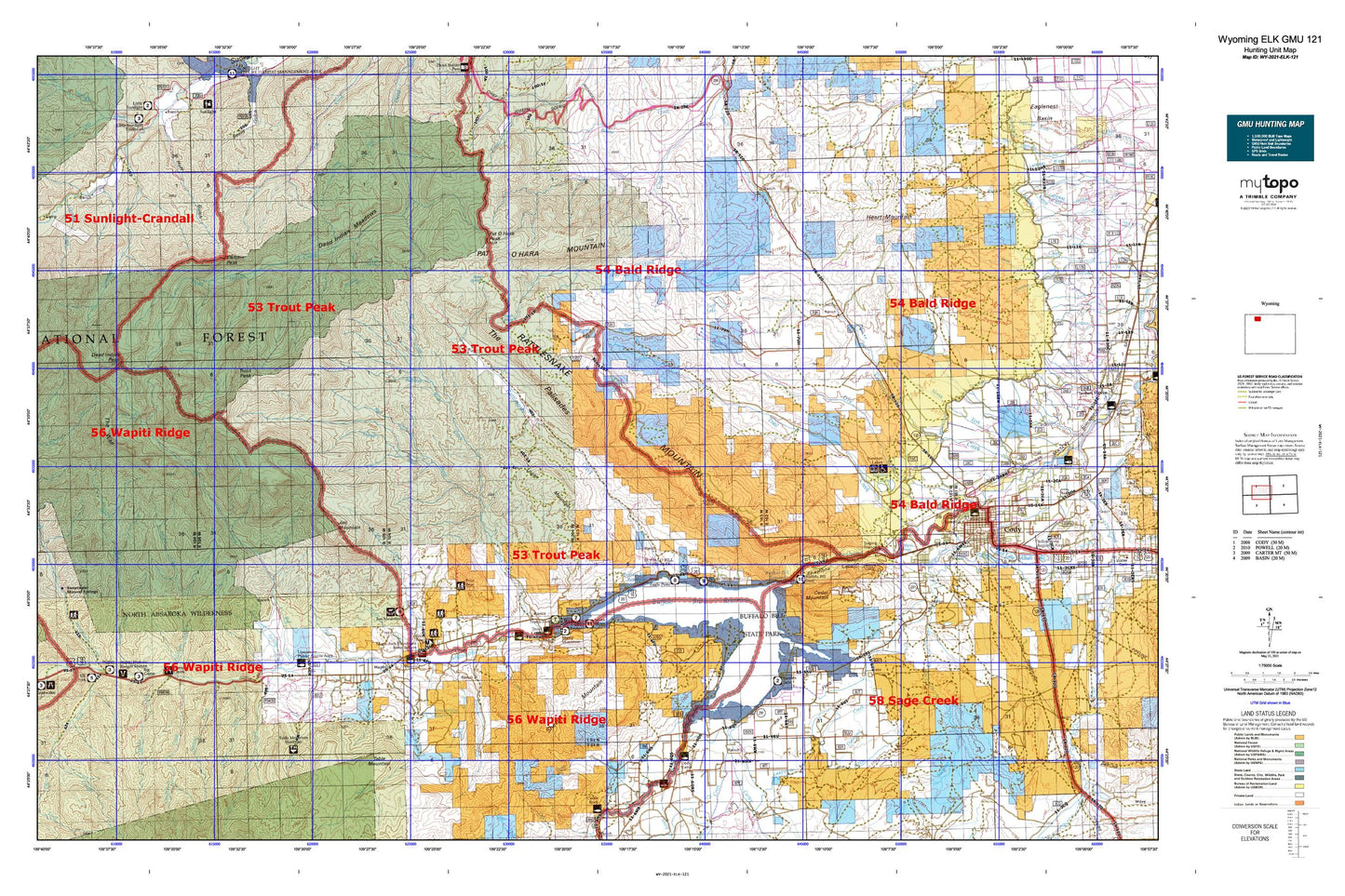
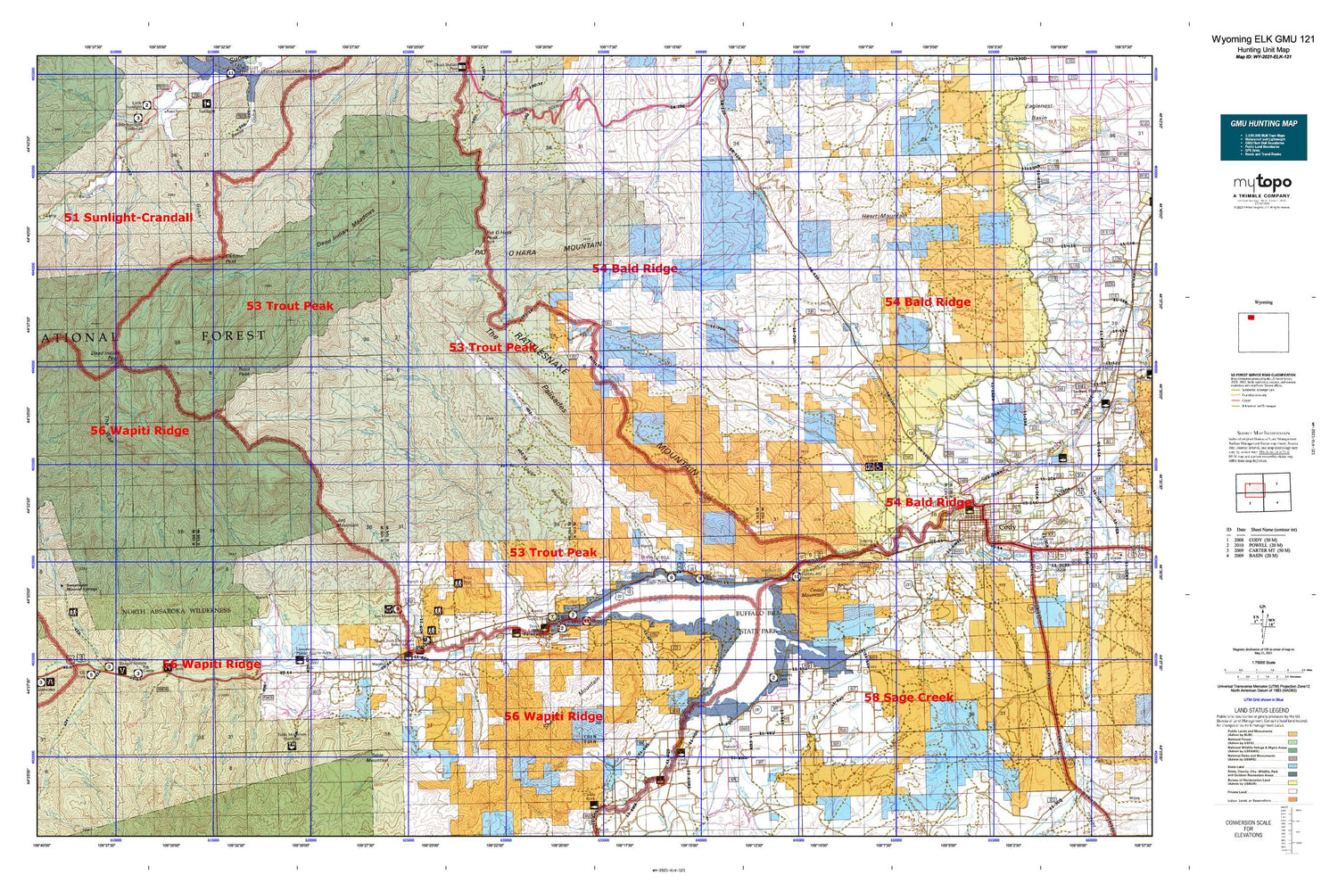
Wyoming Elk GMU 121 Map
Couldn't load pickup availability
Hunting unit map of Wyoming Game Management Unit ELK-121 with topographic lines and unit boundaries. This topo map features UTM / MGRS and Latitude/Longitude grids, plus public land ownership. It comes folded on waterproof paper. Be fully prepared for your hunt with a MyTopo GMU map!.
This map contains the following named places: 82414,82450,Agee Creek,Anvil Rock,Bear Springs,Bi Ho Ba Girl Scout Camp,Big Creek,Big Creek Ditch,Big Creek Falls,Big Game Campground,Big Horn Gypsum Company Quarry,Big Tree Creek,Blue Springs,Bradford Ranch,Breteche Creek,Broken H Lodge,Buffalo Bill Dam,Buffalo Bill Reservoir,Buffalo Bill Reservoir Springs,Burnt Gulch,Burnt Timer Creek,Camel Rock,Canyon Creek,Canyon Creek Ditch,Carter Creek,Cedar Mountain,Celotex Quarry,Chalk Mountain,Chinese Wall,Christ Episcopal Church Memorial Garden Cemetery,Circle H Ranch,Cles Ranch,Clocktower Creek,Cody Canal,Cody Division,Cody High School,Cody Lateral Ditch,Cody Post Office,Cody Volunteer Fire Department,Dahlem Ranch,De Maris Springs,Dead Indian Meadows,Dead Indian Peak,Diamond Bar Ranch,Diamond Creek,Ditch H-16,Ditch H-24,Ditch H-28,Ditch H-33,Dry Creek,Dry Fork,Dunn Creek,East Fork Big Creek,East Fork Spring Creek,Elk Fork,Elk Fork Campground,Elkhorn Peak,Flag Peak,Fly Creek,Flying L Skytel Airport,Four Bear Ranch,Frost Dam,Frost Reservoir,Goose Rock,Grace Creek,Green Creek,Green Creek Summer Homes,Grizzly Creek,Grizzly Ranch,Gunnysack Creek,Half Mile Creek,Hanging Rock,Hanging Rock Campground,Heart Mountain,Holy City,Horse Creek,Horse Creek Camp Ground,Horse Creek Picnic Area,Indian Pass,Indian Pass Lateral,Irma Flats,Iron Creek,Iron King Claims,Jim Creek,Jim Mountain,Johnson Ranch,KLZY-FM (Powell),KMBU-FM (Powell),KODI-AM (Cody),KTAG-FM (Cody),KYDZ-FM (Cody),Lanchbury Ranch,Laughing Pig Rock,Laughing Water Creek,Livingston Elementary School,Logan Mountain,Lost Creek,Lundvall Ranch,Macy Ranch,Marlow Ranch,Marquette Creek,Monument Hill,Mooncrest Ranch,Morning Creek,Murray Creek,Nameit Creek,Needle Hot Springs,Newton Lakes,North Fork Shoshone River,North Fork Valley Ditch,Northfork Pit,Old Trail Town Cemetery,Old Woman Cabin Rock,Oxyoke Canyon,Pagoda Creek,Pagoda Creek Summer Homes,Park County,Park County Fire Protection District 2 Station 4 Wapiti Valley,Pat O'Hara Basin,Pat O'Hara Mountain,Pat O'Hara Peak,Pearson Cabin,Post Creek,Rand Creek,Rattlesnake Canyon,Rattlesnake Creek,Rattlesnake Mountain,Red Butte,Red Butte Mine,Red Ridge,Rhodes Ranch,Rimrock Ranch,River Rest Resort,Riverside Cemetery,Robbers Roost Cabin,Robbers Roost Creek,Salinger Ranch,Sheep Mountain,Sheephead Creek,Shoshone Canyon,Shoshone Canyon Mine,Shoshone Hot Springs,Shoshone National Forest Wapiti - Clarks Fork - Greybull Ranger District Fire Engine Crew,Signal Peak,Singing Brook,Slack Creek,Slipper Rock,South Fork Shoshone River,Spout Springs,Stafford Ranch,Stockdale Creek,Stonebridge Dam,Stonebridge Reservoir,Stout Ranch,Strawberry Gulch,Sulphur Creek,Sweetwater Creek,Sweetwater Creek Mine,Table Mountain,The Palisades,The Wall,Trail Creek,Trail Creek Ranch Cemetery,Trask Ranch,Trough Spring,Trout Creek,Trout Creek Ranch,Trout Creek Trail,Trout Peak,Valley Ditch,Wall Creek,Wapiti,Wapiti Campground,Wapiti Elementary School,Wapiti Post Office,Wapiti Ranger Station,Wapiti Valley Church Cemetery,Weber Creek,West Park Hospital,West Park Hospital Emergency Medical Services,West Park Hospital Heliport,Whit Creek,Wilson-McKissack Ditch,Wyoming Highway Patrol District 5 Division N,Younglove Pit


