
MyTopo
Wyoming Elk GMU 22 Map
Couldn't load pickup availability
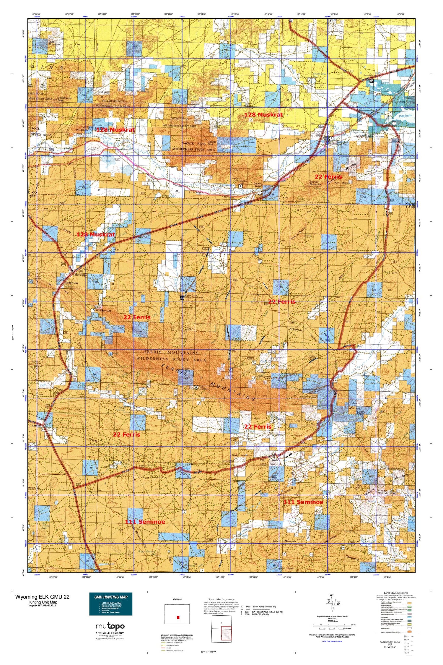
Hunting unit map of Wyoming Game Management Unit ELK-22 with topographic lines and unit boundaries. This topo map features UTM / MGRS and Latitude/Longitude grids, plus public land ownership. It comes folded on waterproof paper. Be fully prepared for your hunt with a MyTopo GMU map!.
This map contains the following named places: 2 Reservoir,82620,Arkansas Basin,Arkansas Flats,Babbs Mine,Bar II Ranch,Bar V Ranch,Bear Mountain,Beef Acre,Beef Gap,Berthaton Claims,Beulah Belle Lake,Big Sand Spring,Birch Creek,Black Canyon,Black Rock Draw,Boot Creek,Boot Ranch,Bradley Peak,Bradley Peak Mine,Brady Creek,Bucklin Number 2 Dam,Bucklin Reservoirs,Buzzard Ranch,Carbon County Fire Department Muddy Gap,Cedar Creek,Cherry Creek,Cherry Creek Prospect,Cottonwood Creek,Cress Creek,Currant Creek,Devils Gate,Diversion Dam,Dorr Meadow,Dorr Place,Dry Creek,East Arkansas Creek,Ferris,Ferris Mountain Ranch,Ferris Mountains,Ferris Mountains Mine,Fort Ridge,Frederick Richard Fulkerson Gravesite,Gantz Ranch,Garden Creek,General Petroleum Oil Field,George Tully Homestead,Granite Mountain,Hanna Mahoney Reservoir Number Two,Hannah Mahoney Number 1 Dam,Hannah Mahoney Number 1 Reservoir,Hannah Mahoney Number 2 Dam,Hays Meadow,Independence Deposits,Independence Rock,Independence Rock Burial Ground,Indian Creek,Indian Creek Meadow,Jackson Lake,Jennie Claim Number One Mine,Jimmys Place,Junk Hill,Larsen Place,Last Chance Mine,Little Camp Creek,Little Sand Spring,Mahoney Dome Oil Field,Mahoney Lake,Marsh Ditch,Marsh Reservoir,Martins Cove,Marvin Place,McCargar Place,Miller Spring,Miners Canyon,Muddy Creek,Muddy Gap,Muddy Gap Junction,Murphree Creek,New York Claim,Ohio Camp,Oilcan Ranch,Omaha Soda Deposit,Ordway Pocket,Pete Creek,Philadelphia Claim,Piaya Lake,Point of Rocks,Pole Canyon,Pony Express Station,Rawlins Draw,Rawlins Draw Mine,Riddle Ranch,Rinshaw Lake,Roberts Ranch,Rush Creek,Sand Creek Canyon,Sand Springs,Sand Springs Creek,Savage Peak,Savage Pocket,School Creek,Schounmaker Ditch,Seminoe Mountains Area Mine,Sentinel Rocks,Sharp 47 Ranch,Soda Lake,Spanish Mine,Spanish Trails Group Mine,Spear Ranch,Steamboat Lake,Sun Ranch,Sweetwater Pony Express Station,Sweetwater River,Sweetwater Rocks,Three Forks,Turkey Creek,Turkey Track Ditch,Turkey Track Ranch,Vermiculite Sales Corporation Deposit Number One,West Branch Pete Creek,West Junk Creek,Whiskey Creek,Whiskey Gap,Willow Creek,Wilmington and Wilkesbarre Deposits,Y Z Ditch,Youngs Pass


