MyTopo
Wyoming Mule Deer GMU 160 Map
Couldn't load pickup availability
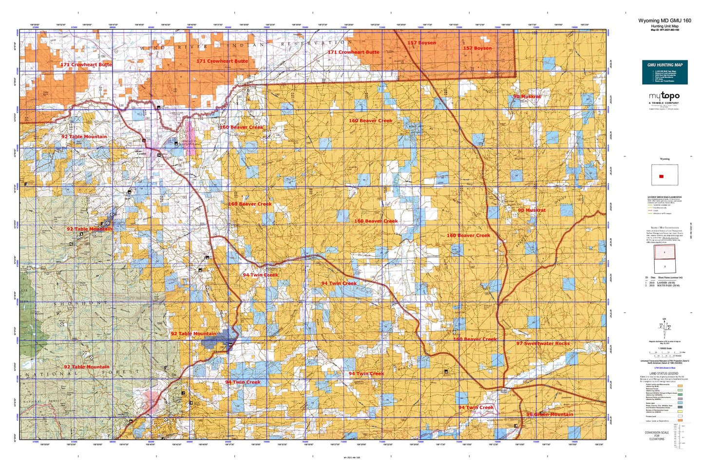
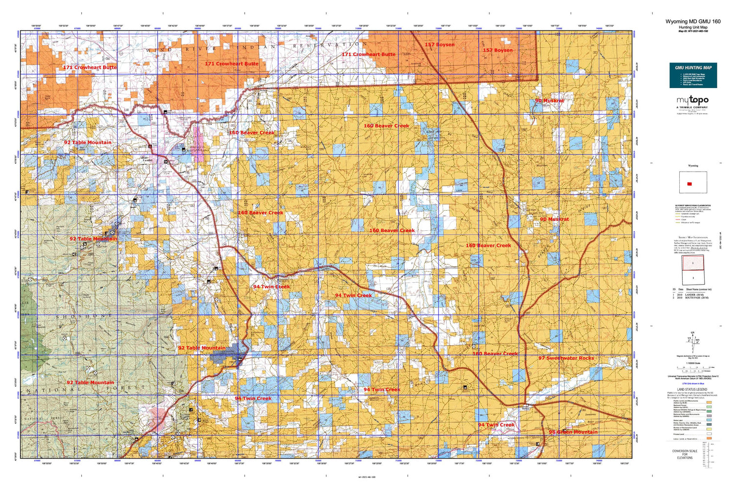
Hunting unit map of Wyoming Game Management Unit MD-160 with topographic lines and unit boundaries. This topo map features UTM / MGRS and Latitude/Longitude grids, plus public land ownership. It comes folded on waterproof paper. Be fully prepared for your hunt with a MyTopo GMU map!.
This map contains the following named places: 82515,82520,Alkali Butte,Alkali Butte Unit,Antelope Creek,Antelope Springs Reservoir,Arthur Ranch,Atlantic Creek,Auer Ranch,Auer Reservoir,Baldwin Creek,Baldwin Creek School,Barrett Creek,Bayer Mountain,Beason Creek,Beaver Creek Counting Pens,Bergstedt Ranch,Big Cottonwood Ditch,Blue Hill Lateral,Bowman Ranch,Bragg Mountain,Bringolf Ranch,Brown Jug Ditch,Bruce Campground,Bruce Picnic Area,Brush Corral,Canyon Creek,Carmody Lake,Carr Reservoir,Cedar Butte,Cemetery Ditch,Charlies Reservoir,Cherry Creek,Christina Lake Trail,Chugwater Reservoir,City of Lander,Cold Spring Trail,Cold Sulphur Creek,Cole Spring Creek,Columbia Geneva Mines,Commissary Hill,Cony Mountain,Cottontail Reservoir,Cottonwood Creek,Countryman Ranch,Critnan Creek,Crooked Creek,Deep Creek,Deep Pit Reservoir,Del Monte Draw Reservoir,Devils Creek,Dickinson Creek,Dilabaugh Buttes,Dishpan Butte,Dobe Reservoir,Dry Lake,Dry Lake Area Mine,Dry Twin Creek,Dutch Flat Extension,East Fork Cottonwood Creek,Elderberry Creek,Enterprise Ditch,Enterprise Reservoir,Enterprise Supply Ditch,Eversole Ranch,Fairfield Creek,Fairfield Hill,Farlow Homestead,Fiddlers Creek,Fiddlers Lake,Fiddlers Lake Campground,Flagg Ranch,Flat Ditch,Fort McGraw,Fossil Hill,Fremont County Youth Camp,Frye Lake,Gaylor and Warnock Ditch,Gold Dollar Mine,Goldman Meadows,Government Meadows Windmill,Granite Peak,Grant Young Ditch,Gustave Lake,Gustin Homestead,Gustin Reservoir,Hall Creek,Hall Ranch,Hancock Ranch,Hart Ranch,Harvey Basin,Haynes Reservoir,Henton Ranch,Hidden Creek,Hopkins Reservoir,Hornecker Creek,Hudson,Hudson Siding,Iiams Creek,Independent Ditch,Indian Trail,Jackson Reservoir,Kotey Place,Lander,Lander Division,Lander Hill,Lander Valley Reservoir,Limestone Mountain,Little Antelope Creek,Little Dickinson Creek,Little Popo Agie Basin,Little Popo Agie River,Little Rock Creek,Louis Beach Campground,Louis Creek,Louis Lake,Louis Lake Campground,Louis Lake Guard Station,Louis Lake Picnic Area,Louis Lake Resort,Louis Lake Trail,Lower Silas Lake,Lyons Ditch,Macfie Pens,Macfie Ranch,Madison Creek,Mathisen Ranch,Matteson Ranch,Maxon Basin,McKinney Ranch,Mexican Creek,Meyer Basin,Meyer Lookout,Middle Fork Guard Station,Middle Fork Trail,Middle Popo Agie River,Milford,Millard Ditch,Miller Ditch,Miners Delight,Miners Delight Mine,Monument Butte,Mormon Basin,Nicol Table Mountain Ditch,Ninemile Hill,Ninemile Reservoir,North Fork Ditch,North Fork Hall Creek,North Popo Agie River,North Sand Draw Unit,Pabst Peak,Pan Group Mine,Paralda Ditch,Pass Creek,Pine Bar Ranch,Popo Agie Campground,Porcupine Creek,Prodigy Hill,Rate Reservoir,Red Bluff Creek,Red Butte,Red Canyon Creek,Red Lake,Rennecker Peak,Roaring Fork Creek,Rock Draw Reservoir,Roundtop Mountain,Samuel P Large Ditch,Sand Draw,Sand Draw Coal Mine,Sandstone Ditch,Sandstone Reservoir,Sawmill Creek,Schlichting Ditch,Schoettlin Mountain,Sevenmile Reservoir,Sheep Creek,Sheep Mountain,Shoshone Stock Driveway,Silas Creek,Sinks Canyon Campground,Sioux Ditch,Sioux Pass Trail,Slide Windmill,Smith Creek,Snow Creek,South Fork Hall Creek,South Fork Squaw Creek,South Pass Ski Tow,Spring Creek,Squaw Creek,Squaw Creek Shopping Center,Stambaugh Creek,Standish Ditch,Surrell Creek,Sweetwater Crossing,Sweetwater Station,Table Mountain,Table Mountain Community Hall,Table Mountain Ditch,Table Mountain Ditch Extension,Taylor Ditch,Taylor Ditch Extension,The Sinks,Thompson Creek,Timber Top,Tomahawk Lake,Town of Hudson,Townsend Creek,Tweed Creek,Tweed Ditch,Twin Creek,University of Missouri Geology Camp,Upper Milford School,Upper Rock Creek Reservoir,Walker Ditch,Weiser Creek,Weiser Knoll,Weiser Ranch,West Fork Cottonwood Creek,Whitehead Ranch,Wilkinson Ranch,Wilkinson Sheep Sheds,Williams Mine,Willow Creek,Wind River,Wingfoot Pens,Wingfoot Reservoir,Wise Ditch,Wolf Trail,Worthen Meadow Reservoir,Wyopo,Yellowstone Ranch,Young Basin,Young Mountain


