MyTopo
Wyoming Moose 20 Map
Couldn't load pickup availability
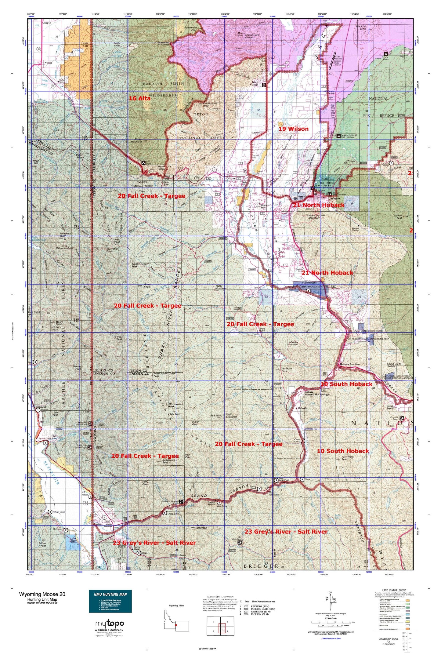
Hunting unit map of Wyoming Game Management Unit MOOSE-20 with topographic lines and unit boundaries. This topo map features UTM / MGRS and Latitude/Longitude grids, plus public land ownership. It comes folded on waterproof paper. Be fully prepared for your hunt with a MyTopo GMU map!.
This map contains the following named places: 83014,83025,Adams Canyon,Alpine Campground,Alpine Summer Home Area,Anchor Ranch,Apres Vous Peak,Aspen Ranch,Austin Canyon,Bailey Creek,Baldy Knoll,Bear Canyon,Beaver Dam Canyon,Big Basin Canyon,Black Canyon,Blind Canyon,Blue Bell Creek,Bohnetts Canyon,Box Canyon,Boyles Hill,Budd Prospect Mine,Burbank Creek,Bureau of Public Roads Camp,Burnt Timber Canyon,Butler Creek,Butler Creek Ranch,Cabin Creek,Cabin Creek Campground,Cache Creek,Coal Creek,Coal Creek Campground,Coal Creek Meadows,Coburn Creek,Coles Canyon,Cottonwood Creek,Crane Creek,Crater Lake,Crescent H Fall Creek Pit Mine,Davis Claim,Deadhorse Canyon,Deadhorse Peak,Deer Creek,Dells Canyon,Dog Creek,Driveway Canyon,Dry Canyon,Dry Fork,Dry Wash,East Elbow Campground,East Gros Ventre Butte,East Table Creek,East Table Creek Campground,Elbow Campground,Elk Exhibition Pasture,Elk Gulch,Fall Creek,Ferry Peak,Fish Creek,Flat Creek,Game Creek,Game Creek Trail,Garden Canyon,Georges Canyon,Gin Pole Draw,Glory Slide,Granite Canyon,Granite Canyon Trail,Granite Creek,Green Knoll,Green Mountain,Gros Ventre Junction,Gros Ventre River,Hells Hole,Hoback,Hoback Canyon,Hoback Junction,Hoback River,Horse Creek,Horsethief Canyon,Housetop Mountain,Hungry Creek,Indian Peak,Iron Rim Creek,Jackson,Jackson Country Square Shopping Center,Jackson Hole Country Club,Jackson Hole Ski Area,Jackson National Fish Hatchery,Jensen Canyon,Johnny Counts Flat,Jordan Canyon,Keyser Creek,Lake Basin,Lake Creek,Lake Gulch,Lee Guard Station,Leeks Canyon,Little Cottonwood Creek,Little Dog Creek,Little Horse Creek,Little Horsethief Canyon,Little Palisades Peak,Little Red Creek,Long Spring Basin,Long Spring Canyon,Lorian Canyon,Mail Cabin Creek,Marion Lake,Marshall Creek,Martin Creek,Melody Ranch,Mesquite Creek,Middle Fork Cut Off Trail,Middle Fork Granite Creek,Middle Fork Phillips Canyon,Mike Harris Camnpground,Mike Harris Creek,Mikesell Canyon,Mill Creek,Millers Butte,Moose Creek,Moose Creek Ranch,Moose Gulch,Moose Lake,Moose Meadows,Moose Wilson Road,Mosquito Creek,Mosquito Pass,Mount Glory,Mud Lake,Mud Pass,Mud Peak,Munger Mountain,Needle Peak,Neeley Cove,Nordwall Canyon,North Fork Elk Creek,North Fork Fall Creek,North Fork Game Creek,North Fork Granite Creek,North Fork Indian Creek,North Fork Mosquito Creek,North Fork Phillips Canyon,North Fork Trail Creek,North Twin Creek,Nowlin Creek,Oat Canyon,Observation Peak,Oliver Peak,Open Canyon,Palmer Creek,Phillips Canyon,Phillips Canyon Trail,Phillips Ridge,Pine Bar,Pine Bar Diggings,Pine Creek,Pink Garter Plaza,Placer Creek,Plummer Canyon,Pole Canyon,Porcupine Creek,Pow Wow Point,Powder Peak,Pritchard Creek,Pritchard Pond,Pup Creek,R Lazy S Ranch,Rafter J Ranch,Red Creek,Red Peak,Red Top Meadows,Rendezvous Mountain,Rendezvous Mountain Trail,Rendezvous Peak,Rock Creek,Rock Springs Canyon,Rocky Mountains,Roos Creek,Salt Lick Draw,Sawpit Creek,Sheep Creek,Sherman Canyon,Siddoway Fork,Ski Lake,Sleeping Indian Pond,Smith Canyon,Smoky Hollow,Smoky Hollow Peak,Snake River Range,Snow King Mountain,Sob Creek,Sourdough Creek,South Cabin Creek,South Fork Elk Creek,South Fork Fall Creek,South Fork Game Creek,South Fork Granite Creek,South Fork Indian Creek,South Park,South Twin Creek,Spaulding Basin,Spring Creek,Spring Gulch,Squaw Canyon,Squaw Creek,Starvation Peak,Stateline Canyon,Station Creek,Station Creek Campground,Talbot Canyon,Taylor Basin,Taylor Creek,Taylor Mountain,Taylor Mountain Trail,Teton Crest Trail,Teton Village,Town of Jackson,Trail Creek,Trail Creek Campground,Trail Creek Ranch,Tucker Pit Mine,Warm Springs Ranch,West Bailey Creek,West Burbank Creek,West Gros Ventre Butte,West Table Creek,West Table Creek Boat Ramp,Wilson,Wilson Canyon,Wilson South Pit and Plant Mine,Wolf Creek,Wolf Creek Campground,Wolf Mountain,Woods Canyon


